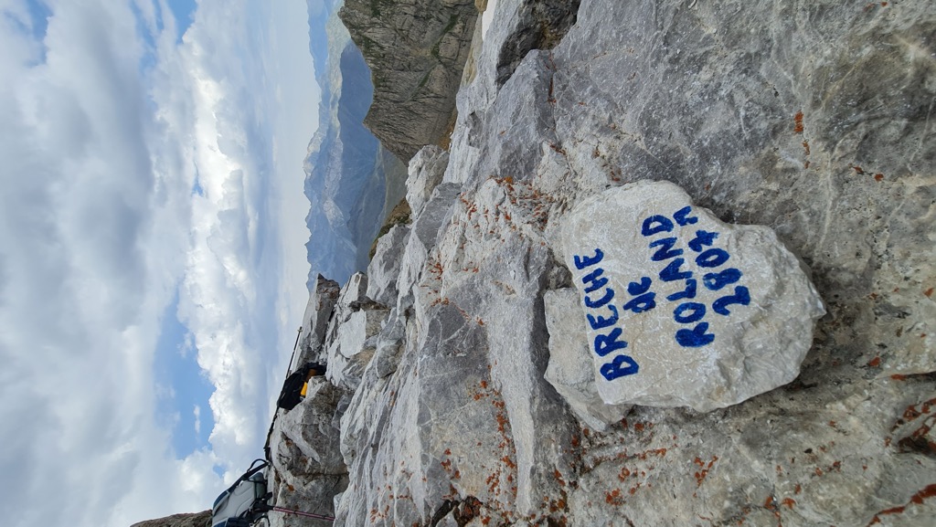
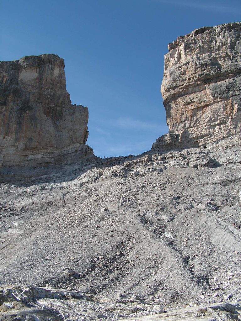
Roland's Breach (French: La Brèche de Roland; Spanish: La Brecha de Rolando; Aragonese: La Breca de Roldán; Basque: Errolanen Arraila; Catalan: La Bretxa de Rotllà) is the name of a natural gap, 40 m across and 100 m high, at an elevation of 2804 m in the Pyrenees on the border of Aragón, northern Spain, and Hautes-Pyrénées, France. The gap is situated in the Ordesa y Monte Perdido National Park on the Franco-Spanish border, close to the steep cliffs of the Cirque de Gavarnie. According to one legend Roland's Breach was cut by Count Roland with his sword Durendal in an attempt to destroy the sword, after being defeated during the Battle of Roncesvalles in 778. In a variant of one of the legends associated with Salto de Roldán, a rock formation about 25 km (16 mi) north of Huesca, Roland (Spanish: Roldán), the foremost of Charlemagne's paladins, was being hotly pursued by Saracens, the Muslim Arab occupiers of Spain. Cornered at Salto de Roldán, he escaped by leaping the chasm on horseback from one of the crags to the other; the horse died in the attempt. Roland continued northward on foot, and smote the Pyrenees with his sword to create Roland's Breach, so that he could see France one last time before he died. The provenance of this myth is unclear as the Cirque du Gavarnie is approximately 150 km East South East from the Roncesvaux Pass where the legend of Roland is based. The gap can be reached from the Refugio Sarradets, a nearby mountain shelter, in about an hour's climb.
We use GPS information embedded into the photo when it is available.
3D mountains overlay
Adjust mountain panorama to perfectly match your photos because recorded by camera photo position might be imprecise.
Move tool
Rotate tool
Zoom
More customization
Choose which peak labels should make into the final photo and what photo title should be.
Next
Photo Location
Satellitte
Flat map
Relief map
Latitude
Longitude
Altitude
OR
Latitude
°'''
Longitude
°'''
Apply
Register Peak
Peak Name
Latitude
Longitude
Altitude
Register
Teleport
PeakVisor
This 3D model of Sagarmatha National Park in Nepal was made using the PeakVisor app topographic data. The mobile app features higher precision models worldwide, more topographic details, and works offline. Download PeakVisor maps today.
Download OBJ model
PeakVisor
The download should start shortly. If you find it useful please consider supporting the PeakVisor app.
PeakVisor for iOS and Android
Be a superhero of outdoor navigation with state-of-the-art 3D maps and mountain identification in the palm of your hand!