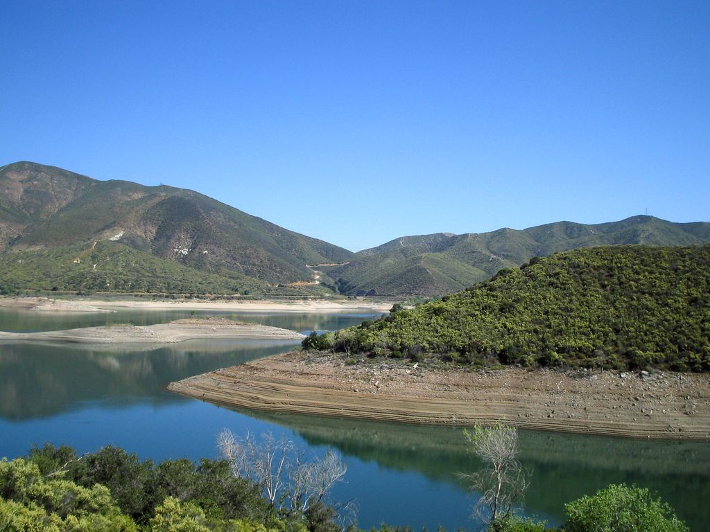
Bouquet Reservoir is an artificial lake in the Angeles National Forest of Los Angeles County, California about 15 miles (24 km) west from Palmdale. At elevation of 2,993 feet (912 m) in the Sierra Pelona Mountains, the reservoir capacity is 36,500 acre⋅ft (45,000,000 m3) and is formed by Bouquet Canyon Dam on Bouquet Creek, which is a tributary of the Santa Clara River. The dam is constructed of earthfill and is 190 feet (58 m) tall, measured from the elevation of the original streambed. The dam was built by the city of Los Angeles and was completed in 1934 (1934) Official opening ceremonies were held at noon on March 28, 1934. The reservoir is part of the Los Angeles Aqueduct system, which is where it gets much of its water. Both are owned by the Los Angeles Department of Water and Power. The reservoir's drainage basin is only 13.6 square miles (35 km2) where the average annual rainfall is 14–20 inches (360–510 mm). Its purpose is to provide regulation of releases and to store water in case there is an interruption upstream.
Show more
Sun and Moon
Mon
Tue
Wed
Thu
Fri
Sat
Sun
May 2022
Date and time
00:00
06:00
12:00
18:00
Today
--
--
Sunrise
--
Sunset
--
Moonrise
--
Moonset
Phase
🌔 Waxing Gibbous
The perfect light time for beautiful photos:
--
Sunrise
--
Sunset
PeakVisor app
Get the app on your smartphone
New Panorama Tools
Trace location on the map
Measure distances
All the instruments are available in the context menu as well.
We use GPS information embedded into the photo when it is available.
3D mountains overlay
Adjust mountain panorama to perfectly match your photos because recorded by camera photo position might be imprecise.
Move tool
Rotate tool
Zoom
More customization
Choose which peak labels should make into the final photo and what photo title should be.
Next
Photo Location
Satellitte
Flat map
Relief map
Latitude
Longitude
Altitude
OR
Latitude
°'''
Longitude
°'''
Apply
Register Peak
Peak Name
Latitude
Longitude
Altitude
Register
Teleport
PeakVisor
This 3D model of Sagarmatha National Park in Nepal was made using the PeakVisor app topographic data. The mobile app features higher precision models worldwide, more topographic details, and works offline. Download PeakVisor maps today.
Download OBJ model
PeakVisor
The download should start shortly. If you find it useful please consider supporting the PeakVisor app.
PeakVisor for iOS and Android
Be a superhero of outdoor navigation with state-of-the-art 3D maps and mountain identification in the palm of your hand!