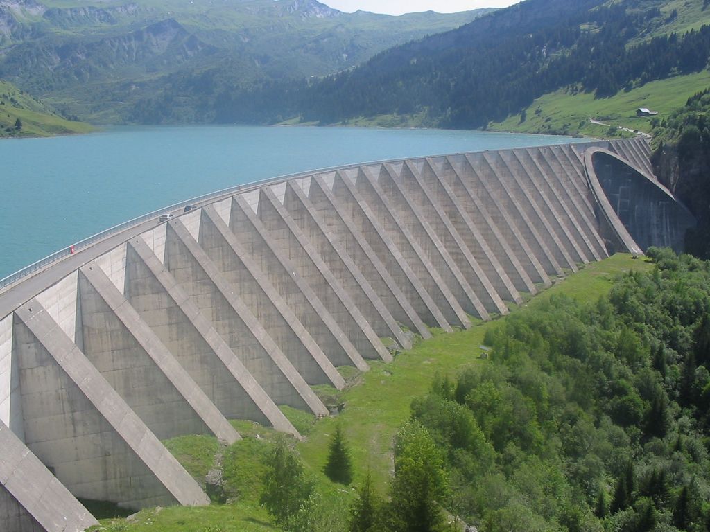
The Roselend Dam is an arch-buttress dam located 5 km (3 mi) east of Beaufort in the Savoie department of the Rhône-Alpes region in south-eastern France. It is located just west and below the Cormet de Roselend mountain pass. The dam was designed by Coyne et Bellier and construction began in 1955. The reservoir began to fill in 1960, the power station was operational in 1961 and the dam complete in 1962. It was constructed for the primary purpose of hydroelectric power generation and supports the 546 MW La Bâthie Power Station.
We use GPS information embedded into the photo when it is available.
3D mountains overlay
Adjust mountain panorama to perfectly match your photos because recorded by camera photo position might be imprecise.
Move tool
Rotate tool
Zoom
More customization
Choose which peak labels should make into the final photo and what photo title should be.
Next
Photo Location
Satellitte
Flat map
Relief map
Latitude
Longitude
Altitude
OR
Latitude
°'''
Longitude
°'''
Apply
Register Peak
Peak Name
Latitude
Longitude
Altitude
Register
Teleport
PeakVisor
This 3D model of Sagarmatha National Park in Nepal was made using the PeakVisor app topographic data. The mobile app features higher precision models worldwide, more topographic details, and works offline. Download PeakVisor maps today.
Download OBJ model
PeakVisor
The download should start shortly. If you find it useful please consider supporting the PeakVisor app.
PeakVisor for iOS and Android
Be a superhero of outdoor navigation with state-of-the-art 3D maps and mountain identification in the palm of your hand!