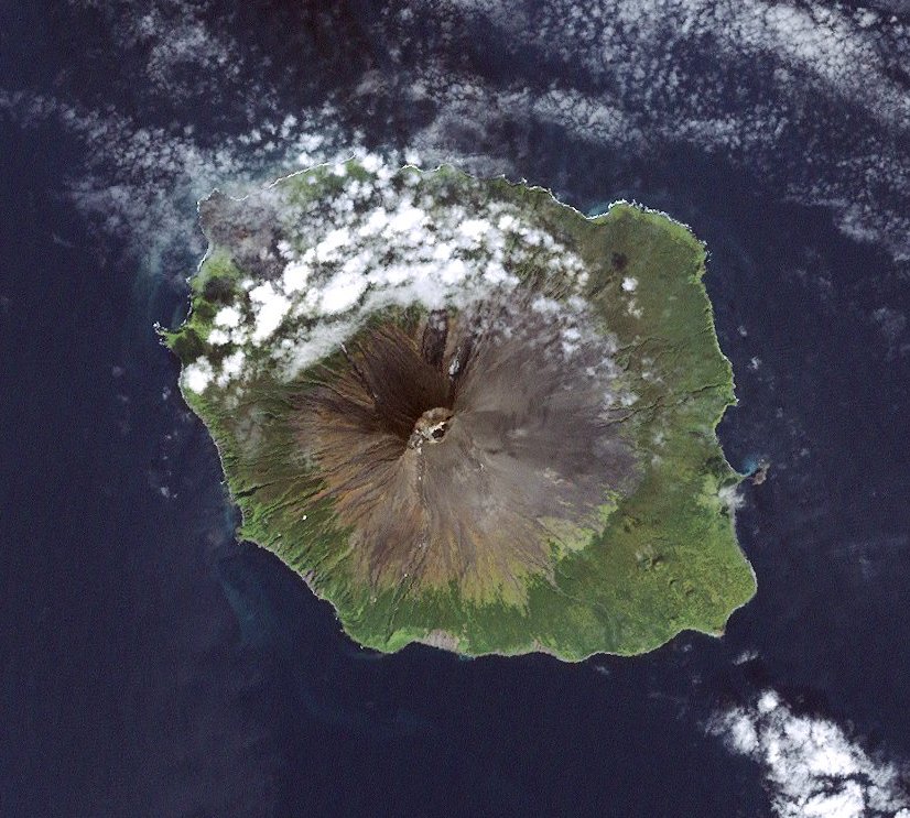
Atlasov Island, known in Russian as Ostrov Atlasova (Остров Атласова), or in Japanese as Araido (阿頼度島), is the northernmost island and volcano and also the highest volcano of the Kuril islands, part of the Sakhalin Oblast in Russia. The Russian name is sometimes rendered in English as Atlasova Island. Other names for the island include Uyakhuzhach, Oyakoba (Ainu) and Alaid, the name of the volcano on the island. The island is named after Vladimir Atlasov, a 17th-century Russian explorer who incorporated the nearby Kamchatka Peninsula into Russia. It is essentially the cone of the submarine volcano Vulkan Alaid protruding above the Sea of Okhotsk to a height of 2,285 metres (7,497 feet). The island has an area of 119 square kilometres (46 square miles), and is currently uninhabited. Numerous pyroclastic cones dot the lower flanks of basaltic to basaltic andesite volcano, particularly on the NW and SE sides, including an offshore cone formed during the 1933–34 eruption. Its near perfect shape gave rise to many legends about the volcano among the peoples of the region, such as the Itelmens and Kuril Ainu. The Russian scientist Stepan Krasheninnikov was told the story that it was once a mountain in Kamchatka, but the neighbouring mountains became jealous of its beauty and exiled it to the sea, leaving behind Kurile Lake in southern Kamchatka. Geographically, this story is not without evidence, as after the last Ice Age most of the icecaps melted, raising the world's water level, and possibly submerging a landbridge to the volcano. Following the transfer of the Kuril Islands to Japan by the Treaty of St Petersburg, 1875, Oyakoba as it is called by the Ainu and some Japanese, became the northernmost island of the empire and subject of much aesthetic praise, described in haiku, ukiyo-e, etc. Ito Osamu (1926) described it as more exquisitely shaped than Mount Fuji. Administratively this island belongs to the Severo-Kurilsky District, in the Sakhalin Oblast of the Russian Federation.
We use GPS information embedded into the photo when it is available.
3D mountains overlay
Adjust mountain panorama to perfectly match your photos because recorded by camera photo position might be imprecise.
Move tool
Rotate tool
Zoom
More customization
Choose which peak labels should make into the final photo and what photo title should be.
Next
Photo Location
Satellitte
Flat map
Relief map
Latitude
Longitude
Altitude
OR
Latitude
°'''
Longitude
°'''
Apply
Register Peak
Peak Name
Latitude
Longitude
Altitude
Register
Teleport
PeakVisor
This 3D model of Sagarmatha National Park in Nepal was made using the PeakVisor app topographic data. The mobile app features higher precision models worldwide, more topographic details, and works offline. Download PeakVisor maps today.
Download OBJ model
PeakVisor
The download should start shortly. If you find it useful please consider supporting the PeakVisor app.
PeakVisor for iOS and Android
Be a superhero of outdoor navigation with state-of-the-art 3D maps and mountain identification in the palm of your hand!