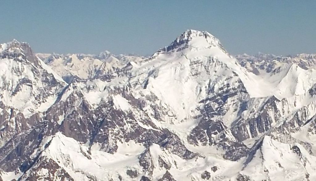
Yukshin Gardan Sar (Urdu: یکشن گردن سر) is a high peak in the Shimshal Valley, a village in the Karakoram range in Pakistan. Its height is also often given as 7,469 m (24,505 ft) or 7,641 m (25,069 ft). It lies about 16 km (10 mi) northeast of Khunyang Chhish and 6 km (3.75 mi) northwest of Kanjut Sar. It is flanked on the northwest by the Yazghil Glacier and on the northeast by the Yukshin Gardan Glacier; both drain into the Shimshal River. According to many residents of Shimshal, Yukshin Gardan Sar is the name of the adjacent peak Kanjut Sar, and vice versa. In Shimshal village, the original namings are widely accepted and used, as opposed to what is recognised internationally.
Yukshin Gardan Sar was first climbed in 1984, by a Pakistani-Austrian group, led by Rudolf Wurzer. They ascended via the South Ridge, which they accessed via the Yazghil Glacier on the west side of the peak.
The second ascent followed very shortly after the first, on July 23, 1984. A Pakistani-Japanese group that had been on the mountain simultaneously with the first ascent party switched from their unworkable North Ridge route to make an alpine style ascent of the first ascent route on the South Ridge.
The third ascent of the peak was in 1986, by a Spanish team comprising Alejandro Arranz, Iñaki Aldaya, Alfredo Zabalza, and Tomás Miguel. They used the same route as the first-ascent party. According to the Himalayan Index, there have been no other ascents or attempts on this peak since that time.
We use GPS information embedded into the photo when it is available.
3D mountains overlay
Adjust mountain panorama to perfectly match your photos because recorded by camera photo position might be imprecise.
Move tool
Rotate tool
Zoom
More customization
Choose which peak labels should make into the final photo and what photo title should be.
Next
Photo Location
Satellitte
Flat map
Relief map
Latitude
Longitude
Altitude
OR
Latitude
°'''
Longitude
°'''
Apply
Register Peak
Peak Name
Latitude
Longitude
Altitude
Register
Teleport
PeakVisor
This 3D model of Sagarmatha National Park in Nepal was made using the PeakVisor app topographic data. The mobile app features higher precision models worldwide, more topographic details, and works offline. Download PeakVisor maps today.
Download OBJ model
PeakVisor
The download should start shortly. If you find it useful please consider supporting the PeakVisor app.
PeakVisor for iOS and Android
Be a superhero of outdoor navigation with state-of-the-art 3D maps and mountain identification in the palm of your hand!