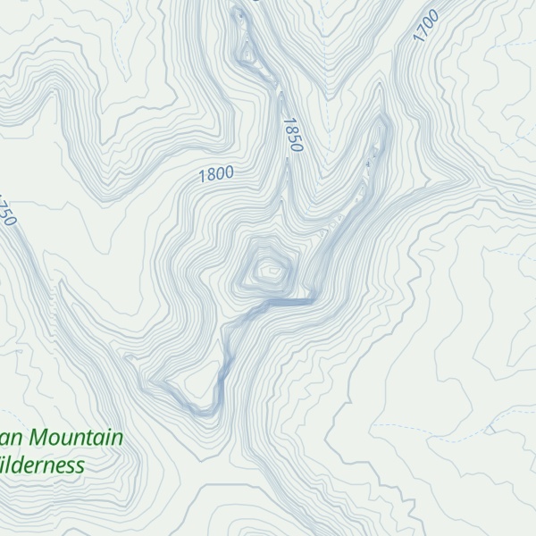
Window Blind Peak is a 7,030-foot-elevation (2,143-meter) summit located in the San Rafael Swell of Emery County, Utah, U.S. Towering 1,800 feet above its surrounding terrain, it is the highest point of the Mexican Mountain Wilderness Study Area. Ownership is administered by the Bureau of Land Management. It is situated 2.1 miles (3.4 km) southeast of Bottleneck Peak, 1.52 miles (2.45 km) south of Assembly Hall Peak, and the nearest higher neighbor is Cedar Mountain, 8.95 miles (14.40 km) to the north-northeast. Precipitation runoff from this feature drains north into the nearby San Rafael River. The first ascent of this peak was made September 23, 1973, by Jim Langdon, Dale Black, and Dave Palmer via the West Face.
By elevation Window Blind Peak is
# 55 out of 187 in Emery County # 1 out of 5 in Mexican Mountain Wilderness
By prominence Window Blind Peak is
# 6 out of 187 in Emery County # 1 out of 5 in Mexican Mountain Wilderness
We use GPS information embedded into the photo when it is available.
3D mountains overlay
Adjust mountain panorama to perfectly match your photos because recorded by camera photo position might be imprecise.
Move tool
Rotate tool
Zoom
More customization
Choose which peak labels should make into the final photo and what photo title should be.
Next
Photo Location
Satellitte
Flat map
Relief map
Latitude
Longitude
Altitude
OR
Latitude
°'''
Longitude
°'''
Apply
Register Peak
Peak Name
Latitude
Longitude
Altitude
Register
Teleport
PeakVisor
This 3D model of Sagarmatha National Park in Nepal was made using the PeakVisor app topographic data. The mobile app features higher precision models worldwide, more topographic details, and works offline. Download PeakVisor maps today.
Download OBJ model
PeakVisor
The download should start shortly. If you find it useful please consider supporting the PeakVisor app.
PeakVisor for iOS and Android
Be a superhero of outdoor navigation with state-of-the-art 3D maps and mountain identification in the palm of your hand!