Available for connected Garmin and Suunto accounts.
Scan the QR code and open PeakVisor on your phone
The Saddle map
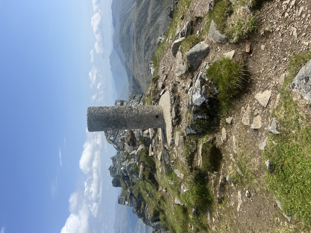
The Saddle
M
Add photo
1 010 m
Elevation
Elevation is the altitude of a place above sea level.
16 m
Prominence
Peak’s prominence is the least vertical to be covered to get from the summit to any other higher terrain.
Proportional Prominence880 m
Munro
Mountains in Scotland with a height of over 914 m / 3 000 ft bear a special name, the Munros. They are named after Sir Hugh Munro, the 4th Baronet (1856–1919), who produced the first list of such hills, known as Munro’s Tables, in 1891.
The Saddle (Scottish Gaelic: An Dìollaid) is one of the great Scottish mountains; seen from the
site of the Battle of Glen Shiel it forms (with Faochag) one of the best-known views in the Highlands. It is in the Highland local government area, on the boundary between the counties of Inverness-shire and Ross and Cromarty.
The mountain provides exciting and challenging climbing. The traverse of the Forcan Ridge — in winter or summer — is one of the classic Scottish mountain expeditions. The mountain's name refers to the shape of the summit ridge when seen from Glen Shiel with the twin summits and ridge in between resembling a saddle. The mountain was originally known by its Gaelic name of An Dìollaid but this has now been lost through common usage of its English translation and it is now one of the few mountains in highland Scotland with an English name.
There's a hiking trail (T2) leading to the summit.
We use GPS information embedded into the photo when it is available.
3D mountains overlay
Adjust mountain panorama to perfectly match your photos because recorded by camera photo position might be imprecise.
Move tool
Rotate tool
Zoom
More customization
Choose which peak labels should make into the final photo and what photo title should be.
Next
Photo Location
Satellitte
Flat map
Relief map
Latitude
Longitude
Altitude
OR
Latitude
°'''
Longitude
°'''
Apply
Register Peak
Peak Name
Latitude
Longitude
Altitude
Register
Teleport
PeakVisor
This 3D model of Sagarmatha National Park in Nepal was made using the PeakVisor app topographic data. The mobile app features higher precision models worldwide, more topographic details, and works offline. Download PeakVisor maps today.
Download OBJ model
PeakVisor
The download should start shortly. If you find it useful please consider supporting the PeakVisor app.
PeakVisor for iOS and Android
Be a superhero of outdoor navigation with state-of-the-art 3D maps and mountain identification in the palm of your hand!