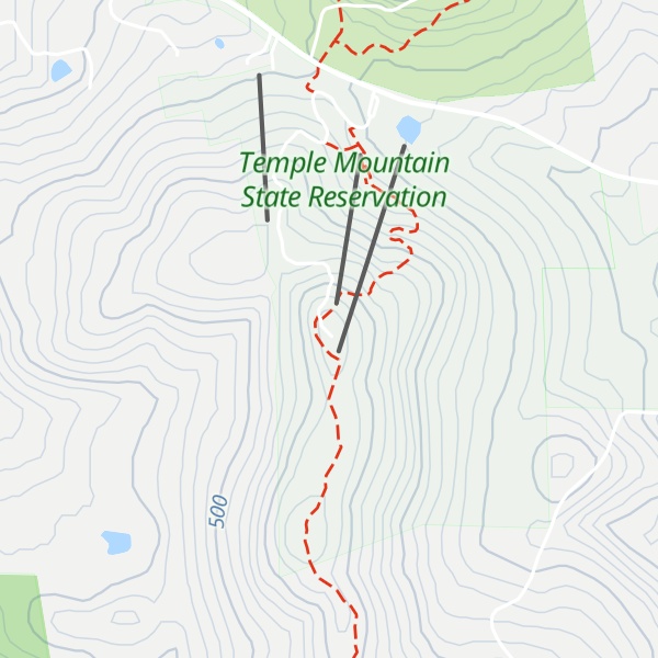
Temple Mountain is a 2,045-foot (623 m) mountain in the Wapack Range in Hillsborough County, New Hampshire, United States.
The mountain lies within the towns of Sharon, Temple and Peterborough. The 22-mile (35 km) Wapack Trail traverses the mountain. The northern face includes the state-owned 350-acre (1.4 km2) Temple Mountain Reservation Area, formerly Temple Mountain Ski Area. The mountain is 3.5 miles (5.6 km) long and has several summits; three of them are named: Burton Peak 2,010 feet (610 m), Whitcomb Peak 1,710 feet (520 m), and Holt Peak, the high point.
Pack Monadnock Mountain is located directly to the north along the Wapack ridgeline; Kidder Mountain to the south. Scattered ledges along the ridgeline offer long vistas west to Mount Monadnock and south along the spine of the Wapack Range; the abandoned ski area on the north side of the mountain offers 270-degree views.
The east side of the mountain drains into the Souhegan River watershed, thence into the Merrimack River and Atlantic Ocean; the west side drains into the Contoocook River, thence into the Merrimack River.
There's a trail called Wapack Trail leading to the summit. Temple Mountain is one of the 7 peaks along the Wapack Trail.
We use GPS information embedded into the photo when it is available.
3D mountains overlay
Adjust mountain panorama to perfectly match your photos because recorded by camera photo position might be imprecise.
Move tool
Rotate tool
Zoom
More customization
Choose which peak labels should make into the final photo and what photo title should be.
Next
Photo Location
Satellitte
Flat map
Relief map
Latitude
Longitude
Altitude
OR
Latitude
°'''
Longitude
°'''
Apply
Register Peak
Peak Name
Latitude
Longitude
Altitude
Register
Teleport
PeakVisor
This 3D model of Sagarmatha National Park in Nepal was made using the PeakVisor app topographic data. The mobile app features higher precision models worldwide, more topographic details, and works offline. Download PeakVisor maps today.
Download OBJ model
PeakVisor
The download should start shortly. If you find it useful please consider supporting the PeakVisor app.
PeakVisor for iOS and Android
Be a superhero of outdoor navigation with state-of-the-art 3D maps and mountain identification in the palm of your hand!