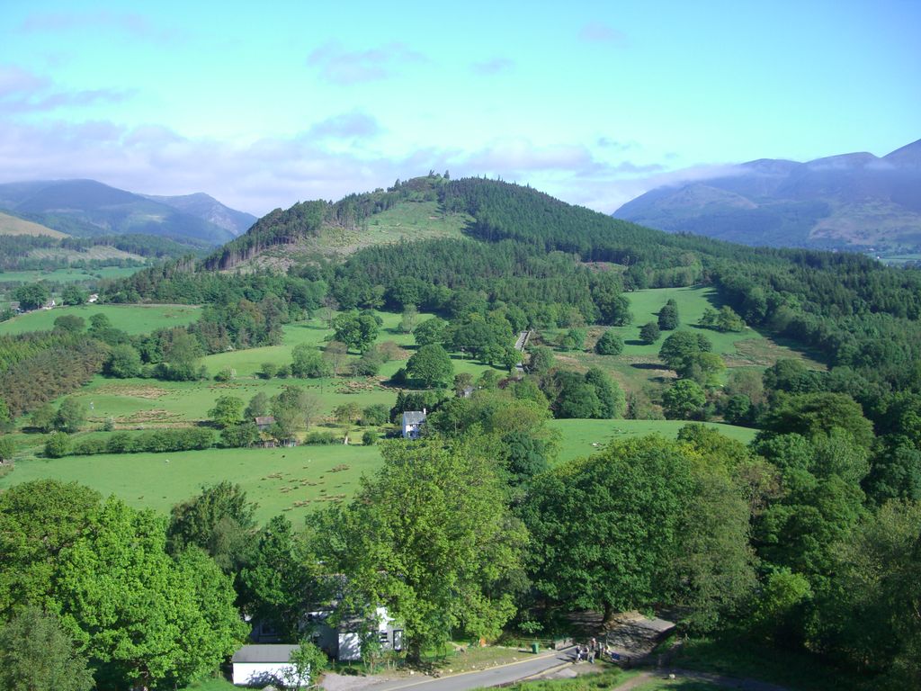
Swinside is a hill in the northwestern area of the English Lake District. It is small, wooded and surrounded by much bigger and more popular fells, meaning it is often overlooked. Alfred Wainwright, for instance, failed to include it in his pictorial guides to fells in the Lake District.
Swinside has an elevation of 244.8 m (803 ft) and a prominence of 151.9 m (498 ft), so
unlike many of its grander neighbours, it is a Marilyn as a result of being surrounded by a moat of low boggy ground. Until recently it was also completely covered by trees, but a track now leads up to the summit where the trees have been felled. The land is privately owned and there is no public footpath to the summit although the owner recently allowed local residents from the nearby village of Portinscale to visit the summit on a sponsored walk. It is reported that the hill is used for quad biking trips and that permission to enter on foot can often be obtained on request.
By prominence Swinside is
# 53 out of 864 in Lake District National Park # 74 out of 1704 in Cumbria # 52 out of 838 in The English Lake District WHS
We use GPS information embedded into the photo when it is available.
3D mountains overlay
Adjust mountain panorama to perfectly match your photos because recorded by camera photo position might be imprecise.
Move tool
Rotate tool
Zoom
More customization
Choose which peak labels should make into the final photo and what photo title should be.
Next
Photo Location
Satellitte
Flat map
Relief map
Latitude
Longitude
Altitude
OR
Latitude
°'''
Longitude
°'''
Apply
Register Peak
Peak Name
Latitude
Longitude
Altitude
Register
Teleport
PeakVisor
This 3D model of Sagarmatha National Park in Nepal was made using the PeakVisor app topographic data. The mobile app features higher precision models worldwide, more topographic details, and works offline. Download PeakVisor maps today.
Download OBJ model
PeakVisor
The download should start shortly. If you find it useful please consider supporting the PeakVisor app.
PeakVisor for iOS and Android
Be a superhero of outdoor navigation with state-of-the-art 3D maps and mountain identification in the palm of your hand!