Stenbury Down is a chalk down on the Isle of Wight. It is located close to the town of Ventnor, in the southeast of the island, and rises to 226 metres at its highest point, west of Wroxall, Isle of Wight. Stenbury Down is an elongate down running approximately north to south.
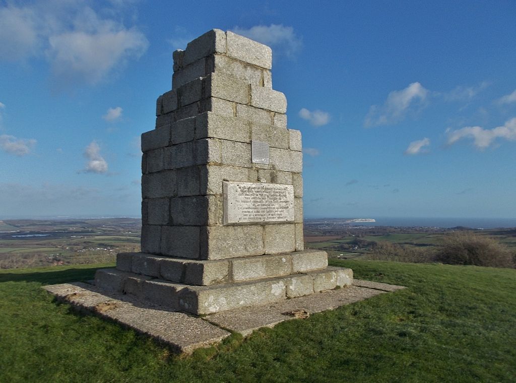
At the north end of Stenbury Down, also called Appuldurcombe Down, there is an obelisk erected in 1774 by Sir Richard Worsley in memory of Sir Robert Worsley of Appuldurcombe House. The monument was struck by lightning in 1831 and partially demolished. In 1983 it was restored to its current state by General Sir Richard Worsley with assistance from the Isle of Wight Council and the people of Gatcombe Parish.
There are also two prominent radio masts. The northern end terminates in the Gat Cliff, whereas the southern end transition into Week Down.
Vehicle access is available via Rew Lane and a steep unnamed road.
We use GPS information embedded into the photo when it is available.
3D mountains overlay
Adjust mountain panorama to perfectly match your photos because recorded by camera photo position might be imprecise.
Move tool
Rotate tool
Zoom
More customization
Choose which peak labels should make into the final photo and what photo title should be.
Next
Photo Location
Satellitte
Flat map
Relief map
Latitude
Longitude
Altitude
OR
Latitude
°'''
Longitude
°'''
Apply
Register Peak
Peak Name
Latitude
Longitude
Altitude
Register
Teleport
PeakVisor
This 3D model of Sagarmatha National Park in Nepal was made using the PeakVisor app topographic data. The mobile app features higher precision models worldwide, more topographic details, and works offline. Download PeakVisor maps today.
Download OBJ model
PeakVisor
The download should start shortly. If you find it useful please consider supporting the PeakVisor app.
PeakVisor for iOS and Android
Be a superhero of outdoor navigation with state-of-the-art 3D maps and mountain identification in the palm of your hand!