Scan the QR code and open PeakVisor on your phone
From dazzling chalk cliffs to rolling rural hills, the Isle of Wight AONB has a slice of scenery to please every hiker. There are 30 named hills in Isle of Wight AONB. The highest and the most prominent hill in the area is St. Boniface Down (241 m/791 ft).
The Isle of Wight AONB is one of 42 Areas of Outstanding Natural Beauty (AONB) dotted across England, Wales, and Northern Ireland. The AONB covers an area of approximately 73 sq. mi (189 sq. km) on the Isle of Wight.
The Isle of Wight is located less than 5 mi (8 km) off the coast of Hampshire in England across a strait known as the Solent. It's the largest offshore island of England. The AONB encompasses roughly half of the island, including the northwest and southwest coastlines and the eastern downlands.
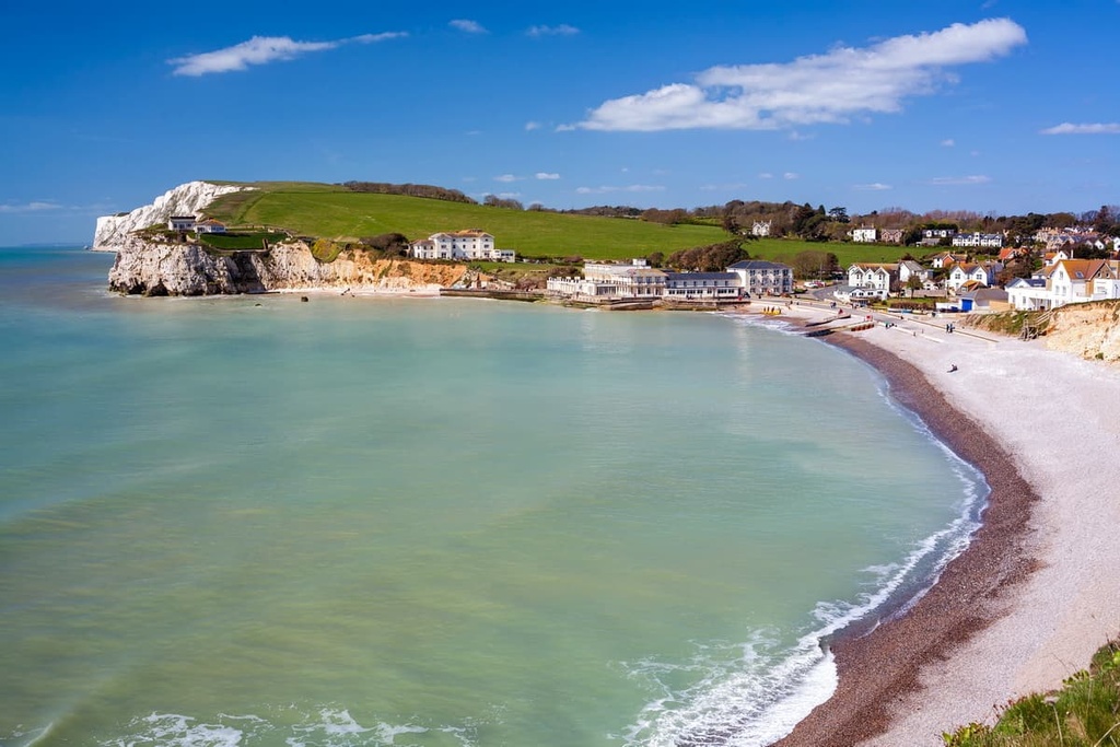
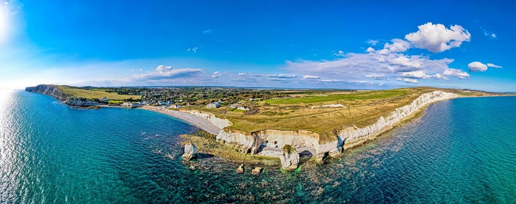
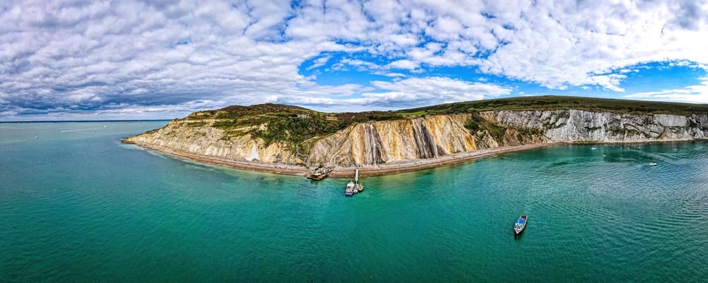
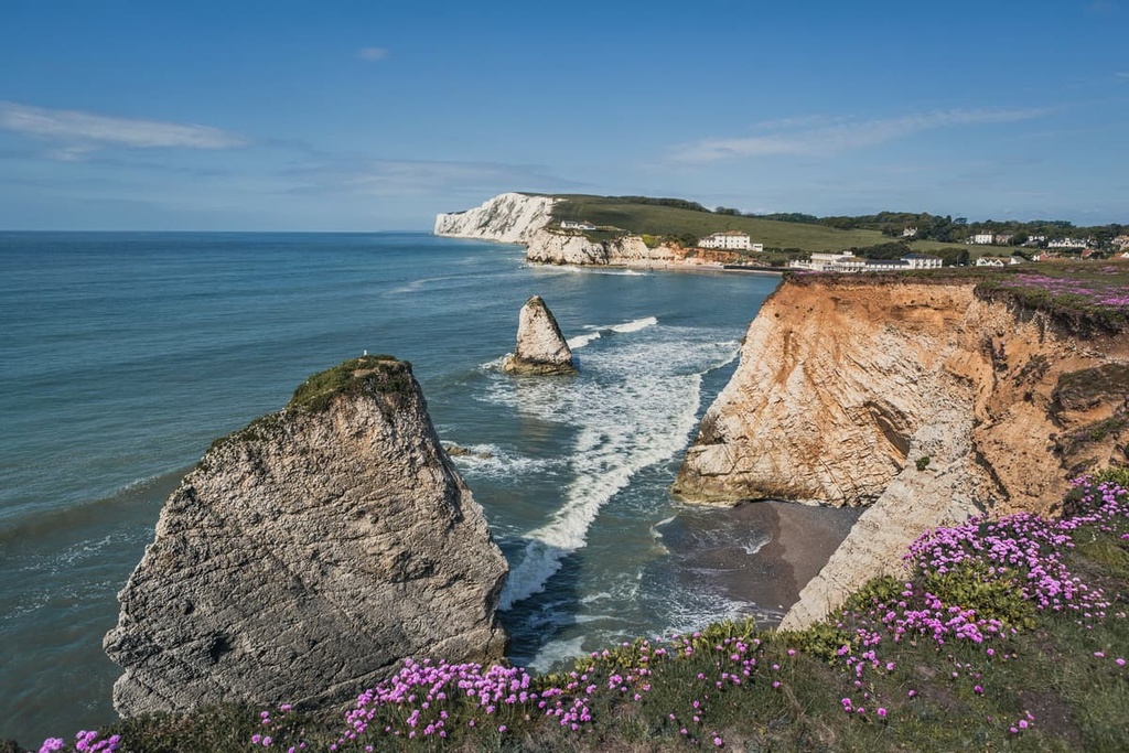
One of the most prominent features of the Isle of Wight AONB is the chalk downlands and cliffs in West Wight. Towering chalk cliffs and sandy bays characterize the coastline to the south at Tennyson Heritage Coast, while mudflats and clay cliffs are found to the north at the Hamstead Heritage Coast.
One of the most interesting coastal areas of the Isle of Wight is the Undercliff. The Undercliff is a strip of land that’s about 5 mi (8km) long and around 0.25 to 0.5 miles (0.4 to 0.8 km) wide on the island's southern coast. It's located above a low sea cliff and backed up by taller chalk and green sand cliffs. The area is known for its warm microclimate and numerous landslides.
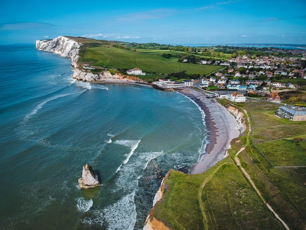
From east to west across West Wight runs a chalk downland ridge that ends at the Needles, a row of three chalk stacks off the Isle of Wight's most westerly point. Rising 30 m (98 ft) out of the English Channel, the Needles is one of the UK's most famous coastal rock formations.
The inland areas of Isle of Wight AONB are mainly rural, with roughly 80 percent of the area dedicated to agriculture. The landscape is varied, ranging from sandstone hills to chalk heathlands to woodlands.
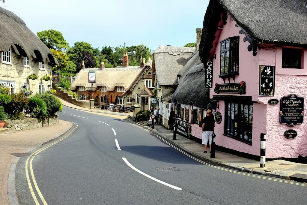
Despite having a population of around 10,000 people, the Isle of Wight AONB has no significant settlements. Several seaside resort towns border the AONB, including Shanklin, Ventnor, and Cowes. The county town of the Isle of Wight, Newport, sits on the northeast boundary of the AONB's southwest section, in the middle of the island.
The varied landscape of the Isle of Wight AONB is due partly to the island's complex geology. The island is composed entirely of sedimentary rocks that formed between the early Cretaceous and middle Paleogene, between 127 and 30 million years ago.
There is a distinct geological split across the Isle of Wight, with the northern half of the island composed of clay and the southern half composed of chalk. The inland downs are mainly chalk but contain rocks from the Lower and Upper Greensands, as well as the Wealden Group.
Archeologists believe the Isle of Wight was separated from the mainland during the last major interglacial period around 125,000 years ago.
For centuries, the Isle of Wight has been an essential site for paleontologists. The island's mudstones, sandstones, and limestones are rich in fossils, with erosion often revealing rare fossilized remains.
The Isle of Wight is considered one of the most critical sites in Europe for dinosaur fossils, with bones and footprints found in the east at Yaverland and the west at Compton Bay.
There are many exposed chalk hills called ‘downs’ that are located across the Isle of Wight. Eight hills in the AONB exceed 200 m (656 ft) in elevation, and there are two Marilyns (a hill that exceeds 150 m/492 ft in prominence): St. Boniface Down (241 m/791 ft) and Brighstone Down (214 m/702 ft).
Other notable hills in the AONB include St Catherine's Hill (236 m/774 ft), Shanklin Down (235 m/771 ft), and Tennyson Down (149 m/488 ft).
Due to the Isle of Wight's conservation efforts and biodiversity, it's designated a UNESCO Biosphere Reserve. Shaped independently from the mainland for approximately 125,000 years, the Isle of Wight is home to a unique array of unique flora and fauna.
One of the most common and fascinating sights on the Isle of Wight is red squirrels. The Isle of Wight is one of only a few places in England where there are no gray squirrels, allowing red squirrels to thrive undisturbed.
The Isle of Wight AONB also supports nationally important populations of hazel dormice, water voles, and Alcathoe bats. Larger mammals, including herds of wild goats and deer, can occasionally be spotted around Ventnor Downs.
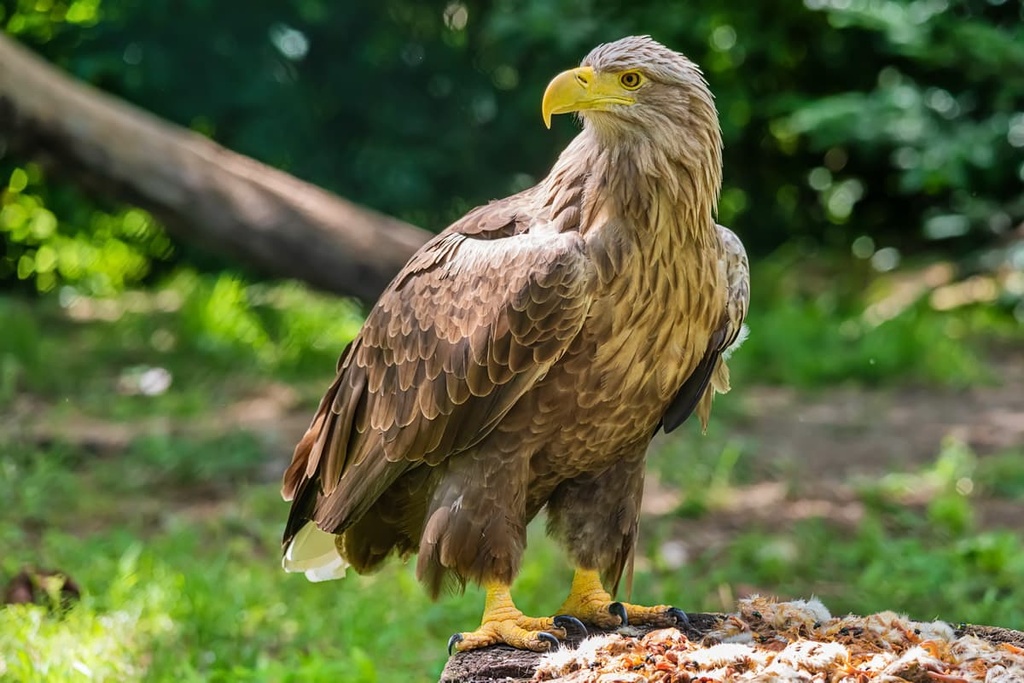
The varied landscape and rugged cliffs of the Isle of Wight make the island a haven for many bird species. One of the most famous species is the white-tailed eagle, which has been successfully reintroduced to the island after the last wild breeding pair left in 1780.
Around 200 bird species have been recorded on the island, including Dartford warblers, peregrine falcons, and ospreys.
Forty-three of the UK's 61 butterfly species also live on the Isle of the Wight, including Glanville fritillaries, which is found almost nowhere else in the country. Other notable species include purple hairstreaks, marbled whites, and chalkhill blues.
Due to its isolation from the mainland, the Isle of Wight is home to some nationally scarce species and is missing many common plants and trees.
The trees of the Isle of Wight are varied, ranging from monkey puzzles to downy birches to sessile oaks. Common shrubs include bilberries, cotoneasters, and spindles.
Spring is one of the best times to visit the Isle of Wight. You can observe green-winged orchids at the Newtown National Nature Reserve and wander among carpets of bluebells on Ventnor Downs.
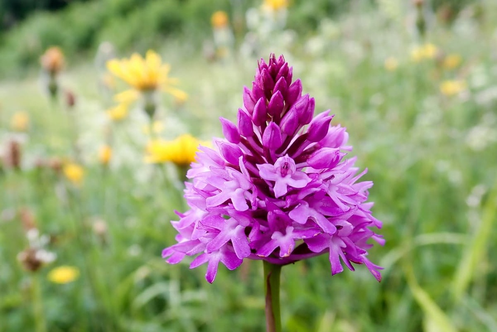
Nine orchid species are native to the Isle of Wight, and the county flower is the pyramidal orchid. Other beautiful and rare plant species to watch out for in the AONB include southern marsh orchids, early gentians, and carline thistles.
Humans have inhabited the Isle of Wight since before it became an island. There’s clear evidence that hominids lived on the Isle of Wight during the Lower Palaeolithic, over 350,000 years ago. Archaeologists have discovered around 300 handaxes in the region that date back to this period.
While there are several archeological sites across the Isle of Wight dating back to the Mesolithic period, the most important ancient activity took place in the Bronze Age.
As tin mines ran dry across Devon and Cornwall, miners turned to the Isle of Wight as a key source of ore. There's evidence that Bronze Age miners would cart tin across the Solent at low tide. At the time, the Solent strait was much shallower than it is today.
The Isle of Wight didn't escape the Roman Conquest of Britain. The Belgae, a confederation of tribes encompassing much of Western Europe, ruled the Isle of Wight in 85 BCE. However, the island was then captured by the Roman commander Vespasian less than a century later. The remains of several Roman villas have been discovered across the island, including the Brading Roman Villa.
The Middle and Dark Ages were especially difficult for the Isle of Wight. Many Germanic tribes such as the Jutes attempted to conquer the island, and it was subjected to numerous Viking raids. The island was eventually united with England under King Alfred the Great, becoming a part of Hampshire.
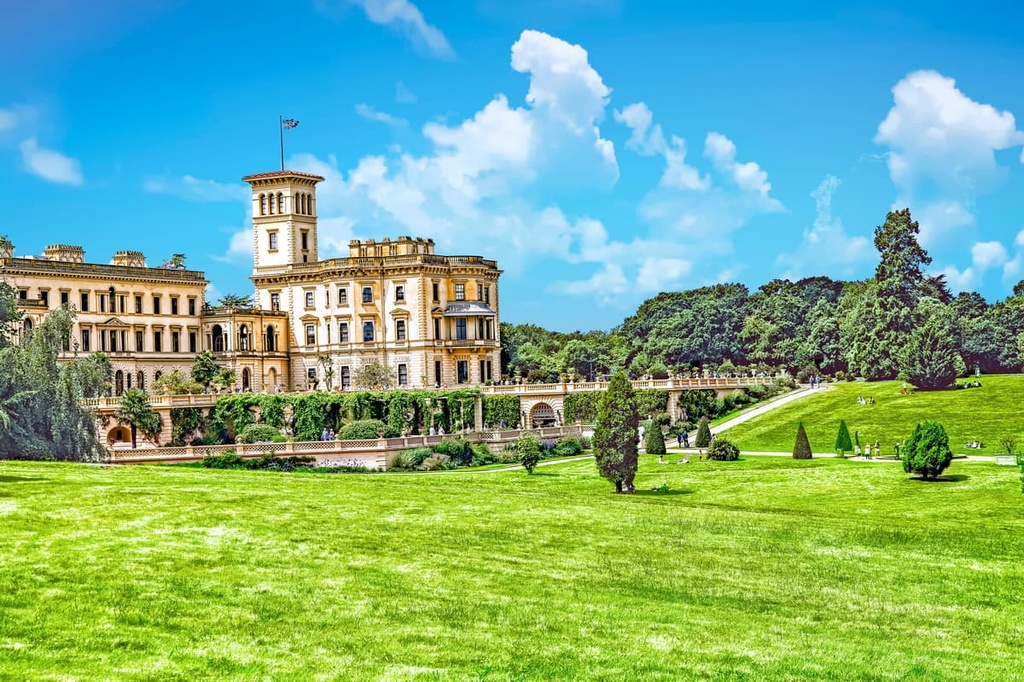
Skip forward to the nineteenth century and the Isle of Wight became a popular vacation destination for Britain’s elite. This was due partly to Queen Victoria, who took Osbourne House on the island as her winter residence. Many famous people used the Isle of Wight as a resort during this time, including Charles Dickens, Alfred, Lord Tennyson, and Julia Margaret Cameron.

During the Victorian age, the Isle of Wight saw several technological firsts. In 1878, Graham Alexander Bell demonstrated one of the first public uses of a telephone to Queen Victoria by placing a call to Cowes. In 1897, Guglielmo Marconi set up the world's first radio station on the island's western tip at the Needles Battery.
Between 1968 and 1970, West Wight was the site of the first Isle of Wight Festivals, attracting acts like Bob Dylan, Miles Davis, and The Who. The 1970 edition of the festival is famous for being one of the last times Jimi Hendrix performed live before his death. The festival was brought back in 2002 and has taken place annually since.
The Isle of Wight AONB was established in 1963 to protect the island's unique ecosystems and geological heritage. It was the twelfth AONB to be established across England, Scotland, and Northern Ireland.
Whether you're planning a clifftop stroll or a ramble across rolling heathlands, the Isle of Wight AONB has you covered. Read on to learn about the Isle of Wight AONB's best hill walks.
Part of the Ventnor Downs on the Isle of Wight's southern coast is St Boniface Down (241 m/791 ft). It's the county top of the Isle of Wight and one of only two Marilyns on the island.
St. Boniface Down is popular as it provides a challenging walk with sweeping views as far as Portsmouth on the mainland. There's also a legendary wishing well on the hill's southside. According to myth, reaching the wishing well from the south without looking back means any wish you make will come true.
One of the best ways to explore St. Boniface Down is on the National Trust walk across Ventnor Downs. This circular walk is 2.6-mi (4.2 km) long and takes around 2 hours to complete. Dogs are welcome but should stay on a leash.
Starting from the Dakota car park, the walk takes you along the perimeter of RAF Ventnor, past several Bronze Age burial mounds, and down into a coombe.
After exiting the coombe, you'll pass several buildings, including the old Ventnor train station, before climbing a steep slope onto St. Boniface Down. The path then loops back around to your starting point.
An alternative walk in the area is along the path from the A3055 road between Bonchurch and Luccombe. The path leads into Bonchurch Landslips, a Site of Special Scientific Interest (SSSI). One of the best parts of this walk is that it takes you through two scenic rock clefts, the Devil's Chimney and the Chink.
Shanklin Down (235 m/771 ft) and Nansen Hill (226 m/741 ft) are the third and fourth highest hills on the Isle of Wight, respectively. Both hills are a part of Ventnor Downs and are located around a mile (1.6 km) from St. Boniface Down.
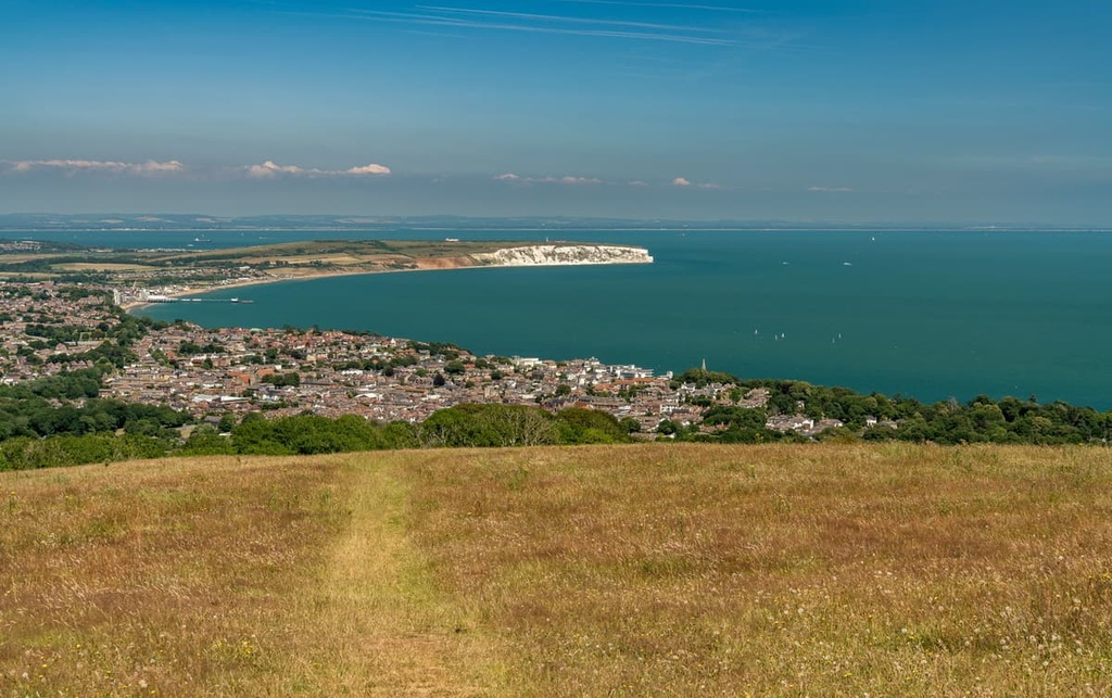
Shanklin Down misses out on being the island's highest point by 2 m (6.5 ft) but offers arguably the island's most expansive views. The entirety of East Wight is visible from the hill's trig point, including all the way to Nab Tower lighthouse, which is located 5 mi (8 km) off the east coast.
The area around Luccombe is gorgeous, with bluebells carpeting the downs in the spring. The scenery around Bonchurch inspired the works of romantic poet Algernon Swinburne, who lived in the area as a child.
The best way to explore the downs is on the National Trust's Luccombe and the Landslip walk. This circular walk is 4.5 miles (7.5 km) long and takes approximately 2 hours 30 minutes to complete. Dogs are welcome but should stay on a leash.
The walk starts from the Luccombe Down car park and leads steeply down Nansen Hill and then up two flights of stairs through the Devil's Chimney. Then, the path meanders through The Landslip and onto the exposed slopes of Shanklin Down. High winds are common on Shanklin Down, so take care.
The path then takes you off the open downs, past St. Blasius church and Holme Copse, before reaching Shanklin Down's trig point. You'll be treated to panoramas of the Isle of Wight from atop Shanklin Down, with Tennyson Down (149 m/ 489 ft) to the far west and Culver Down to the far east.
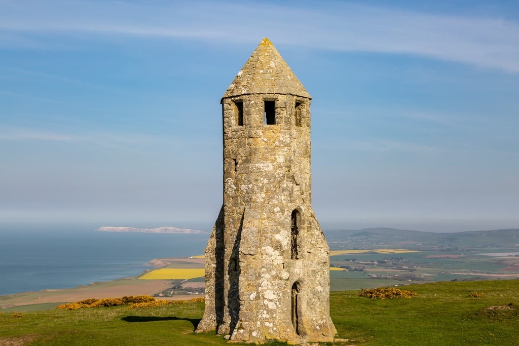
Located between the towns of Niton and Chale overlooking the Back of the Wight is St. Catherine's Down (236 m/774 ft). It's the second-highest hill on the island, offering vistas across ancient grasslands and several narrow ravines known as chines.
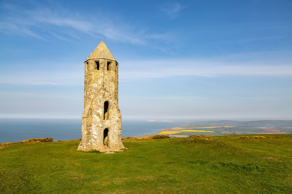
Atop St. Catherine's Down is St. Catherine's Oratory. Known locally as the Pepperpot, St. Catherine's Oratory is a fourteenth-century lighthouse and the second-oldest surviving lighthouse on the British Isles, after Dover's Roman Lighthouse.
There's a National Trust path called the Monk and the Merchant Walk, which takes in the best of St. Catherine's Down. The walk is 4.8 mi (8km) long and takes around 2 hours 30 minutes to complete. Dogs are welcome but should stay on a leash.
From the Blackgang viewpoint car park, you'll walk around the boundary of the hill before cutting onto St. Catherine's Down. Here you'll pass the Hoy Monument, a column built in 1814 to commemorate the Russian Tsar Alexander I’s visit to Great Britain.
You'll then pass along the wall of a large country house called The Hermitage before passing Wydcome House. The Wydcome Valley is popular with nature watchers, as golden-ringed dragonflies, demoiselle damselflies, and green-veined white butterflies are common in the area.
Eventually, the path leads uphill onto Head Down and to St. Catherine's Oratory. After passing the St. Catherine's Down's trig point, a straight path leads back to the car park.
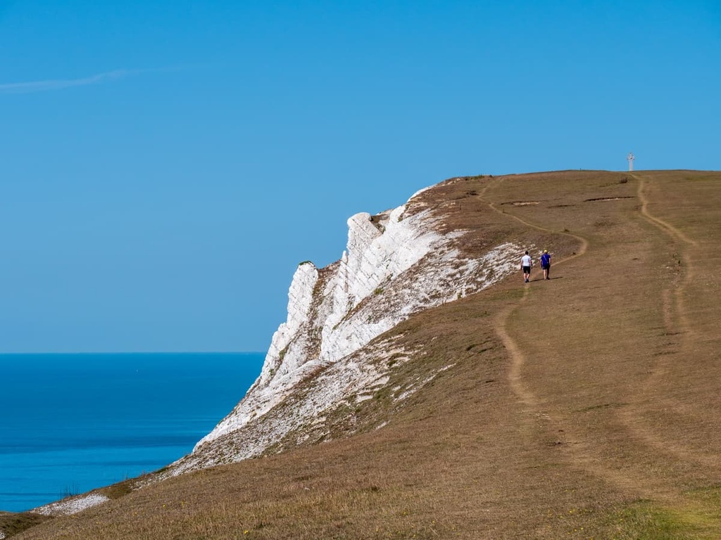
Perhaps the best walk in West Wight is across Tennyson Down (149 m/ 489 ft). Named after Victorian poet laureate Alfred, Lord Tennyson, Tennyson Down is a whaleback chalk seacliff. At the down's highest point is the Tennyson Monument commemorating Lord Tennyson.
The National Trust's Tennyson Down Walk takes you to the highest point on Tennyson Down and then across to the Old and New Batteries, which afford the best views of the Needles.
This 7-mi (11km) circular walk takes around 3 hours to complete. Do note that the walk takes you in a figure of eight shaped loop and can be split in half if needed. The walk is steep with exposed cliffs, so a head for heights is required. Dogs are welcome but should stay on a leash.
From the High Down Chalk Pit car park, the path will take you steeply uphill to the Tennyson Monument. You can then follow any of the clifftop paths west towards the Needles.
You'll first pass the New Battery and then the Old Battery on the way to Alum Bay. After enjoying views of the Needles, you'll loop around and follow the path along the bottom of the hill back towards the car park.
The second leg of the walk leads towards Farringford, the home of Alfred, Lord Tennyson. After passing the manor house, the path turns towards Freshwater Bay, passing the thatched St. Agnes' Church.
One of the final landmarks you’ll pass is the Dimbola Lodge, the former home of Victorian photographer Julia Margaret Cameron. Then the trail turns and leads uphill to the Tennyson Monument, with a steep path downhill back to the car park.
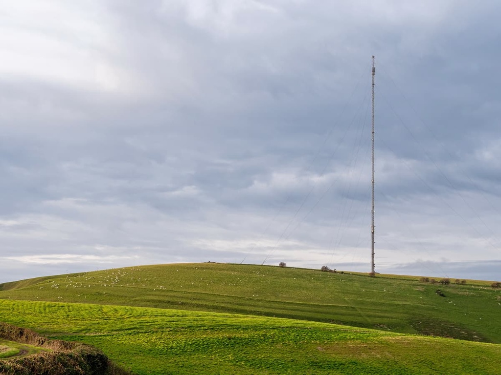
If you're looking to discover some of the inland hills on the Isle of Wight, head to Chillerton Down (168 m/551 ft). Situated not far from the middle of the island, Chillerton Down offers a challenging walk through woods and valleys, with the sea visible from its summit.
The National Trust's Chillerton Down Walk takes in Chillerton Down, Berry Hill (132 m/433 ft), and the "five barrows" Iron Age fort. The walk is 9.25 miles (16 km) long and takes around 4 hours to complete. Note that the walking route is a figure eight shape, so it can be cut in half if necessary.
Park at the lay-by off Berry Shute, Chillerton to begin this walk. You'll start by following the G13 bridleway to the bottom of Chillerton Down before climbing the hill and passing the 229-m (751 ft) tall Chillerton transmitting station. You'll find a popular viewpoint further down the transmitting station's fenceline.
The trail then passes through a copse, following several bridleways and footpaths on the way to the Blackwater Mill. The path then loops back south, skirting around Gatcombe Withy Bed. You'll then pass by St. Olaves Church, parts of which date back to the thirteenth century.
The final stretch takes you almost to the summit of Berry Hill before descending back to your starting point.
For over 150 years, holidaymakers have flocked to the Isle of Wight to enjoy its rural scenery, beautiful coastline, and picturesque settlements. Read on to find out about the best places to visit in and around the Isle of Wight AONB.
Newport is the county town and largest settlement on the Isle of Wight. Resting on the River Medina at the geographical center of the Isle of Wight, Newport is less than a 30-minute drive from anywhere on the island.
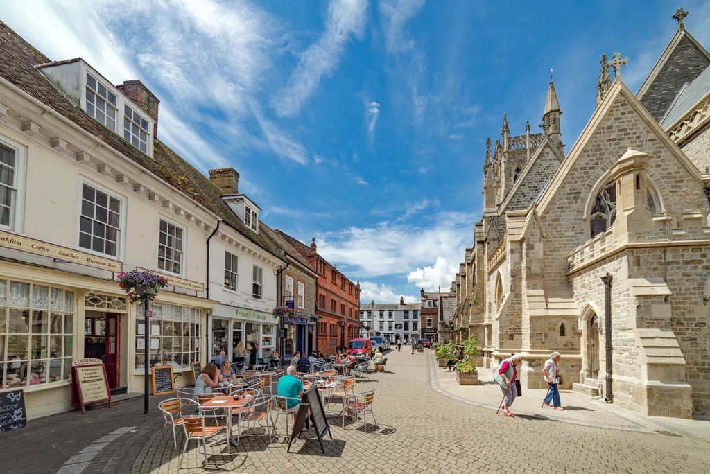
During your visit to Newport, ensure you tour the twelfth-century Carisbrooke Castle, where Charles I was imprisoned while awaiting trial. The Monkey Haven–Primate Rescue Centre near Newport is one of the island's best family-friendly attractions. Popular hotels in Newport include One Holyrood, The Wheatsheaf Hotel, and the Newport Quay Hotel.
Sat on the Isle of Wight's northeastern coastline is the town of Ryde. The island's second-largest settlement, Ryde grew from two small villages in the nineteenth century to one of the island's main vacation resorts. Ryde is home to a white sandy beach and the fourth-longest listed pier in the UK.
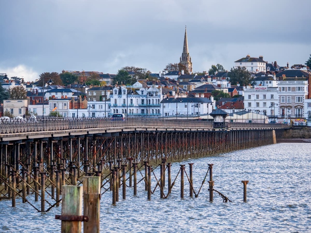
You'll find a wide range of attractions in Ryde, from Quarr Abbey to the Rosemary Vineyard. However, its position in the northeast means it's far from some of the best hikes in the Isle of Wight AONB. Popular hotels in Ryde include the Royal Esplanade Hotel, The Boathouse, and the Haven Hall Hotel.
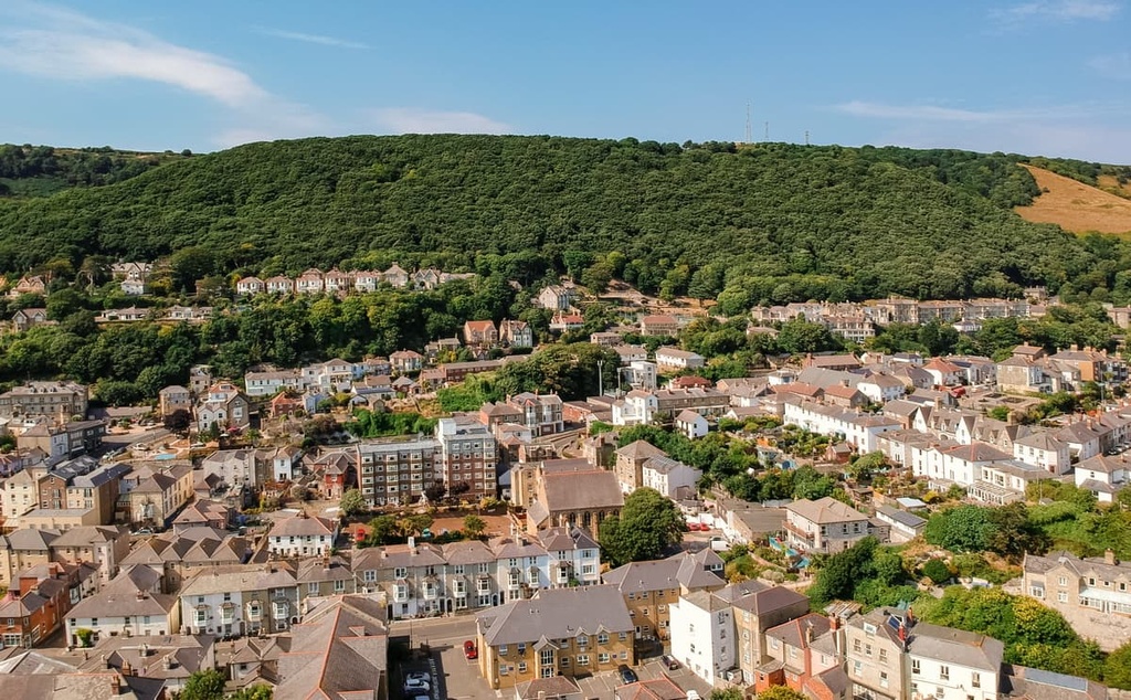
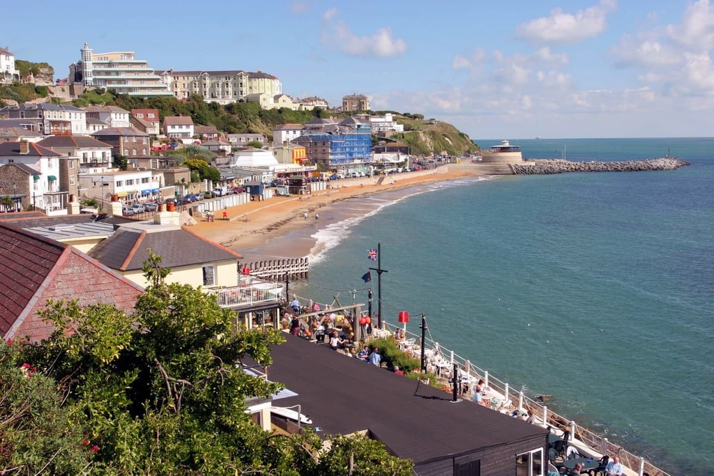
The village of Shanklin sits overlooking Sandown Bay and is one of the island's most popular resorts. Along with neighboring Sandown and Lake, Shanklin boasts pristine beaches with traditional seaside attractions and an esplanade.
Shanklin is conveniently located close to Ventnor Downs and many of the highest hills on the Isle of Wight. Visitors should also consider taking a stroll through the lush Shanklin Chine. Shanklin has several seafront hotels, including The Channel View Hotel, the Clifton Hotel Shanklin, and the OYO Shanklin Beach Hotel.
Further down the coast from Shanklin is another popular Victorian resort, Ventnor. Located just south of the island's highest point, St. Boniface Down, Ventnor is a gorgeous terraced village with a sandy beach. The protection given by the downs means Ventnor has its own microclimate, with more sunny days than the rest of the island.
You'll find several popular attractions in and around Ventnor, like the Ventnor Botanical Gardens and the eighteenth-century Appuldurcombe House. Popular hotels in Ventnor include The Royal Hotel, The Wellington Hotel, and The Spyglass Inn.
Hikers looking to explore as much of the Back of the Wight as possible should visit Freshwater. This small western village stretches from near Totland to Freshwater Bay and is one of the closest settlements to the Needles. If you’re looking to plan long walks along the island's towering chalk cliffs, you will love staying in Freshwater.
Despite its small size, Freshwater is home to many popular attractions, including the Dimbola Museum & Galleries, Fort Victoria Country Park, and Compton Beach. Popular hotels in Freshwater include the Albion Hotel and The Bay B&B.