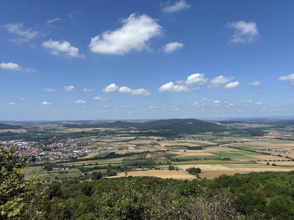
The Staffelberg is a hill in Bavaria, Germany. It is part of the Franconian Switzerland and one of the most important landmarks in Franconia. First settlements date from the Neolithic. Romans, Celts and Franconians followed. During the La Tène period the Celtic oppidum of Menosgada was built on the plateau of the Staffelberg.
Nowadays, it is a famous tourist attraction – not only because of the view over the Main valley. The Staffelberg is located close to Vierzehnheiligen and the district capital of Lichtenfels. At the foot of the hill lies the town of Bad Staffelstein.
On the peak of the hill there is a little chapel (Adelgundiskapelle) and a restaurant. The entire hill is protected by environmental laws.
There's a trail leading to the summit. Staffelberg is one of the 3 peaks along the multi-day Gottesgartenrundweg Süd.
By elevation Staffelberg is
# 1 out of 1 in Staffelberg # 21 out of 139 in Landkreis Lichtenfels
By prominence Staffelberg is
# 1 out of 1 in Staffelberg # 17 out of 628 in Naturpark Fränkische Schweiz - Frankenjura # 5 out of 139 in Landkreis Lichtenfels
We use GPS information embedded into the photo when it is available.
3D mountains overlay
Adjust mountain panorama to perfectly match your photos because recorded by camera photo position might be imprecise.
Move tool
Rotate tool
Zoom
More customization
Choose which peak labels should make into the final photo and what photo title should be.
Next
Photo Location
Satellitte
Flat map
Relief map
Latitude
Longitude
Altitude
OR
Latitude
°'''
Longitude
°'''
Apply
Register Peak
Peak Name
Latitude
Longitude
Altitude
Register
Teleport
PeakVisor
This 3D model of Sagarmatha National Park in Nepal was made using the PeakVisor app topographic data. The mobile app features higher precision models worldwide, more topographic details, and works offline. Download PeakVisor maps today.
Download OBJ model
PeakVisor
The download should start shortly. If you find it useful please consider supporting the PeakVisor app.
PeakVisor for iOS and Android
Be a superhero of outdoor navigation with state-of-the-art 3D maps and mountain identification in the palm of your hand!