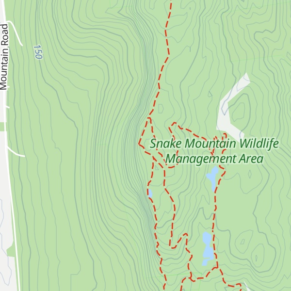
Snake Mountain, also called Grand View Mountain, is an isolated mountain in the U.S. state of Vermont. The mountain straddles the Addison-Weybridge town line in Addison County. Most of the mountain, including the summit, is part of the 1,215-acre (492 ha) Snake Mountain Wildlife Management Area (WMA) administered by the Vermont Fish & Wildlife Department. Adjacent to the WMA is the 81-acre (33 ha) Wilmarth Woods Natural Area protected by The Nature Conservancy.
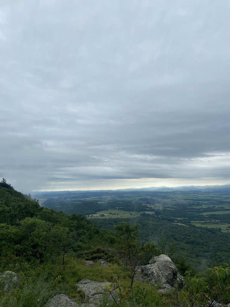
Snake Mountain is one of a series of scattered hills extending into the Champlain Valley from the greater Taconic Mountains along Vermont's southwestern edge. Seen from the west, the prominent sheer cliffs of the mountain rise dramatically out of the valley making it easy to distinguish from other nearby hills and mountains. From the summit, there is an open vista of Lake Champlain and the Adirondack Mountains to the west. The view from the summit is sometimes called "Grand View.”
There's a hiking trail (T1) called Summit Trail leading to the summit.
By elevation Snake Mountain is
# 55 out of 102 in Addison County
By prominence Snake Mountain is
# 61 out of 1311 in Vermont # 5 out of 102 in Addison County
We use GPS information embedded into the photo when it is available.
3D mountains overlay
Adjust mountain panorama to perfectly match your photos because recorded by camera photo position might be imprecise.
Move tool
Rotate tool
Zoom
More customization
Choose which peak labels should make into the final photo and what photo title should be.
Next
Photo Location
Satellitte
Flat map
Relief map
Latitude
Longitude
Altitude
OR
Latitude
°'''
Longitude
°'''
Apply
Register Peak
Peak Name
Latitude
Longitude
Altitude
Register
Teleport
PeakVisor
This 3D model of Sagarmatha National Park in Nepal was made using the PeakVisor app topographic data. The mobile app features higher precision models worldwide, more topographic details, and works offline. Download PeakVisor maps today.
Download OBJ model
PeakVisor
The download should start shortly. If you find it useful please consider supporting the PeakVisor app.
PeakVisor for iOS and Android
Be a superhero of outdoor navigation with state-of-the-art 3D maps and mountain identification in the palm of your hand!