Skatutakee Mountain is a 1,998-foot (609 m) monadnock located in Hancock, New Hampshire approximately 13 mi (21 km) east of the city of Keene and 8 mi (13 km) north of Mount Monadnock. The mountain shares a common base with Thumb Mountain, 1,978 feet (603 m), 3,000 feet (910 m) to the west. Much of the mountain is wooded but open ledges near the summit provide views of the surrounding countryside; vistas include the north face of Mount Monadnock.
The south side of the mountain drains into Jaquith Brook, thence into Nubanusit Brook, the Contoocook River, the Merrimack River, and the Atlantic Ocean. The north side drains into Ferguson Brook, thence the Contoocook River.
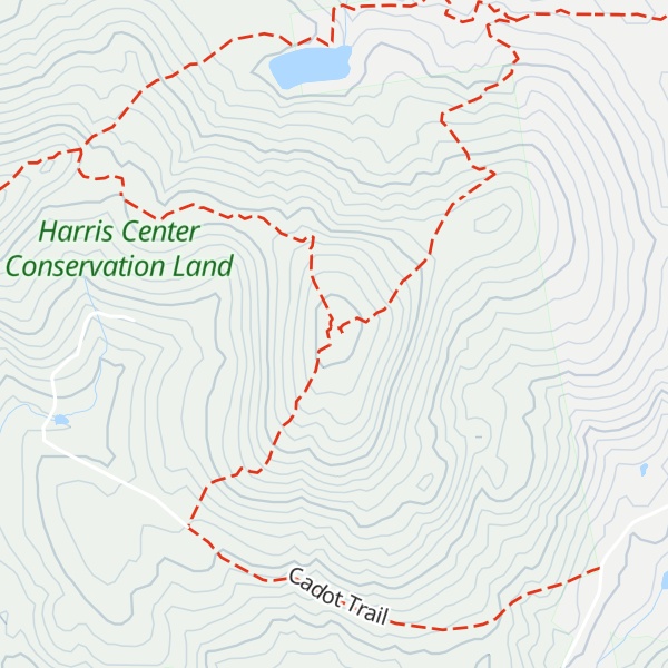
The mountain is part of a 12,500 acres (51 km2) "supersanctuary" composed of a number of conservation properties and easements facilitated by the Harris Center for Conservation Education, other non-profit entities, and the state of New Hampshire. The Harris Center maintains several hiking trails on the mountain and an environmental educational center at the mountain's north foot.
There's a trail called Thumbs Up Trail leading to the summit.
We use GPS information embedded into the photo when it is available.
3D mountains overlay
Adjust mountain panorama to perfectly match your photos because recorded by camera photo position might be imprecise.
Move tool
Rotate tool
Zoom
More customization
Choose which peak labels should make into the final photo and what photo title should be.
Next
Photo Location
Satellitte
Flat map
Relief map
Latitude
Longitude
Altitude
OR
Latitude
°'''
Longitude
°'''
Apply
Register Peak
Peak Name
Latitude
Longitude
Altitude
Register
Teleport
PeakVisor
This 3D model of Sagarmatha National Park in Nepal was made using the PeakVisor app topographic data. The mobile app features higher precision models worldwide, more topographic details, and works offline. Download PeakVisor maps today.
Download OBJ model
PeakVisor
The download should start shortly. If you find it useful please consider supporting the PeakVisor app.
PeakVisor for iOS and Android
Be a superhero of outdoor navigation with state-of-the-art 3D maps and mountain identification in the palm of your hand!