Available for connected Garmin and Suunto accounts.
Scan the QR code and open PeakVisor on your phone
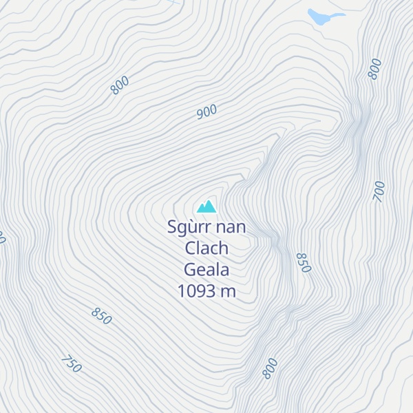
Sgùrr nan Clach Geala map
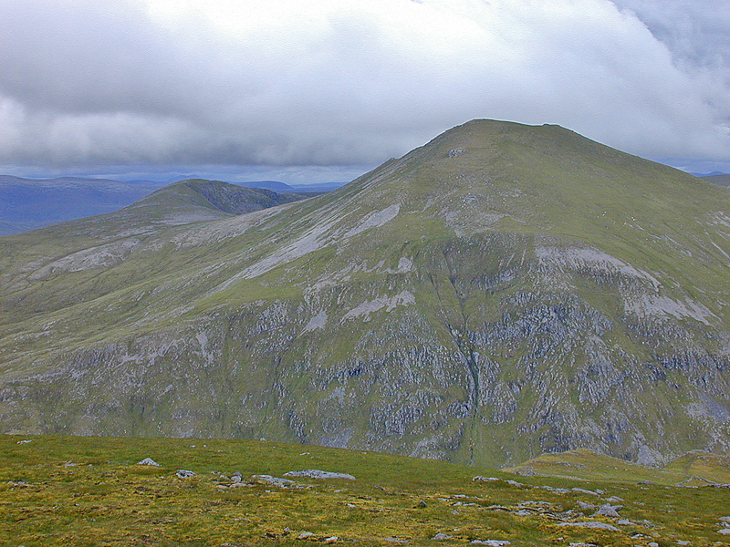
Sgùrr nan Clach Geala
N
Add photo
1 093 m
Elevation
Elevation is the altitude of a place above sea level.
225 m
Prominence
Peak’s prominence is the least vertical to be covered to get from the summit to any other higher terrain.
Proportional Prominence1 012 m
Munro
Mountains in Scotland with a height of over 914 m / 3 000 ft bear a special name, the Munros. They are named after Sir Hugh Munro, the 4th Baronet (1856–1919), who produced the first list of such hills, known as Munro’s Tables, in 1891.
Sgùrr nan Clach Geala is a mountain in Wester Ross in the Northwest Highlands of Scotland, south of Ullapool. With a height of 1,093 metres (3,586 ft), it is one of ten Munros in the group of hills known as the Fannichs.
There's a trail leading to the summit.
By elevation Sgùrr nan Clach Geala is
# 58 out of 4967 in Highland # 94 out of 18277 in Scotland # 94 out of 34760 in United Kingdom # 15 out of 6015 in the Northwest Highlands
We use GPS information embedded into the photo when it is available.
3D mountains overlay
Adjust mountain panorama to perfectly match your photos because recorded by camera photo position might be imprecise.
Move tool
Rotate tool
Zoom
More customization
Choose which peak labels should make into the final photo and what photo title should be.
Next
Photo Location
Satellitte
Flat map
Relief map
Latitude
Longitude
Altitude
OR
Latitude
°'''
Longitude
°'''
Apply
Register Peak
Peak Name
Latitude
Longitude
Altitude
Register
Teleport
PeakVisor
This 3D model of Sagarmatha National Park in Nepal was made using the PeakVisor app topographic data. The mobile app features higher precision models worldwide, more topographic details, and works offline. Download PeakVisor maps today.
Download OBJ model
PeakVisor
The download should start shortly. If you find it useful please consider supporting the PeakVisor app.
PeakVisor for iOS and Android
Be a superhero of outdoor navigation with state-of-the-art 3D maps and mountain identification in the palm of your hand!