Available for connected Garmin and Suunto accounts.
Scan the QR code and open PeakVisor on your phone
Sgùrr Choinnich map
Sgùrr Choinnich
N
Add photo
999 m
Elevation
Elevation is the altitude of a place above sea level.
134 m
Prominence
Peak’s prominence is the least vertical to be covered to get from the summit to any other higher terrain.
Proportional Prominence700 m
Munro
Mountains in Scotland with a height of over 914 m / 3 000 ft bear a special name, the Munros. They are named after Sir Hugh Munro, the 4th Baronet (1856–1919), who produced the first list of such hills, known as Munro’s Tables, in 1891.
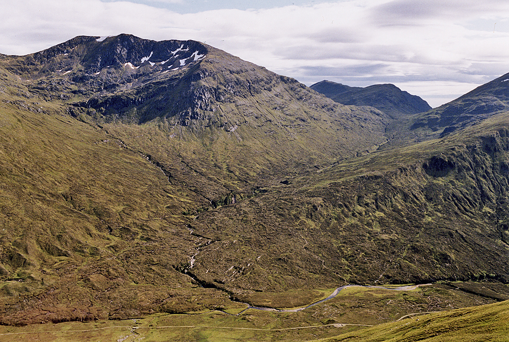
Sgùrr Choinnich is a mountain with a height of 999 metres (3,278 ft) in the Northwest Highlands of Scotland. Classed as a Munro, it is in the Achnashellach Forest area between Glen Carron and Loch Monar. It has mostly steep, grassy slopes, with a narrow summit ridge that runs east–west. There are crags on the northern side of this ridge, looking down into the corrie of Coire Choinnich.
From the summit there are fine views of the Coulin and Torridon peaks to the north, whilst southward lies a large expanse of wilderness around Loch Monar.
The hill is often climbed along with the neighbouring Sgùrr a' Chaorachain, to the east, as the pair are linked by a high bealach at the head of Coire Choinnich. The most normal route of ascent starts from the north, near Craig, a small village in Glen Carron. A good track leads up the side of the Allt a' Chonais burn, and once across the burn one possible route of ascent is the north ridge of Sgùrr a' Chaorachain. From the summit of this peak one may continue west onto the summit of Sgùrr Choinnich. From the east, a well defined ridge leads to the bealach of Bealach Bhearnais; here a stalkers track leads from the glen of Allt a' Chonais is met, thus a circular route is possible. Alternatively from Bealach Bhearnais one may choose to ascend the neighbouring peaks of Beinn Tharsuinn and Sgùrr nan Feartaig.
We use GPS information embedded into the photo when it is available.
3D mountains overlay
Adjust mountain panorama to perfectly match your photos because recorded by camera photo position might be imprecise.
Move tool
Rotate tool
Zoom
More customization
Choose which peak labels should make into the final photo and what photo title should be.
Next
Photo Location
Satellitte
Flat map
Relief map
Latitude
Longitude
Altitude
OR
Latitude
°'''
Longitude
°'''
Apply
Register Peak
Peak Name
Latitude
Longitude
Altitude
Register
Teleport
PeakVisor
This 3D model of Sagarmatha National Park in Nepal was made using the PeakVisor app topographic data. The mobile app features higher precision models worldwide, more topographic details, and works offline. Download PeakVisor maps today.
Download OBJ model
PeakVisor
The download should start shortly. If you find it useful please consider supporting the PeakVisor app.
PeakVisor for iOS and Android
Be a superhero of outdoor navigation with state-of-the-art 3D maps and mountain identification in the palm of your hand!