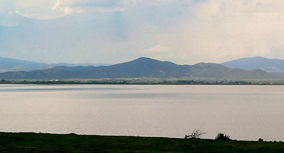
The Scratchgravel Hills, el. 5,233 feet (1,595 m) are a small summit of hills northwest of Helena in Lewis and Clark County, Montana. The area has seen increased development and a drop in water level in recent years. The Scratchgravel Hills have alluvial deposits on top of faulted granitic bedrock. There was extensive mining in the area in late 1800s through the 1930s. The northern part of the region has folding shale, sandstone and limestone from the Algonkian (Belt) age. Adjacent granite has altered them into quartz-mica schist and related rocks. The southern and central portions of the region contains quartz monzonite. Bitterroot and conifers are common in the area.
We use GPS information embedded into the photo when it is available.
3D mountains overlay
Adjust mountain panorama to perfectly match your photos because recorded by camera photo position might be imprecise.
Move tool
Rotate tool
Zoom
More customization
Choose which peak labels should make into the final photo and what photo title should be.
Next
Photo Location
Satellitte
Flat map
Relief map
Latitude
Longitude
Altitude
OR
Latitude
°'''
Longitude
°'''
Apply
Register Peak
Peak Name
Latitude
Longitude
Altitude
Register
Teleport
PeakVisor
This 3D model of Sagarmatha National Park in Nepal was made using the PeakVisor app topographic data. The mobile app features higher precision models worldwide, more topographic details, and works offline. Download PeakVisor maps today.
Download OBJ model
PeakVisor
The download should start shortly. If you find it useful please consider supporting the PeakVisor app.
PeakVisor for iOS and Android
Be a superhero of outdoor navigation with state-of-the-art 3D maps and mountain identification in the palm of your hand!