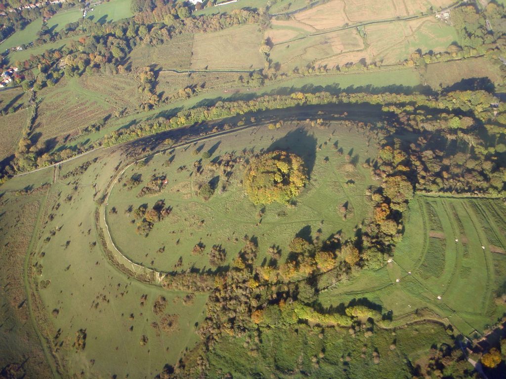
St. Catherine's Hill is a chalk downland hill and 43-hectare (110-acre) biological Site of Special Scientific Interest on the outskirts of Winchester in Hampshire, England. It is owned by Winchester College but open to the public. It is managed by Hampshire and Isle of Wight Wildlife Trust, and topped by an Iron Age hillfort, a scheduled monument. In the Black Death, plague pits were dug in the dry valley on the south side of the hill. In the Early modern period, a mizmaze was cut on the hilltop. Winchester College football used to be played on the hill; in an old custom, members of the college assemble on the hill every year, early in the morning.
Geologically, the hill is part of a local anticline in the chalk, which is of Turonian age in the Upper Cretaceous. The local ecology is dominated by the chalk, which results in a thin dark soil, a rendzina, which favours lime-loving plants from orchids to bellflowers.
There's a trail leading to the summit.
By prominence St. Catherine's Hill is
# 54 out of 256 in South Downs National Park # 39 out of 371 in Hampshire
We use GPS information embedded into the photo when it is available.
3D mountains overlay
Adjust mountain panorama to perfectly match your photos because recorded by camera photo position might be imprecise.
Move tool
Rotate tool
Zoom
More customization
Choose which peak labels should make into the final photo and what photo title should be.
Next
Photo Location
Satellitte
Flat map
Relief map
Latitude
Longitude
Altitude
OR
Latitude
°'''
Longitude
°'''
Apply
Register Peak
Peak Name
Latitude
Longitude
Altitude
Register
Teleport
PeakVisor
This 3D model of Sagarmatha National Park in Nepal was made using the PeakVisor app topographic data. The mobile app features higher precision models worldwide, more topographic details, and works offline. Download PeakVisor maps today.
Download OBJ model
PeakVisor
The download should start shortly. If you find it useful please consider supporting the PeakVisor app.
PeakVisor for iOS and Android
Be a superhero of outdoor navigation with state-of-the-art 3D maps and mountain identification in the palm of your hand!