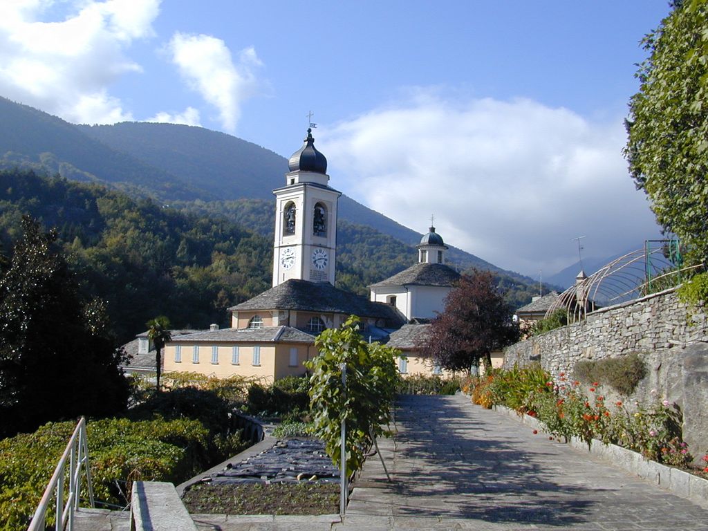
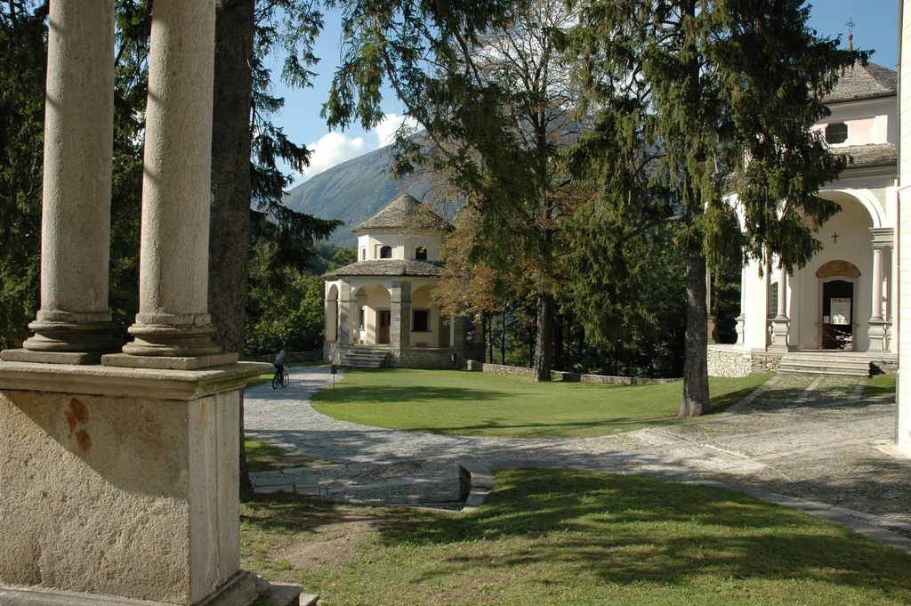
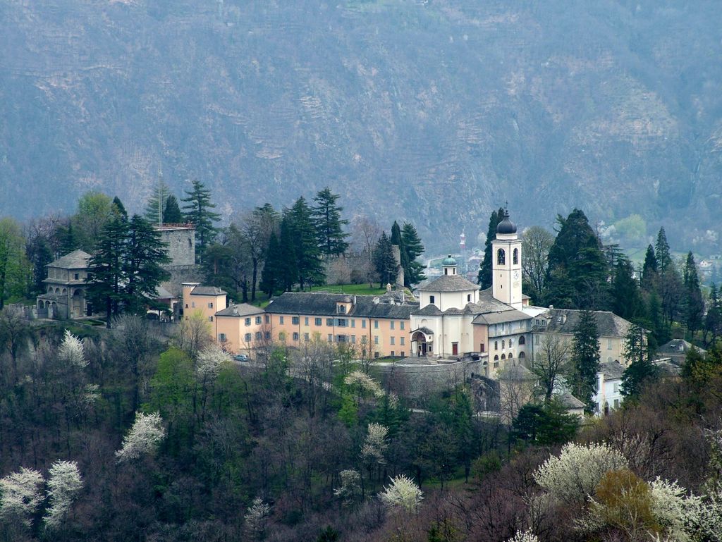
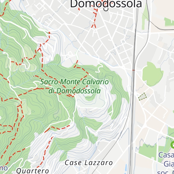
The Sacred Mount Calvary of Domodossola (also known as Sacro Monte Calvario) is a Roman Catholic sanctuary on the Mattarella Hill, overlooking Domodossola (Piedmont, northern Italy). It is one of the nine Sacri Monti of Piedmont and Lombardy, included in the UNESCO World Heritage list.
It was built in 1657 in response to the wishes of the Capuchin friars, Gioacchino da Cassano and Andrea da Rho. The chapels, dedicated to the Via Crucis, are positioned along a devotional route which starts on the outskirts of Domodossola and ends at the summit of Mount Mattarella.
The sanctuary on the summit was consecrated in 1690 and in 1828 the philosopher priest, Antonio Rosmini, founded the Institute of Charity.
Over the centuries the Sacred Mountain has undergone various modifications, rebuilding and restoration including, in 1957, the wooden statues in chapels 3, 5, 6 and 7.
It is a stop-over on the CoEur devotional path.
There's a hiking trail (T1) called Via Crucis leading to the summit.
By elevation Sacro Monte di Domodossola is
# 1 out of 1 in Sacro Monte Calvario di Domodossola
By prominence Sacro Monte di Domodossola is
# 1 out of 1 in Sacro Monte Calvario di Domodossola
We use GPS information embedded into the photo when it is available.
3D mountains overlay
Adjust mountain panorama to perfectly match your photos because recorded by camera photo position might be imprecise.
Move tool
Rotate tool
Zoom
More customization
Choose which peak labels should make into the final photo and what photo title should be.
Next
Photo Location
Satellitte
Flat map
Relief map
Latitude
Longitude
Altitude
OR
Latitude
°'''
Longitude
°'''
Apply
Register Peak
Peak Name
Latitude
Longitude
Altitude
Register
Teleport
PeakVisor
This 3D model of Sagarmatha National Park in Nepal was made using the PeakVisor app topographic data. The mobile app features higher precision models worldwide, more topographic details, and works offline. Download PeakVisor maps today.
Download OBJ model
PeakVisor
The download should start shortly. If you find it useful please consider supporting the PeakVisor app.
PeakVisor for iOS and Android
Be a superhero of outdoor navigation with state-of-the-art 3D maps and mountain identification in the palm of your hand!