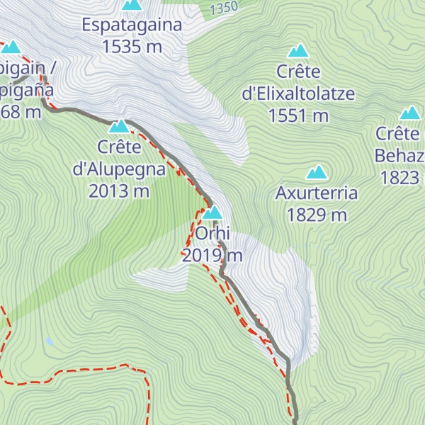
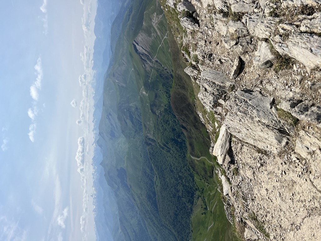
Mount Orhy (French), also Ori or Orhi in Spanish and Basque, is a mountain at the border of Navarre and Soule, in the Pyrenees, and is 2,017 metres (6,617 ft) high. It is the westernmost peak above 2,000 metres (6,562 ft) in the entire range.
A prominent mountain, it is very important in Basque mythology. Its grassy slopes are used as pastures.
There's a hiking trail (T2) leading to the summit. Orhi is one of the 71 peaks along the multi-day Haute Randonnée Pyrénéenne.
By elevation Orhi is
# 1 out of 44 in Selva de Irati / Iratiko oihana # 17 out of 2265 in Navarre # 17 out of 2265 in Navarre
By prominence Orhi is
# 1 out of 44 in Selva de Irati / Iratiko oihana # 63 out of 18724 in the Pyrenees # 8 out of 2265 in Navarre # 7 out of 2688 in New Aquitaine # 8 out of 2265 in Navarre # 7 out of 1032 in Pyrénées-Atlantiques
We use GPS information embedded into the photo when it is available.
3D mountains overlay
Adjust mountain panorama to perfectly match your photos because recorded by camera photo position might be imprecise.
Move tool
Rotate tool
Zoom
More customization
Choose which peak labels should make into the final photo and what photo title should be.
Next
Photo Location
Satellitte
Flat map
Relief map
Latitude
Longitude
Altitude
OR
Latitude
°'''
Longitude
°'''
Apply
Register Peak
Peak Name
Latitude
Longitude
Altitude
Register
Teleport
PeakVisor
This 3D model of Sagarmatha National Park in Nepal was made using the PeakVisor app topographic data. The mobile app features higher precision models worldwide, more topographic details, and works offline. Download PeakVisor maps today.
Download OBJ model
PeakVisor
The download should start shortly. If you find it useful please consider supporting the PeakVisor app.
PeakVisor for iOS and Android
Be a superhero of outdoor navigation with state-of-the-art 3D maps and mountain identification in the palm of your hand!


.jpg)