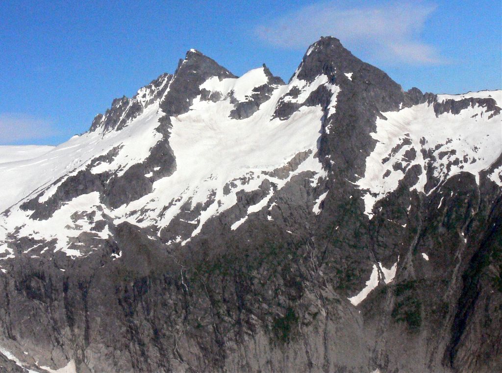
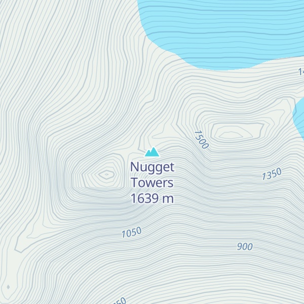
Nugget Towers is a mountain ridge with a series of peaks, two primarily, the highest of which is 5,378-ft (1,639 m) elevation, and located on the southern periphery of the Juneau Icefield, in the Boundary Ranges of southeast Alaska. These peaks are situated east of Mendenhall Glacier, 10 mi (16 km) north of Juneau, and 1.9 mi (3 km) northeast of Bullard Mountain, on land managed by Tongass National Forest. Stroller White Mountain lies 4.5 mi (7 km) west-northwest on the opposite side of the glacier, and Heintzleman Ridge lies 3 mi (5 km) to the south. Although modest in elevation, relief is significant since the mountain rises 3,500 feet (1,067 m) above Nugget Creek's upper basin in less than one mile. Precipitation runoff from the mountain drains into Mendenhall Lake via Nugget Creek and Nugget Falls. This geographic feature's local name was reported in 1965 by U.S. Geological Survey.
We use GPS information embedded into the photo when it is available.
3D mountains overlay
Adjust mountain panorama to perfectly match your photos because recorded by camera photo position might be imprecise.
Move tool
Rotate tool
Zoom
More customization
Choose which peak labels should make into the final photo and what photo title should be.
Next
Photo Location
Satellitte
Flat map
Relief map
Latitude
Longitude
Altitude
OR
Latitude
°'''
Longitude
°'''
Apply
Register Peak
Peak Name
Latitude
Longitude
Altitude
Register
Teleport
PeakVisor
This 3D model of Sagarmatha National Park in Nepal was made using the PeakVisor app topographic data. The mobile app features higher precision models worldwide, more topographic details, and works offline. Download PeakVisor maps today.
Download OBJ model
PeakVisor
The download should start shortly. If you find it useful please consider supporting the PeakVisor app.
PeakVisor for iOS and Android
Be a superhero of outdoor navigation with state-of-the-art 3D maps and mountain identification in the palm of your hand!