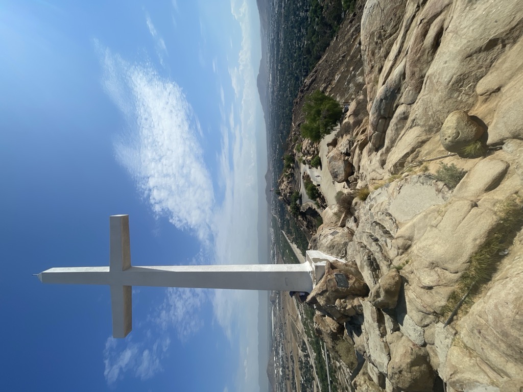
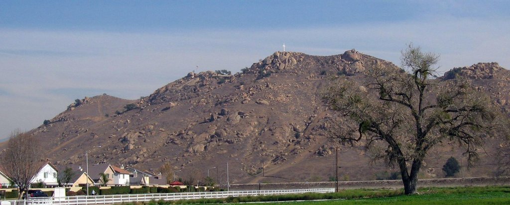
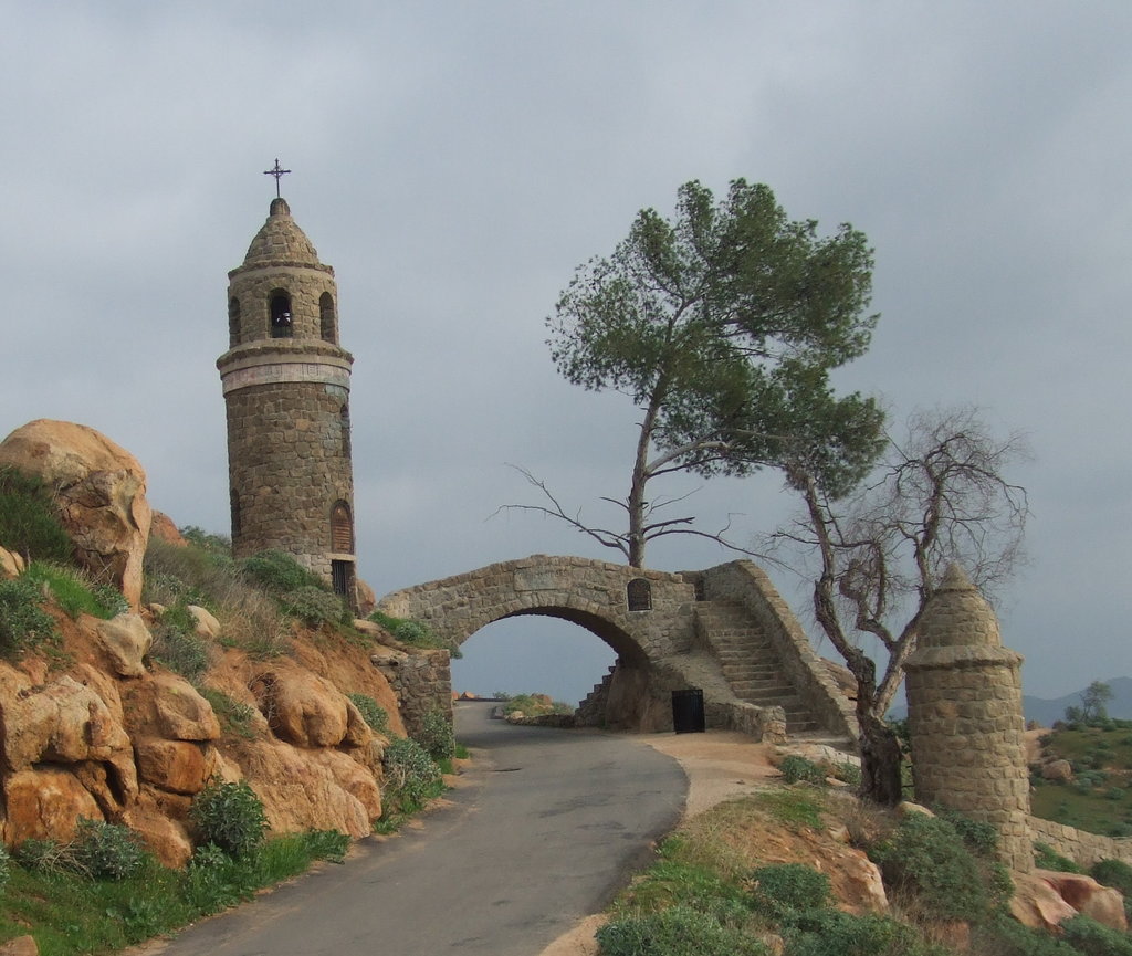
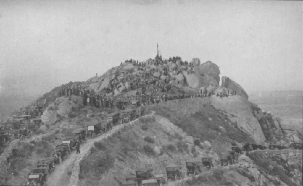
Mount Rubidoux is a mountain just west of downtown in the city of Riverside, California, United States, that has been designated a city park and landmark. The mountain was once a popular Southern California tourist destination and is still the site of the oldest outdoor non-denominational Easter Sunrise service in the United States. Many historic markers and memorials have been placed on the mountain, the most prominent being the cross at the summit dedicated to Father Junípero Serra.
The Santa Ana River flows at the base of the mountain, marking the boundary between the city of Riverside and the Rubidoux neighborhood of the City of Jurupa Valley.
The mountain was named for Louis Rubidoux, who established Rancho Rubidoux in 1847, after purchasing a portion of the Rancho Jurupa from Benjamin Davis Wilson, the second elected mayor of Los Angeles.
There's a trail called Mount Rubidoux Drive leading to the summit.
By prominence Mount Rubidoux is
# 59 out of 203 in Riverside County # 39 out of 121 in the San Bernardino Mountains
We use GPS information embedded into the photo when it is available.
3D mountains overlay
Adjust mountain panorama to perfectly match your photos because recorded by camera photo position might be imprecise.
Move tool
Rotate tool
Zoom
More customization
Choose which peak labels should make into the final photo and what photo title should be.
Next
Photo Location
Satellitte
Flat map
Relief map
Latitude
Longitude
Altitude
OR
Latitude
°'''
Longitude
°'''
Apply
Register Peak
Peak Name
Latitude
Longitude
Altitude
Register
Teleport
PeakVisor
This 3D model of Sagarmatha National Park in Nepal was made using the PeakVisor app topographic data. The mobile app features higher precision models worldwide, more topographic details, and works offline. Download PeakVisor maps today.
Download OBJ model
PeakVisor
The download should start shortly. If you find it useful please consider supporting the PeakVisor app.
PeakVisor for iOS and Android
Be a superhero of outdoor navigation with state-of-the-art 3D maps and mountain identification in the palm of your hand!