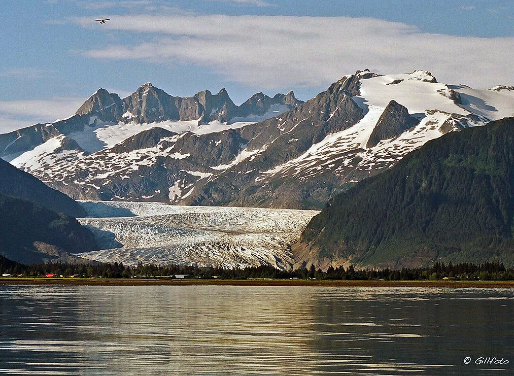
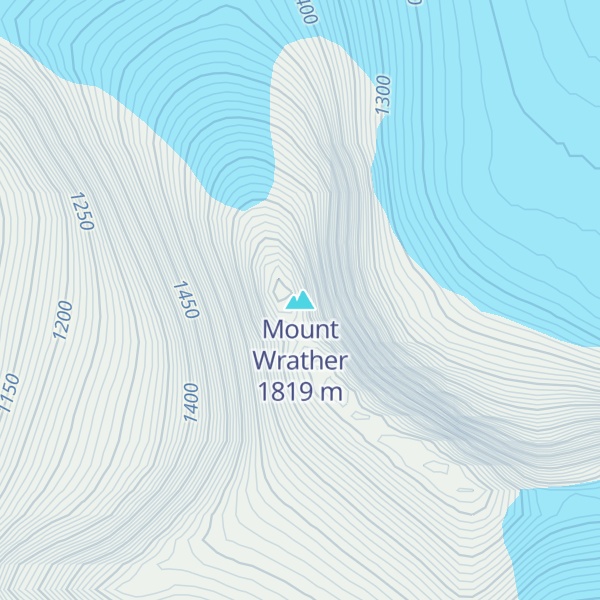
Mount Wrather is a 5,968-foot (1,819 m) mountain summit located in the Boundary Ranges, in the U.S. state of Alaska. The peak is situated within Tongass National Forest, immediately east of the Mendenhall Glacier, 12 mi (19 km) north of Juneau, Alaska, and 9 mi (14 km) north of Juneau International Airport. Although modest in elevation, relief is significant since the mountain rises up from sea-level at Auke Bay in less than nine miles. The mountain's name was officially adopted in 1968 by the USGS to honor William Embry Wrather (1883–1963), the 6th Director of the United States Geological Survey from 1943 to 1956.
We use GPS information embedded into the photo when it is available.
3D mountains overlay
Adjust mountain panorama to perfectly match your photos because recorded by camera photo position might be imprecise.
Move tool
Rotate tool
Zoom
More customization
Choose which peak labels should make into the final photo and what photo title should be.
Next
Photo Location
Satellitte
Flat map
Relief map
Latitude
Longitude
Altitude
OR
Latitude
°'''
Longitude
°'''
Apply
Register Peak
Peak Name
Latitude
Longitude
Altitude
Register
Teleport
PeakVisor
This 3D model of Sagarmatha National Park in Nepal was made using the PeakVisor app topographic data. The mobile app features higher precision models worldwide, more topographic details, and works offline. Download PeakVisor maps today.
Download OBJ model
PeakVisor
The download should start shortly. If you find it useful please consider supporting the PeakVisor app.
PeakVisor for iOS and Android
Be a superhero of outdoor navigation with state-of-the-art 3D maps and mountain identification in the palm of your hand!