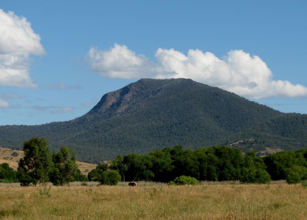
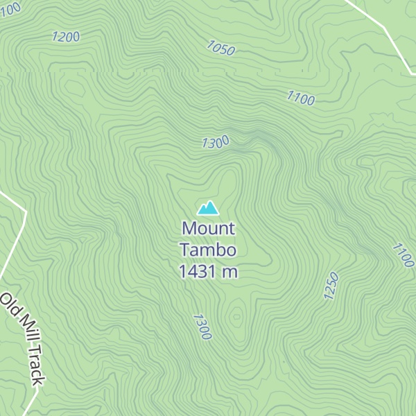
Mount Tambo is a mountain located to the north-east of Omeo in Victoria, Australia. Its peak is 1,430 metres above sea level. It lies within the boundaries of the 6,050 hectare Marble Gully – Mount Tambo Nature Conservation Reserve.
The 2,740 hectare Mount Tambo Reserve was listed on the Register of the National Estate in 1990.
Rare plant species found in Marble Gully – Mount Tambo Nature Conservation Reserve include Marble Daisy Bush, Delicate New Holland-daisy, and Limestone Pomaderris.
To the near north-east is Little Mount Tambo (1,227 metres). The headwaters from Deep Creek, which feeds in to the Tambo River, are on the south-east slopes.
It marks the intersection of the boundaries of the counties of Benambra, Dargo and Tambo.
While travelling with Georg Neumayer's expedition to Mount Kosciuszko in 1862, the painter Eugene von Guerard produced a sketch Mt Tambo & Omeo Swamps 10 Nov 62 and later an oil painting Mount Tambo from the Omeo Station 1862.
By elevation Mount Tambo is
# 1 out of 2 in Marble Gully - Mount Tambo Nature Conservation Reserve # 47 out of 291 in Shire of East Gippsland
By prominence Mount Tambo is
# 1 out of 2 in Marble Gully - Mount Tambo Nature Conservation Reserve # 64 out of 2097 in Victoria # 19 out of 291 in Shire of East Gippsland
We use GPS information embedded into the photo when it is available.
3D mountains overlay
Adjust mountain panorama to perfectly match your photos because recorded by camera photo position might be imprecise.
Move tool
Rotate tool
Zoom
More customization
Choose which peak labels should make into the final photo and what photo title should be.
Next
Photo Location
Satellitte
Flat map
Relief map
Latitude
Longitude
Altitude
OR
Latitude
°'''
Longitude
°'''
Apply
Register Peak
Peak Name
Latitude
Longitude
Altitude
Register
Teleport
PeakVisor
This 3D model of Sagarmatha National Park in Nepal was made using the PeakVisor app topographic data. The mobile app features higher precision models worldwide, more topographic details, and works offline. Download PeakVisor maps today.
Download OBJ model
PeakVisor
The download should start shortly. If you find it useful please consider supporting the PeakVisor app.
PeakVisor for iOS and Android
Be a superhero of outdoor navigation with state-of-the-art 3D maps and mountain identification in the palm of your hand!