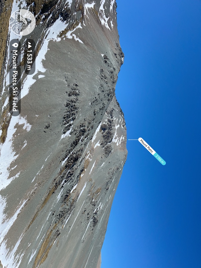
Mount Potts (2,184 meters) is a mountain in Canterbury, New Zealand. It is located in the Hakatere Conservation Park.
Until 2011, the area was operated as an exclusive skifield. Unlike normal resorts, there were no fixed ski tows or chairlifts. Instead, vertical transport was provided by snowcats and helicopter. The ski area covered 660 hectares and included, "steep faces, chutes, rocks to drop off, cornices, wide open powder bowls and gullies". Now, Mount Potts is a popular destination for backcountry skiing because there is easy access to the snow via the old road.
Mount Potts is an hour's drive from Methven, and two hours' drive from Christchurch.
We use GPS information embedded into the photo when it is available.
3D mountains overlay
Adjust mountain panorama to perfectly match your photos because recorded by camera photo position might be imprecise.
Move tool
Rotate tool
Zoom
More customization
Choose which peak labels should make into the final photo and what photo title should be.
Next
Photo Location
Satellitte
Flat map
Relief map
Latitude
Longitude
Altitude
OR
Latitude
°'''
Longitude
°'''
Apply
Register Peak
Peak Name
Latitude
Longitude
Altitude
Register
Teleport
PeakVisor
This 3D model of Sagarmatha National Park in Nepal was made using the PeakVisor app topographic data. The mobile app features higher precision models worldwide, more topographic details, and works offline. Download PeakVisor maps today.
Download OBJ model
PeakVisor
The download should start shortly. If you find it useful please consider supporting the PeakVisor app.
PeakVisor for iOS and Android
Be a superhero of outdoor navigation with state-of-the-art 3D maps and mountain identification in the palm of your hand!