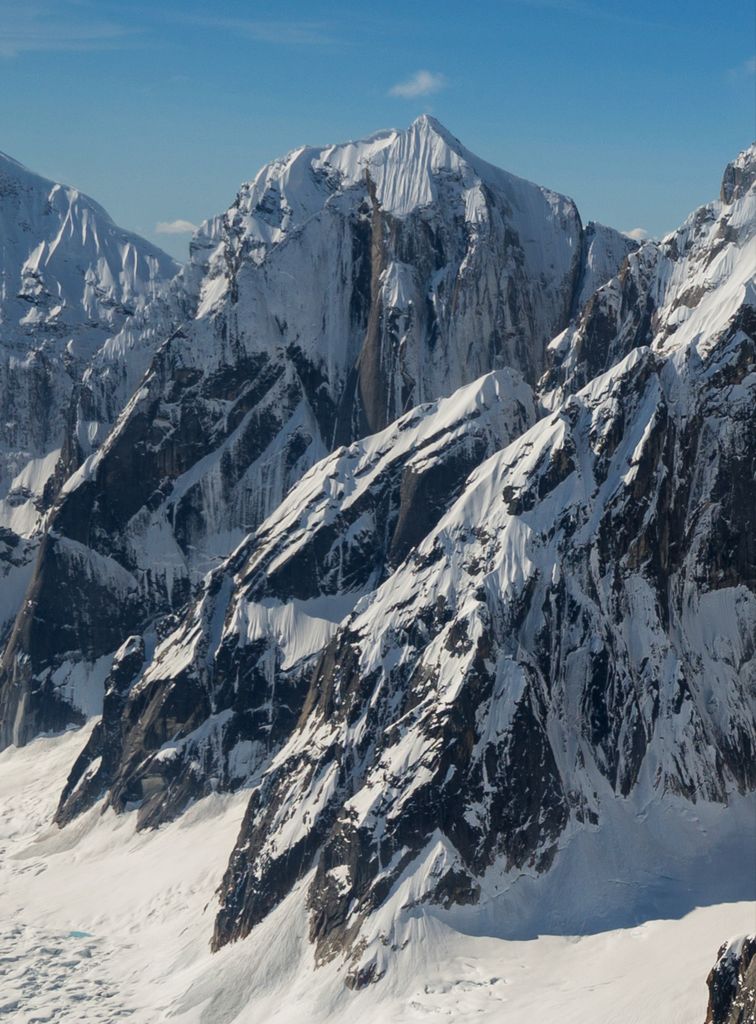
Mount Johnson is an 8,400+ ft (2,560+ m) mountain summit located in the Alaska Range, in Denali National Park and Preserve, in Alaska, United States. It is situated on the west side of the Ruth Gorge, 15 miles (24 km) southeast of Denali and six miles (9.7 km) south-southwest of The Moose's Tooth. The nearest higher neighbor is Mount Wake, 0.69 miles (1.11 km) to the northwest.
Despite its relatively low elevation, it is notable for its north face with over 4,000 feet of vertical sheer granite with climbing routes called the Escalator and Stairway to Heaven. The first ascent of the peak was made in 1979 by Gary Bocarde, Charlie Head, John Lee, and Jon Thomas via the south ridge. The mountain was named by famed explorer Dr. Frederick Cook who claimed the first ascent of Mount McKinley in 1906, but was later disproved. Emory Richard Johnson (1864–1950) was the president of the Geographical Society of Philadelphia (1898–1912) at the time that Cook explored Ruth Gorge in 1906.
We use GPS information embedded into the photo when it is available.
3D mountains overlay
Adjust mountain panorama to perfectly match your photos because recorded by camera photo position might be imprecise.
Move tool
Rotate tool
Zoom
More customization
Choose which peak labels should make into the final photo and what photo title should be.
Next
Photo Location
Satellitte
Flat map
Relief map
Latitude
Longitude
Altitude
OR
Latitude
°'''
Longitude
°'''
Apply
Register Peak
Peak Name
Latitude
Longitude
Altitude
Register
Teleport
PeakVisor
This 3D model of Sagarmatha National Park in Nepal was made using the PeakVisor app topographic data. The mobile app features higher precision models worldwide, more topographic details, and works offline. Download PeakVisor maps today.
Download OBJ model
PeakVisor
The download should start shortly. If you find it useful please consider supporting the PeakVisor app.
PeakVisor for iOS and Android
Be a superhero of outdoor navigation with state-of-the-art 3D maps and mountain identification in the palm of your hand!