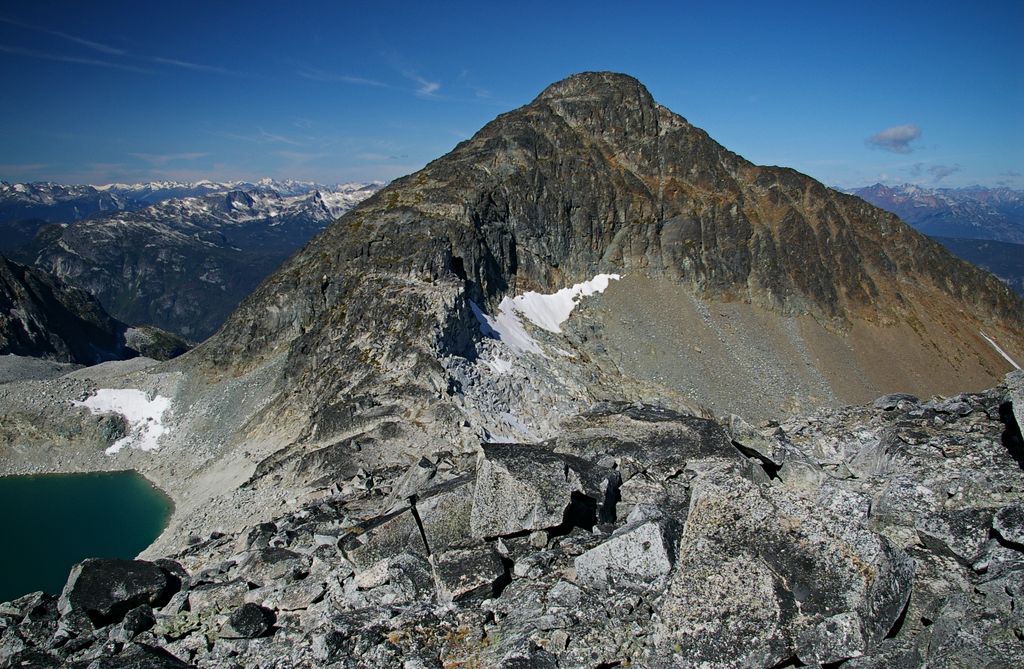
Mount Gardiner is a 2,406-metre (7,894-foot) mountain summit located in the Cayoosh Range of the Lillooet Ranges, in southwestern British Columbia, Canada. It is situated 17 km (11 mi) northeast of Pemberton, immediately west of the Place Glacier, and 1.8 km (1 mi) north of Mount Oleg, its nearest higher peak. The mountain was named for William and Henry Gardiner, early settlers who farmed in Pemberton Meadows. The name was officially adopted on June 11, 1979, by the Geographical Names Board of Canada. Precipitation runoff from the peak drains into tributaries of the Fraser River.
The nearest mountain hut is Place Glacier Glaciology Hut located 1 498m/4 916ft NE of the summit.
We use GPS information embedded into the photo when it is available.
3D mountains overlay
Adjust mountain panorama to perfectly match your photos because recorded by camera photo position might be imprecise.
Move tool
Rotate tool
Zoom
More customization
Choose which peak labels should make into the final photo and what photo title should be.
Next
Photo Location
Satellitte
Flat map
Relief map
Latitude
Longitude
Altitude
OR
Latitude
°'''
Longitude
°'''
Apply
Register Peak
Peak Name
Latitude
Longitude
Altitude
Register
Teleport
PeakVisor
This 3D model of Sagarmatha National Park in Nepal was made using the PeakVisor app topographic data. The mobile app features higher precision models worldwide, more topographic details, and works offline. Download PeakVisor maps today.
Download OBJ model
PeakVisor
The download should start shortly. If you find it useful please consider supporting the PeakVisor app.
PeakVisor for iOS and Android
Be a superhero of outdoor navigation with state-of-the-art 3D maps and mountain identification in the palm of your hand!