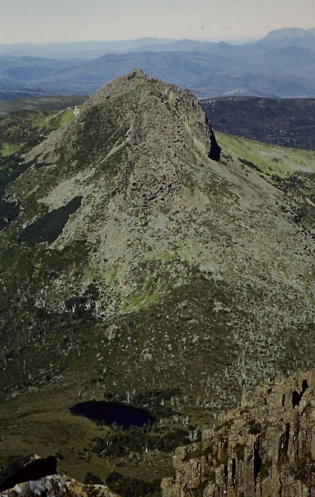
Mount Achilles is a mountain that is part of the Du Cane Range, located in the Cradle Mountain-Lake St Clair National Park in Tasmania, Australia. With an elevation of 1,353 metres (4,439 ft) above sea level, the peak is the 46th highest mountain in Tasmania.
Mount Achilles consists of two main summits, the highest is known as 'Achilles Heel', and the other is referred to as 'Perrins Bluff'.
It is located in the more northern part of the park, and almost due east of Zeehan It is a major feature of the national park, and is a popular venue with bushwalkers and mountain climbers.
By elevation Mount Achilles is
# 18 out of 269 in West Coast # 100 out of 2906 in Tasmania # 41 out of 98 in Cradle Mountain-Lake St Clair National Park
By prominence Mount Achilles is
# 94 out of 269 in West Coast # 41 out of 98 in Cradle Mountain-Lake St Clair National Park
We use GPS information embedded into the photo when it is available.
3D mountains overlay
Adjust mountain panorama to perfectly match your photos because recorded by camera photo position might be imprecise.
Move tool
Rotate tool
Zoom
More customization
Choose which peak labels should make into the final photo and what photo title should be.
Next
Photo Location
Satellitte
Flat map
Relief map
Latitude
Longitude
Altitude
OR
Latitude
°'''
Longitude
°'''
Apply
Register Peak
Peak Name
Latitude
Longitude
Altitude
Register
Teleport
PeakVisor
This 3D model of Sagarmatha National Park in Nepal was made using the PeakVisor app topographic data. The mobile app features higher precision models worldwide, more topographic details, and works offline. Download PeakVisor maps today.
Download OBJ model
PeakVisor
The download should start shortly. If you find it useful please consider supporting the PeakVisor app.
PeakVisor for iOS and Android
Be a superhero of outdoor navigation with state-of-the-art 3D maps and mountain identification in the palm of your hand!