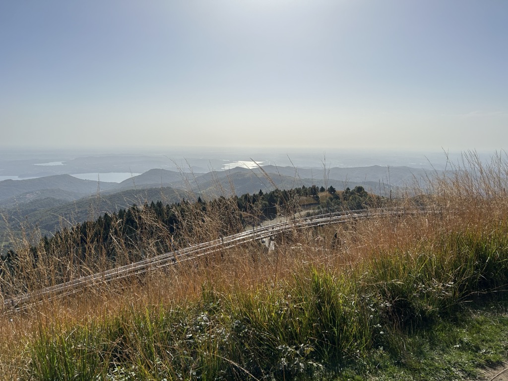
At an elevation of 1,491 m (4,892 ft.), and with a prominence of 1,131 m (3,711 ft.), Mottarrone is known as, "the mountain between the two lakes," and is renowned for its 360° view. Mattarone is situated in the Verbano-Cusio-Ossola province of the Western Alps of north-west Italy.
Apart from breathtaking cable car rides and the two beautiful lakes - Lake Maggiore and Lake Orta - the Mottarone mountain region is famous for its cheese, particularly the Toma del Mottarone.
Activities in the area consist of skiing, cycling, hiking and horse riding. The Mottarone region boasts of 21-ski trails, making it a haven for ski enthusiasts. The first Grand Slalom in the history of skiing was held on Mottarone mountain in January, 1935.
There's a hiking trail (T1) leading to the summit.
The nearest mountain hut is Rifugio Genziana located 362m/1 188ft WSW of the summit.
By prominence Mottarone is
# 71 out of 42694 in Italy # 6 out of 4320 in Piemont # 4 out of 614 in Verbano-Cusio-Ossola # 5 out of 2009 in the Pennine Alps
We use GPS information embedded into the photo when it is available.
3D mountains overlay
Adjust mountain panorama to perfectly match your photos because recorded by camera photo position might be imprecise.
Move tool
Rotate tool
Zoom
More customization
Choose which peak labels should make into the final photo and what photo title should be.
Next
Photo Location
Satellitte
Flat map
Relief map
Latitude
Longitude
Altitude
OR
Latitude
°'''
Longitude
°'''
Apply
Register Peak
Peak Name
Latitude
Longitude
Altitude
Register
Teleport
PeakVisor
This 3D model of Sagarmatha National Park in Nepal was made using the PeakVisor app topographic data. The mobile app features higher precision models worldwide, more topographic details, and works offline. Download PeakVisor maps today.
Download OBJ model
PeakVisor
The download should start shortly. If you find it useful please consider supporting the PeakVisor app.
PeakVisor for iOS and Android
Be a superhero of outdoor navigation with state-of-the-art 3D maps and mountain identification in the palm of your hand!