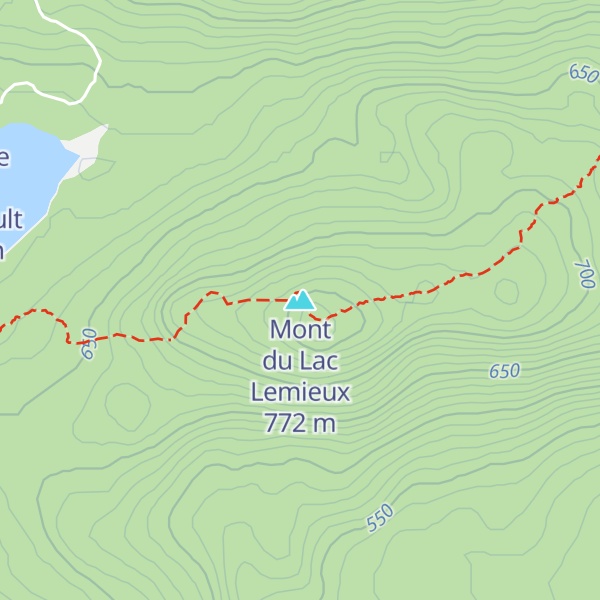
Mont du Lac Lemieux (772m/2 533ft a.s.l.) is a mountain in the Laurentides in Canada. The prominence is 118m/387ft.
There's a hiking trail (T2) called Sentier du Mont-Ouareau leading to the summit. Mont du Lac Lemieux is one of the 9 peaks along the multi-day National Hiking Trail.
The nearest mountain hut is Refuge Paul Perreault located 1 243m/4 077ft WNW of the summit.
By elevation Mont du Lac Lemieux is
# 7 out of 123 in Les Laurentides # 9 out of 82 in Matawinie
By prominence Mont du Lac Lemieux is
# 38 out of 123 in Les Laurentides # 34 out of 82 in Matawinie
We use GPS information embedded into the photo when it is available.
3D mountains overlay
Adjust mountain panorama to perfectly match your photos because recorded by camera photo position might be imprecise.
Move tool
Rotate tool
Zoom
More customization
Choose which peak labels should make into the final photo and what photo title should be.
Next
Photo Location
Satellitte
Flat map
Relief map
Latitude
Longitude
Altitude
OR
Latitude
°'''
Longitude
°'''
Apply
Register Peak
Peak Name
Latitude
Longitude
Altitude
Register
Teleport
PeakVisor
This 3D model of Sagarmatha National Park in Nepal was made using the PeakVisor app topographic data. The mobile app features higher precision models worldwide, more topographic details, and works offline. Download PeakVisor maps today.
Download OBJ model
PeakVisor
The download should start shortly. If you find it useful please consider supporting the PeakVisor app.
PeakVisor for iOS and Android
Be a superhero of outdoor navigation with state-of-the-art 3D maps and mountain identification in the palm of your hand!