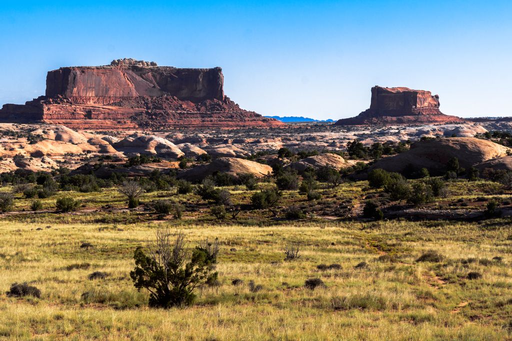
Merrimac Butte is a 5,627-foot (1,715-metre) sandstone summit located in Grand County, Utah, United States, about 12 miles northwest of the town of Moab. Merrimac Butte is a thin, 200–600-foot-wide and 1,600-foot-long east-to-west butte with 200-foot-tall vertical Entrada Sandstone walls overlaying a Carmel Formation base.
Monitor Butte is situated immediately east of Merrimac Butte. The two buttes were named after the Monitor and Merrimack, two ironclad steamships known for clashing during the American Civil War. They can be seen from Highway 313 after it climbs out of Sevenmile Canyon en route to the Island in the Sky section of Canyonlands National Park or Dead Horse Point State Park.
We use GPS information embedded into the photo when it is available.
3D mountains overlay
Adjust mountain panorama to perfectly match your photos because recorded by camera photo position might be imprecise.
Move tool
Rotate tool
Zoom
More customization
Choose which peak labels should make into the final photo and what photo title should be.
Next
Photo Location
Satellitte
Flat map
Relief map
Latitude
Longitude
Altitude
OR
Latitude
°'''
Longitude
°'''
Apply
Register Peak
Peak Name
Latitude
Longitude
Altitude
Register
Teleport
PeakVisor
This 3D model of Sagarmatha National Park in Nepal was made using the PeakVisor app topographic data. The mobile app features higher precision models worldwide, more topographic details, and works offline. Download PeakVisor maps today.
Download OBJ model
PeakVisor
The download should start shortly. If you find it useful please consider supporting the PeakVisor app.
PeakVisor for iOS and Android
Be a superhero of outdoor navigation with state-of-the-art 3D maps and mountain identification in the palm of your hand!