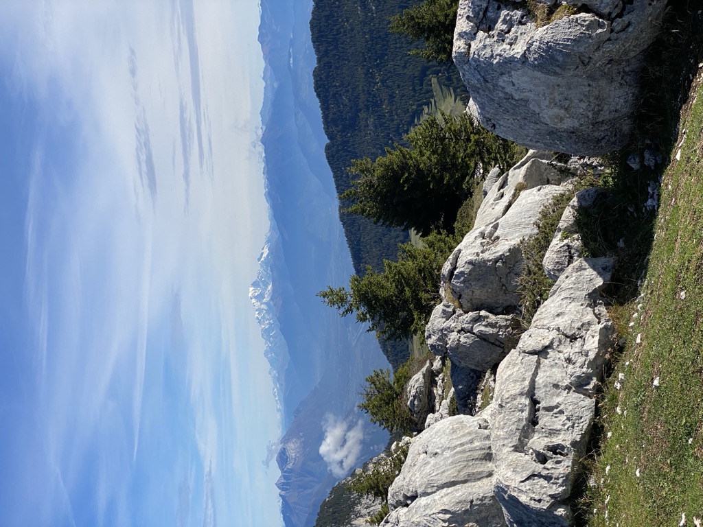
The Sommet du Pinet (or Le Pinet or Le Truc) is a Chartreuse mountain situated at the south of the mont Granier, culminating at 1,867 m above sea level.
Located between the townships of Entremont-le-Vieux, Saint-Pierre-d'Entremont in Savoie and Sainte-Marie-du-Mont, its ridge marks the border between Isère and Savoie.
There's a hiking trail (T2) called Sommet du Pinet leading to the summit.
The nearest mountain hut is Cabane de l'Alpette located 1 518m/4 980ft ENE of the summit.
By elevation Le Pinet is
# 14 out of 28 in Réserve naturelle des Hauts de Chartreuse # 17 out of 175 in Parc naturel régional de Chartreuse # 17 out of 159 in the Chartreuse Mountains
By prominence Le Pinet is
# 3 out of 28 in Réserve naturelle des Hauts de Chartreuse # 20 out of 175 in Parc naturel régional de Chartreuse # 17 out of 159 in the Chartreuse Mountains
We use GPS information embedded into the photo when it is available.
3D mountains overlay
Adjust mountain panorama to perfectly match your photos because recorded by camera photo position might be imprecise.
Move tool
Rotate tool
Zoom
More customization
Choose which peak labels should make into the final photo and what photo title should be.
Next
Photo Location
Satellitte
Flat map
Relief map
Latitude
Longitude
Altitude
OR
Latitude
°'''
Longitude
°'''
Apply
Register Peak
Peak Name
Latitude
Longitude
Altitude
Register
Teleport
PeakVisor
This 3D model of Sagarmatha National Park in Nepal was made using the PeakVisor app topographic data. The mobile app features higher precision models worldwide, more topographic details, and works offline. Download PeakVisor maps today.
Download OBJ model
PeakVisor
The download should start shortly. If you find it useful please consider supporting the PeakVisor app.
PeakVisor for iOS and Android
Be a superhero of outdoor navigation with state-of-the-art 3D maps and mountain identification in the palm of your hand!