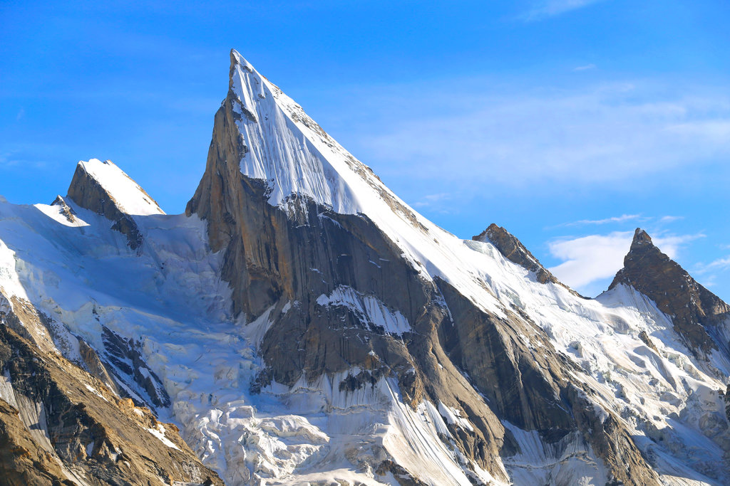
Laila Peak (Urdu: لیلی چوٹی) is a mountain located in the Hushe Valley, near the Gondogoro Glacier within the Karakoram. Situated in the Gilgit-Baltistan region of Pakistan, Laila Peak has an elevation of 6,096 meters (20,000 ft). Its distinctive feature is its spear-like shape, and its northwest face presents a challenging slope of 45 degrees, spanning over 1500 vertical meters.
Laila Peak has been successfully climbed by mountaineers such as Simon Yates, among others. According to the local inhabitants of Hushe, this peak has been summited only twice, with a total of just seven individuals having reached its summit.
Laila Peak was climbed in winter for the first time by Spanish mountaineers Alex Txikon and José Fernandez in February 2013.
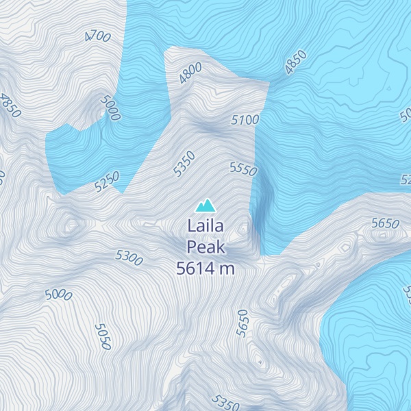
The height of Laila Peak in the Hushe Valley has been a subject of controversy and discrepancy. Various sources and maps have mentioned different elevations for the peak. Some believe it to be around 6200 meters, while others suggest it as 6614 meters. However, according to a Japanese mountaineering map by Tsuneo Miyamori published in 2003, the height of Laila Peak is listed as 6096 meters.
We use GPS information embedded into the photo when it is available.
3D mountains overlay
Adjust mountain panorama to perfectly match your photos because recorded by camera photo position might be imprecise.
Move tool
Rotate tool
Zoom
More customization
Choose which peak labels should make into the final photo and what photo title should be.
Next
Photo Location
Satellitte
Flat map
Relief map
Latitude
Longitude
Altitude
OR
Latitude
°'''
Longitude
°'''
Apply
Register Peak
Peak Name
Latitude
Longitude
Altitude
Register
Teleport
PeakVisor
This 3D model of Sagarmatha National Park in Nepal was made using the PeakVisor app topographic data. The mobile app features higher precision models worldwide, more topographic details, and works offline. Download PeakVisor maps today.
Download OBJ model
PeakVisor
The download should start shortly. If you find it useful please consider supporting the PeakVisor app.
PeakVisor for iOS and Android
Be a superhero of outdoor navigation with state-of-the-art 3D maps and mountain identification in the palm of your hand!