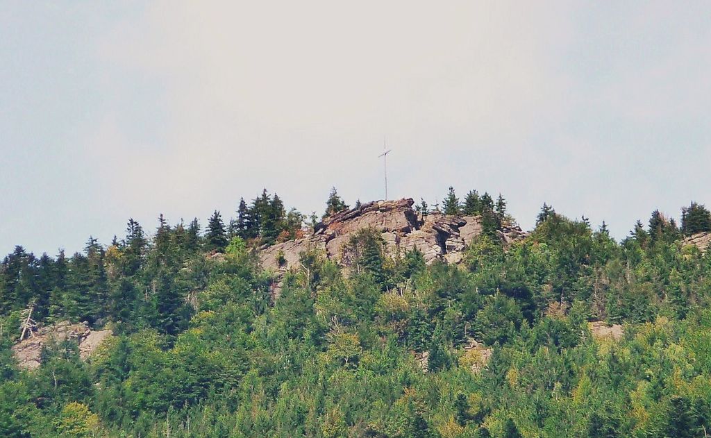
The Kreuzfelsen is a 999 m (3,278 ft) high rock outcrop, that forms the western cornerstone of the Kaitersberg mountain ridge in the Bavarian Forest in southern Germany. From the giant cross on its summit the view sweeps down into the Zeller Valley and over to the town of Bad Kötzting and also far over the western part of the Bavarian Forest.
Below the Kreuzfelsen is "Highwayman Heigl's Cave" (Räuber-Heigl's-Höhle), the hideout of a 19th-century robber. Numerous trails lead up to the summit cross, the most well-trodden being the E6 European long distance path which runs from Kötzting past the nearby Kötztinger Hütte cafe and the Riedlstein to the Großer Arber.
On the Kreuzfelsen there is an extensive range of worthwhile sport climbing routes, that are well-secured and can be negotiated using top roping.
There's a hiking trail (T2) leading to the summit.
The nearest mountain hut is Kötztinger Hütte located 1 463m/4 801ft E of the summit.
By elevation Kreuzfelsen is
# 38 out of 349 in Naturpark Oberer Bayerischer Wald # 38 out of 339 in Landkreis Cham
We use GPS information embedded into the photo when it is available.
3D mountains overlay
Adjust mountain panorama to perfectly match your photos because recorded by camera photo position might be imprecise.
Move tool
Rotate tool
Zoom
More customization
Choose which peak labels should make into the final photo and what photo title should be.
Next
Photo Location
Satellitte
Flat map
Relief map
Latitude
Longitude
Altitude
OR
Latitude
°'''
Longitude
°'''
Apply
Register Peak
Peak Name
Latitude
Longitude
Altitude
Register
Teleport
PeakVisor
This 3D model of Sagarmatha National Park in Nepal was made using the PeakVisor app topographic data. The mobile app features higher precision models worldwide, more topographic details, and works offline. Download PeakVisor maps today.
Download OBJ model
PeakVisor
The download should start shortly. If you find it useful please consider supporting the PeakVisor app.
PeakVisor for iOS and Android
Be a superhero of outdoor navigation with state-of-the-art 3D maps and mountain identification in the palm of your hand!