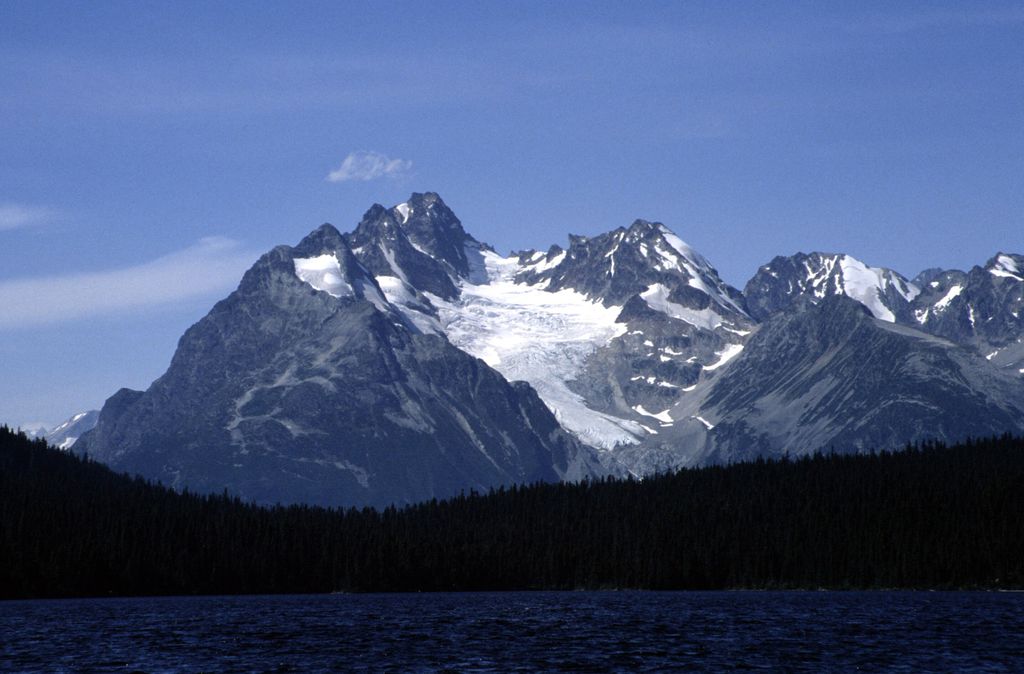
Horribilis Peak is a 2,597-metre (8,520-foot) mountain summit located in the Coast Mountains of the Pacific Ranges in British Columbia, Canada. The mountain is situated 5.5 km (3.4 mi) north of Talchako Mountain, and 28 km (17 mi) south of Stuie. Its nearest higher peak is Utan Peak, 4 km (2.5 mi) to the northwest. The peak was named in 1964 by a George Whitemore mountaineering party in recognition of the grizzly bears upon whose territory the mountaineers were trespassing. The mountain's name was officially adopted April 15, 1984, by the Geographical Names Board of Canada. Precipitation runoff from the mountain drains into Ape Creek which is a tributary of the Talchako River.
By elevation Horribilis Peak is
# 47 out of 232 in Central Coast Regional District
By prominence Horribilis Peak is
# 80 out of 232 in Central Coast Regional District
We use GPS information embedded into the photo when it is available.
3D mountains overlay
Adjust mountain panorama to perfectly match your photos because recorded by camera photo position might be imprecise.
Move tool
Rotate tool
Zoom
More customization
Choose which peak labels should make into the final photo and what photo title should be.
Next
Photo Location
Satellitte
Flat map
Relief map
Latitude
Longitude
Altitude
OR
Latitude
°'''
Longitude
°'''
Apply
Register Peak
Peak Name
Latitude
Longitude
Altitude
Register
Teleport
PeakVisor
This 3D model of Sagarmatha National Park in Nepal was made using the PeakVisor app topographic data. The mobile app features higher precision models worldwide, more topographic details, and works offline. Download PeakVisor maps today.
Download OBJ model
PeakVisor
The download should start shortly. If you find it useful please consider supporting the PeakVisor app.
PeakVisor for iOS and Android
Be a superhero of outdoor navigation with state-of-the-art 3D maps and mountain identification in the palm of your hand!