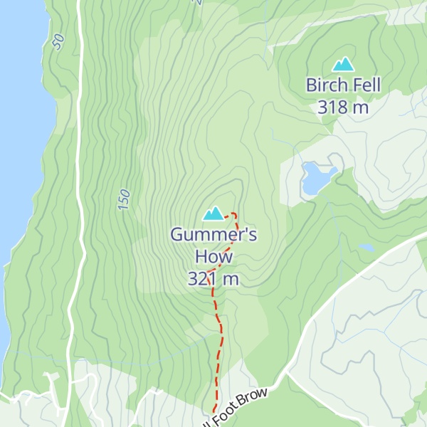
Gummer's How is a hill in the southern part of the Lake District, on the eastern shore of Windermere, near its southern end. How, derived from the Old Norse word haugr, is a common local term for a hill or mound.
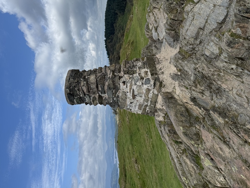
Although a relatively small hill (321 metres above sea level) by the standards of the Lake District, it is the highest of the foothills in the area and commands excellent views, particularly along Windermere (the summit looks out over the magnificent Town Head House estate towards the lake), but also across to the Coniston fells and the central fells, as well as the broad panorama of Morecambe Bay. There is an OS trig point on the summit.
The walk to the summit is usually from the road at Astley's Plantation car park, itself at over 200 metres above sea level, and only 700 metres from the summit. Although short and easy by most standards, and popular with families, it has many of the characteristics of a walk in the higher Lakeland fells, with some (short) steep slopes, rocks to negotiate, and rowan, bracken and heather. The lower slopes are forested, but the upper portion is moorland.
Gummer's How is the subject of a chapter of Wainwright's book The Outlying Fells of Lakeland. He describes it as "an old man's mountain", and says of it: "And when ancient legs can no longer climb it know ye that the sad day has come to hung up the boots for ever and take to slippers".
Simon Jenkins rates the Windermere panorama of the Lake District, Pennines and Morecambe Bay as one of the top ten in England.
There's a trail leading to the summit.
By prominence Gummer's How is
# 80 out of 12948 in the England Hills # 27 out of 864 in Lake District National Park # 80 out of 13057 in England # 37 out of 1704 in Cumbria # 27 out of 838 in The English Lake District WHS
We use GPS information embedded into the photo when it is available.
3D mountains overlay
Adjust mountain panorama to perfectly match your photos because recorded by camera photo position might be imprecise.
Move tool
Rotate tool
Zoom
More customization
Choose which peak labels should make into the final photo and what photo title should be.
Next
Photo Location
Satellitte
Flat map
Relief map
Latitude
Longitude
Altitude
OR
Latitude
°'''
Longitude
°'''
Apply
Register Peak
Peak Name
Latitude
Longitude
Altitude
Register
Teleport
PeakVisor
This 3D model of Sagarmatha National Park in Nepal was made using the PeakVisor app topographic data. The mobile app features higher precision models worldwide, more topographic details, and works offline. Download PeakVisor maps today.
Download OBJ model
PeakVisor
The download should start shortly. If you find it useful please consider supporting the PeakVisor app.
PeakVisor for iOS and Android
Be a superhero of outdoor navigation with state-of-the-art 3D maps and mountain identification in the palm of your hand!