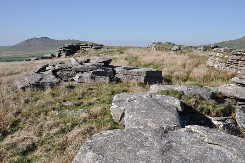
Garrow Tor is a bare, tor-crowned hill, 330 metres (1,080 ft) high, located on Garrow Downs in the northwest of Bodmin Moor in the county of Cornwall, England, UK.
At the summit of Garrow Tor are granite rock outcrops and the hill also bears extensive evidence of early settlement, including a massive stone hedge, Bronze Age settlements and hut circles and Medieval settlements. Panoramic views from the summit include Caradon Hill to the south, Rough Tor and Brown Willy to the north, Butter's Tor to the east, clay country to the west and the Atlantic Ocean to the northwest.
The De Lank River runs past the eastern flank of the tor from north to south, before swinging southwest around the southern foot of the hill. King Arthur's Hall lies a kilometre to the southwest.
When visiting the hill, a useful place to park is by the waterworks to the southwest.
By elevation Garrow Tor is
# 17 out of 94 in Cornwall AONB # 19 out of 161 in Cornwall
By prominence Garrow Tor is
# 15 out of 94 in Cornwall AONB # 24 out of 161 in Cornwall
We use GPS information embedded into the photo when it is available.
3D mountains overlay
Adjust mountain panorama to perfectly match your photos because recorded by camera photo position might be imprecise.
Move tool
Rotate tool
Zoom
More customization
Choose which peak labels should make into the final photo and what photo title should be.
Next
Photo Location
Satellitte
Flat map
Relief map
Latitude
Longitude
Altitude
OR
Latitude
°'''
Longitude
°'''
Apply
Register Peak
Peak Name
Latitude
Longitude
Altitude
Register
Teleport
PeakVisor
This 3D model of Sagarmatha National Park in Nepal was made using the PeakVisor app topographic data. The mobile app features higher precision models worldwide, more topographic details, and works offline. Download PeakVisor maps today.
Download OBJ model
PeakVisor
The download should start shortly. If you find it useful please consider supporting the PeakVisor app.
PeakVisor for iOS and Android
Be a superhero of outdoor navigation with state-of-the-art 3D maps and mountain identification in the palm of your hand!