
Scan the QR code and open PeakVisor on your phone
Cornwall AONB has 95 named peaks. The highest is Brown Willy at 420 m. Other notable peaks include Rough Tor, Kilmar Tor and Little Rough Tor.
Dramatic coastlines, granite uplands, and ancient Celtic ruins await hikers at England's Cornwall Area of Outstanding Natural Beauty (AONB). There are 95 named points in Cornwall AONB. The highest and the most prominent hill is Brown Willy (420 m/1,377 ft).
The Cornwall AONB is an area of protected countryside located in South West England in the United Kingdom. The AONB covers an area of approximately 370 sq. mi (958 sq. km) and is the ninth-largest protected landscape in the country.
The Cornwall AONB is unique because, rather than consisting of one interrupted area, it's split into 12 separate sections. It comprises approximately 27 percent of the county of Cornwall. Eleven of the twelve areas in the AONB are coastal, and Bodmin Moor is the only inland section of the protected area.
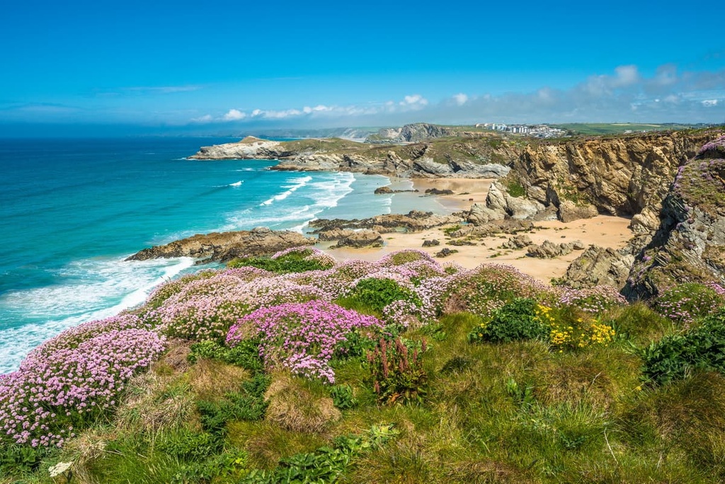
The Cornwall AONB stretches across the entirety of Cornwall, from Hartland in the county's northeast corner to Land's End, the most westerly point in England. As a result, the Cornwall AONB has a diverse landscape consisting of granite uplands, lush grassland, rugged sea cliffs, and pristine beaches.
The Cornwall AONB is located close to several other protected areas and national parks. Bodmin Moor is located approximately 25 mi (40 km) to the west of the Tamar Valley AONB and 28 mi (45 km) to the west of Dartmoor National Park. Exmoor National Park is located approximately 65 mi (105 km) to the northeast of the Cornwall AONB.
You'll have access to many of the largest settlements in South West England during your visit to the Cornwall AONB. Truro, the county town and only city in Cornwall, is located less than 5 mi (8 km) north of the Hartland Heritage Coast. The city of Plymouth in Devon is located approximately 30 mi (48 km) southeast of Bodmin Moor.
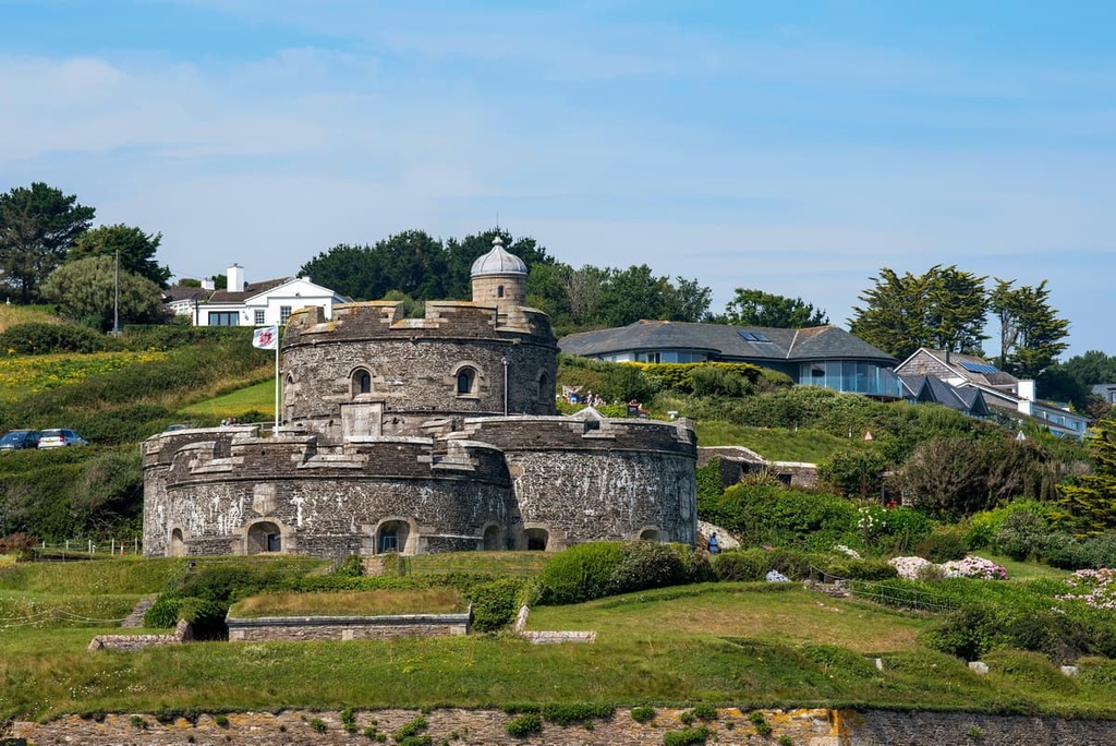
Other notable settlements located in and around the Cornwall AONB include Penzance, Falmouth, and Newquay. The Cornwall AONB is located approximately 225 mi (360 km) southwest of England's capital city, London.
The geology of Cornwall is particularly varied. The spine of the county consists of granite that formed during the Variscan orogeny approximately 280 million years ago. This granite formation is known as the Cornubian batholith.
Surrounding the county's granite backbone is a stratum of killas. Killas is a mining term used in Cornwall and Devon for sedimentary rock that has been altered by heated granite.
This metamorphism doesn't require the original stone to be turned into lava. Instead, it relies on heat, pressure, and chemical activity to cause alterations. The majority of these metamorphic rocks are Devonian slates that formed between 580 to 220 million years ago.
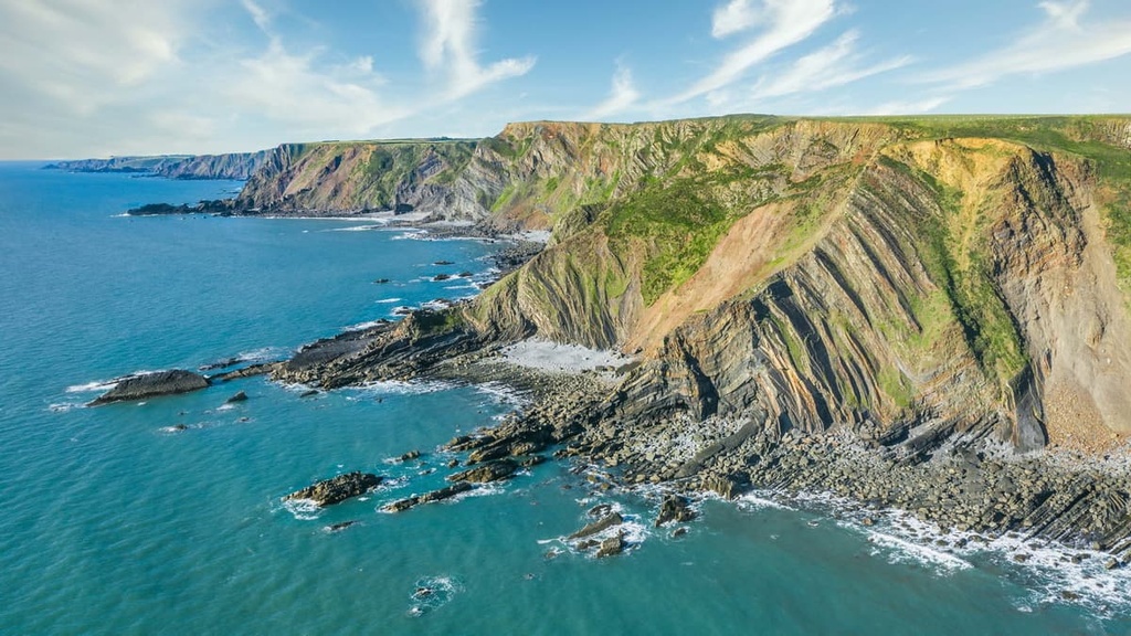
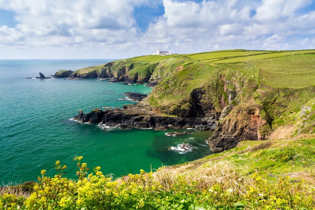
The Hartland Heritage Coast is unique as it consists of sandstones and shales that date back to the Carboniferous age, approximately 360 to 300 million years ago. Another unique feature of the AONB is the Lizard Peninsula that’s located on the county's southeast coastline, which consists of uplifted oceanic crust. It is the best example of exposed ophiolite in the UK.
Today, the Cornwall AONB highlights the main geological features of Cornwall, including its unusual oceanic crust coastline, granite uplands, and Devonian slates.
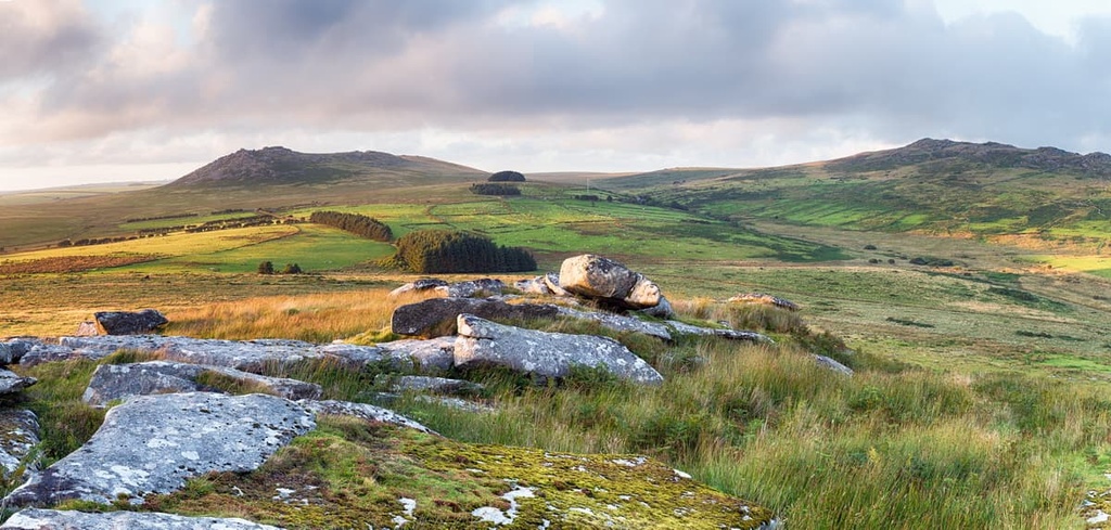
The majority of notable hills in the Cornwall AONB are located in Bodmin Moor. These moorlands feature a range of granite uplands rarely exceeding 400 m (1,312 ft) in height.
The highest hill in the AONB is Brown Willy (420 m/1,377 ft). Brown Willy is also one of only two Marilyns (a summit with a prominence of over 150 m/492 ft) in the AONB, along with Watch Croft (252 m/826 ft) in Penwith. Brown Willy is also the county top of Cornwall.
Other notable hills in the Cornwall AONB include Rough Tor (400 m/1,312 ft), Kilmar Tor (397 m/1,302 ft), and Stowe's Hill (381 m/1,250 ft).
The ecology of the Cornwall AONB is unique and varied, as it contains several Special Areas of Conservation and Sites of Special Scientific Interest (SSSI) across the county. The area's ecological features were a major contributing factor to the establishment of the AONB in the first place.
Thanks to its diverse environments, which range from serene estuaries to rugged hills, the Cornwall AONB is home to a range of fauna. One of the largest wild mammals you'll see inland in the AONB are red deer, the largest deer species in the UK. Wild ponies are also present in Bodmin Moor.
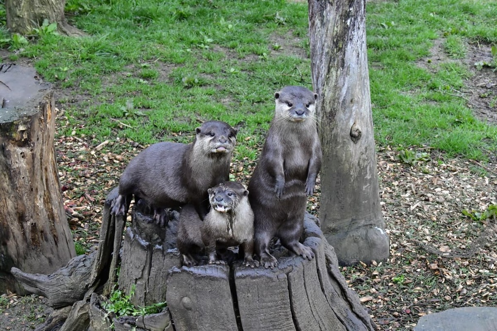
A project to reintroduce beavers to Cornwall began in 2017; however, they are not yet widespread across the county. Other notable mammals you may spot in the Cornwall AONB include European badgers, European otters, and red foxes.
While exploring the coastal areas of the Cornwall AONB, you may spot a number of seabird species. Rare bird sightings along the coast include those of Manx shearwaters, great skuas, and puffins. Other interesting inland bird species include red kites, kingfishers, and European stonechats.
While traveling along the coast, you may also catch a glimpse of Cornwall's sealife. Colonies of gray seal live in isolated coves and caves along Cornwall's coastline. Keen-eyed visitors may even get lucky and spot a blue whale, an orca, or a common dolphin out at sea.
The grasslands and Cornish hedges of the Cornwall AONB are habitats for dozens of insect species. Butterfly and moth species are often seen fluttering around across grasslands, including small emperor moths, speckled wood butterflies, and common butterflies. Other common species include bumblebees, damselflies, and ladybirds.
One of the unique features of the Cornwall AONB is the Cornish hedges. Found only in Cornwall, Cornish hedges are manufactured hedges formed from earth and stone from which a variety of flora grows. These hedges act as barriers and windbreakers and define the landscape of Cornwall. Some of these hedges are ancient, dating back over 4,000 years.
Cornwall is home to many tree species. Due to the Gulf Stream, Cornwall is the only county in England with a sub-tropical climate and is the only place where palm trees can grow naturally. Common tree species found in Cornwall include sessile oak, field maple, and hybrid black poplar.
Wildflowers grow in abundance across the Cornwall AONB. One of the area's most recognizable plants is thrift. Also known as sea pink, thrift is bright pink and widespread across Cornwall's coastline. Other notable wildflower species include English stonecrop, kidney vetch, and hedgerow cranesbill.
There is evidence that suggests humans visited Cornwall during the Paleolithic era. However, researchers believe that humans didn't become permanent residents in the area until around 10,000 years ago.
At the start of recorded history, approximately 2,000 years ago, the region was controlled by the Celtic Dumnonii tribe. The primary language was Common Brittonic, which would develop into the Cornish language. As a result of this cultural history, Cornwall is regarded as one of the six Celtic nations.
Following Roman rule, Cornwall began feuding with the neighboring Anglo-Saxon Kingdom of Wessex before eventually falling under their control by the ninth century. After being invaded by Wessex, Cornwall kept most of its culture and autonomy.
For example, Cornwall was given stannary law, which granted local control over the county's most important product, tin. While no longer relevant, stannary law is still enshrined in English law and is one of the oldest laws in the country.
By the eighteenth century, Cornwall had become an integrated part of Great Britain, with the Cornish language all but disappearing. Following the Industrial Revolution and the decline of Cornish mining, many locals emigrated overseas in what's called the Cornish diaspora.
In recent times, there has been an increase in support for Cornish nationalism and self-government. The Cornish language has been revived, with between 8,000 to 13,000 speakers. In 2001, laws were changed so Cornish people could put Cornish as their ethnicity on identification and surveys.
The Cornwall AONB was established in 1959 to protect the finest natural landscapes on the Cornish peninsula. The Camel Estuary section of the AONB was added in 1981. A partnership of 21 local councils and organizations manages the area.
With one of the finest coastlines in England and several challenging hill walks, the Cornwall AONB is well-worth discovering. Read on to find out about the AONB’s main hiking trails and areas.
Bodmin Moor is the only inland area in the Cornwall AONB. It offers many of the most strenuous walks in the county. It's also the largest granite upland in Cornwall. The moorlands feature Brown Willy (420 m/1,377 ft), the tallest hill in the county, surrounded by several other modest hills that are topped with granite tors.
Brown Willy and Rough Tor
Brown Willy and Rough Tor (400 m/1,312 ft) are very popular with hikers, providing tough, yet rewarding walks. The two hills are located roughly 0.6 mi (1 km) apart, making it easy to climb both hills in one go. Brown Willy is the highest of Bodmin Moor’s hills, while Rough Tor is the most iconic with its striking granite tors.
This circular walk is 5 mi (8 km) long and takes approximately 3 hours to complete. Hiking boots are recommended, as some of the tors can be slippery underfoot. You can start this walk from the Rough Tor car park to the northwest of Rough Tor.
The walk starts by passing the Rough Tor Holy Well before scaling Rough Tor. From the Holy Well, the easiest way to the top of the hill is via the ridge to the left. Avoid stacking or playing with the rocks atop these hills as they may be prehistoric remains and it is illegal to remove them.
From Rough Tor, head to the next obvious tor along the ridge, known as Little Rough Tor (385 m/1,263 ft). From here, continue to Showery Tor (379 m/1,243 ft), which is topped with what's thought to be an ancient religious site.
From Showery Tor, follow the path into the valley, cross the bridge, and ascend Brown Willy. At a trig point, continue along the ridge past several minor summits to the southernmost peak.
The southernmost tor is Brown Willy's true summit and is marked with a cairn. From the summit, you'll be able to see the Cornish coastline to the north and the clay hills around St. Austell to the south.
On the return leg, retrace your steps to the bridge below Showery Tor and follow the left path that skirts around the hills. You'll soon see the car park come into view.
Minions and the Cheesewring
The village of Minions and the surrounding hills and archeological sites are among the most popular tourist attractions in Bodmin Moor.
This walk leads past the Hurlers, a group of Bronze Age stone circles. Legends say the Hurlers were formed when men playing Cornish hurling on the Sabbath were magically transformed into stone as a punishment.
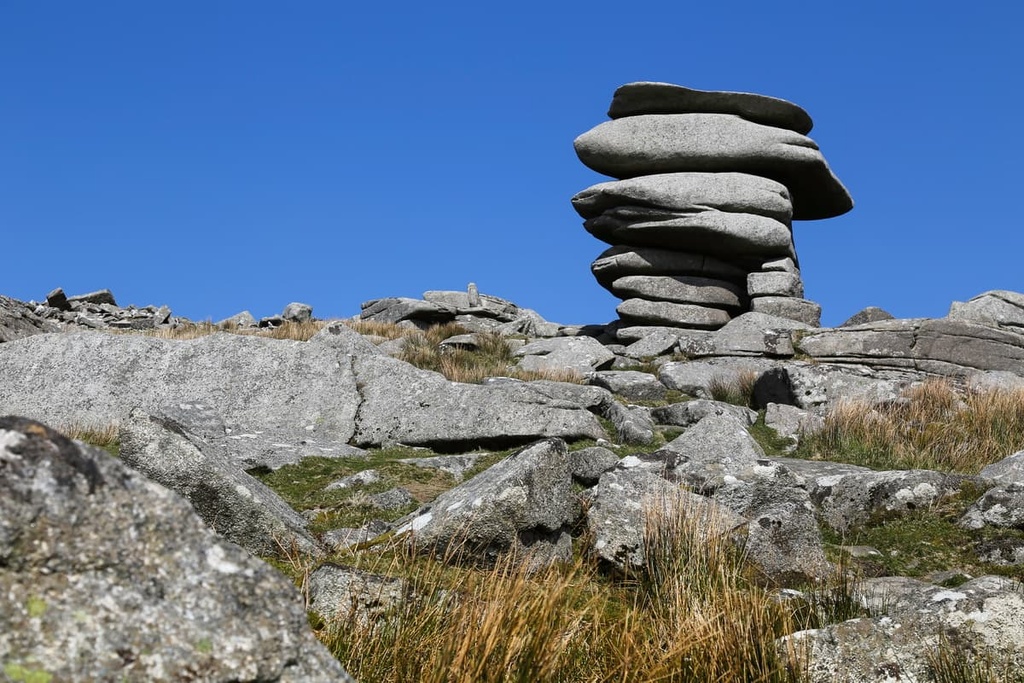
The walk also leads up Stowe's Hill (381 m/1,250 ft) to the Cheesewring, a 10 m (32 ft) tall natural rock formation that looks like large stones have been precariously stacked atop one another.
Be sure to avoid accidentally or purposely vandalizing or removing rocks from Bodmin Moor. Some of the stacks are 1,000 years older than the Egyptian pyramids, and it's illegal to move them.
The circular walk up Stowe's Hill is roughly 3.5 mi (5.5 km) long and takes around 2 hours to complete. In some places, you'll need to cross open moorland to reach Stowe's Hill, so map your route carefully and bring waterproof footwear. The best place to start this walk is from the Hurlers car park in Minions.
You'll start by passing the Hurlers before continuing along the path and bearing right towards the summit of Stowe's Hill. Here, you'll pass a neolithic tomb called Rillaton Barrow. Keep right of the Cheesewring quarry face. From this direction, the Cheesewring is the leftmost rock formation.
Past the Cheesewring, you'll head in the direction of Sharp Tor (381 m/1,250 ft). At the paved labe, follow it towards the group of houses. Then, at the junction, turn right and then left at the public bridleway.
There are plenty of twists and turns on the return leg, so plan your route carefully. On your way back to your starting point, you'll pass by Caradon Hill (369 m/1,210 ft) on your left.
Penwith is the westernmost region of Cornwall. The area consists of the Land's End Peninsula and is a popular tourist resort, thanks to the peninsula's stunning coastline. Penwith is home to several notable geographical features, including the only cape in England, Cape Cornwall, and England's most westerly point, Land's End.
Land's End
The walk to the most westerly point in England, Land's End, is among the most popular hikes in the Cornwall AONB. The villages of Porthcurno and Sennen are located near some of the finest cliffs in Cornwall, such as Carn Les Boel and Carn Barra. One of the best ways to explore Land's End is on the coastal path from Sennen Cove.
The circular walk from Sennen Cove to Land's End is around 6 mi (10 km) long and takes approximately 3 hours to complete. You can follow paths and country lanes along the whole journey. Parts of the return leg of this walk can be confusing, so map out your route carefully. The paths are also steep in places, so hiking boots are recommended.
The best place to start this walk is from the Sennen Cove Harbour car park. Take in views of Cape Cornwall before walking south along the South West Coast Path, which is one of 16 National Trails in England and Wales. After passing Land's End, you'll continue south, past the picturesque Nanjizal Bay.
After passing Nanjizal Bay, head back to your starting point via Bosistow Farm. Map out a route along public access country roads back to your starting point near Sennen.
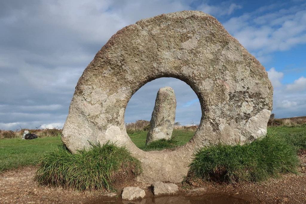
Carn Galver and Mên-an-Tol
This moorland walk up Carn Galver (226 m/741 ft) takes hikers past some fascinating Neolithic and Bronze Age monuments. The best of the lot is Mên-an-Tol, a group of three standing stones with a ring-shaped stone flanked by standing stones. When viewed from the right angle, the monument reads "101.”
It's also possible to take a detour on this walk to the top of Watch Croft (252 m/826 ft), one of only two Marilyns in the AONB.
This circular walk is 5.5 mi (9 km) long and takes about 3 hours to complete. Start the walk from the Carn Galver Engine House and follow the signposted trail to the summit of Carn Galver. The summit offers panoramas across to Watch Croft and of the Cornish coastline.
Then, follow pathways south across the moorlands. Along the way, you can stop at several ancient monuments, including the Four Parish Stone and the Nine Maidens stone circle. After passing the Nine Maidens, you'll come to the best of the ancient monuments, Mên-an-Tol.
To return, follow the paths north as they pass along the southern and then western slopes of Watch Croft. If you've still got plenty of energy, you can plan a detour to the top of Watch Croft. After Watch Croft, you can join the South West Coast Path, which you can follow back to your starting point.
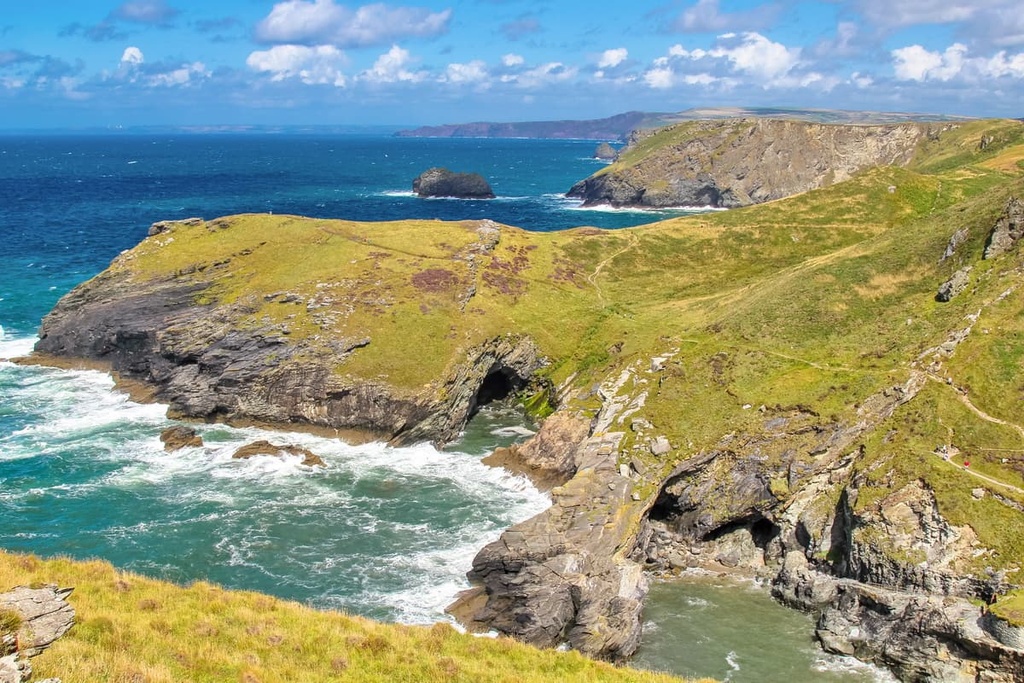
The Lizard is a peninsula on the south coast of Cornwall. It is the most southerly point in the mainland UK.
The Lizard Peninsula is home to many beaches and bays, including Housel Bay, Kennack Sands, and Kynance Cove. The peninsula is also one of Cornwall's most geologically interesting areas, as it features an exposed section of the Earth's oceanic crust, widely considered the best example of its kind in the country.
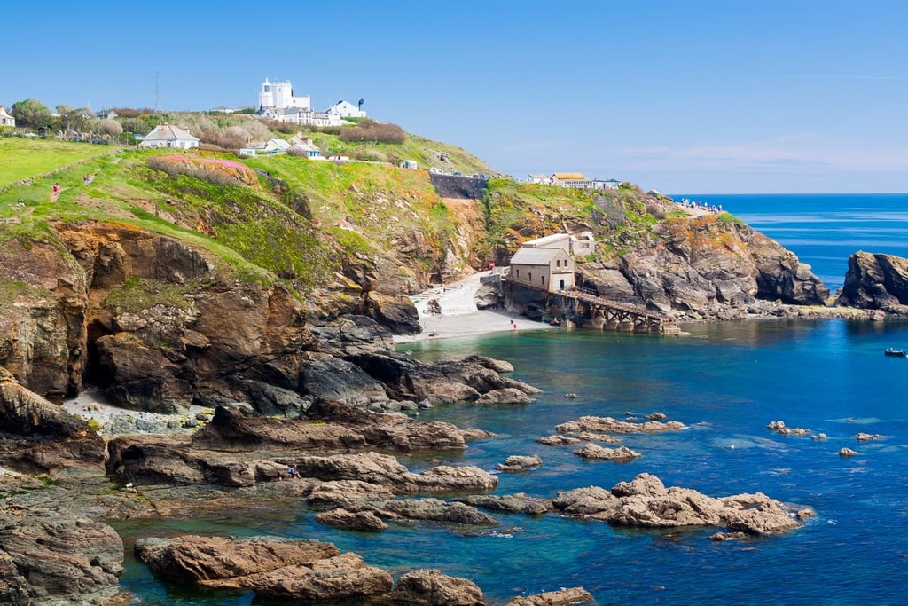
Housel Bay and Bass Point
The Housel Bay and Bass Point walk is a straightforward and rewarding hike that highlights the best of the Lizard Peninsula. The walk is 3.5 mi (6 km) long and takes around 2 hours to complete.
Start this walk from the car park at the center of Lizard village. Head onto Penmenner Road and follow the rough track to the Lizard lighthouse. The lighthouse is a good point of reference for most of the walk in case you get lost.
Descend down the path toward the ocean. At the coastal path, turn left and head for the southernmost point in the UK, Lizard Point. Pass the lighthouse and reach the footbridge at Housel Bay, one of the highlights of the walk.
Back on the clifftops on the opposite side of Housel Bay, turn right at the Housel Bay Hotel, and continue on the South West Coastal Path until you reach Bass Point. Then, descend to Church Cove and pass St. Wynwallow Church, the most southerly church in England. Stay on this road, which leads back to the center of Lizard village.
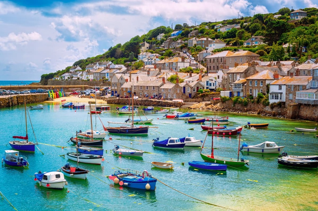
With its many quaint coastal towns and ancient villages, Cornwall is a popular vacation destination. Read on to find out about some of the main settlements in and around the Cornwall AONB.
Sat just across the Cornish county line in Devon is the port city of Plymouth. The largest city in the South West after Bristol, Plymouth is located close to many parks, with the Tamar Valley AONB, the South Devon AONB, and Dartmoor National Park, less than 10 mi (16 km) away. Plymouth also provides easy access to Bodmin Moor, which is located 30 mi (48 km) away.
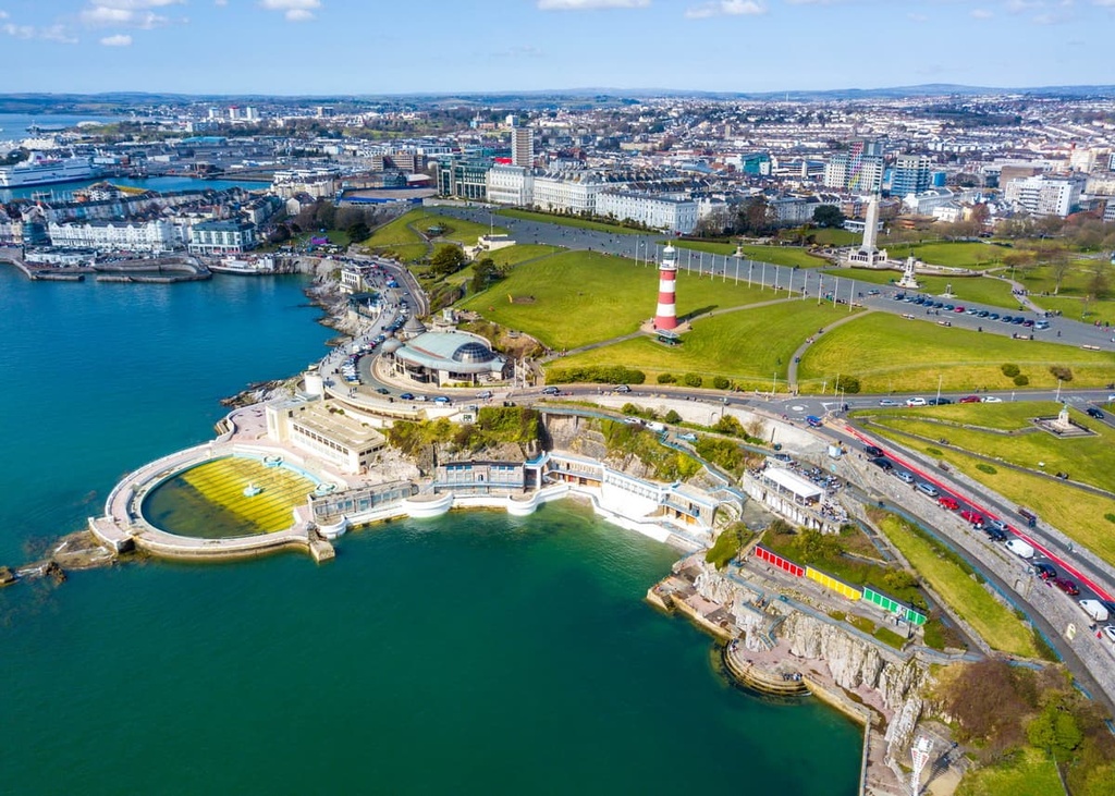
Plymouth has a long maritime history and is home to some of the best attractions in the South West, like the National Marine Aquarium, Saltram, and The Box. You'll find plenty of hotels to choose from in Plymouth, including the Crowne Plaza Plymouth, the New Continental Hotel, and the Grosvenor Plymouth.
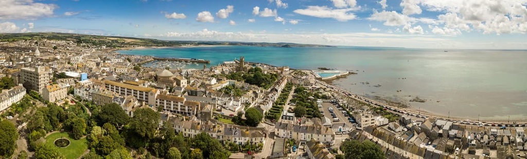
Truro is the county town and only city in Cornwall. It's also England's southernmost city. Truro is located just north of the Roseland Heritage Coastline and is less than 30 mi (48 km) from the Lizard and Penwith. It's a small cathedral city with a population of fewer than 20,000 people.
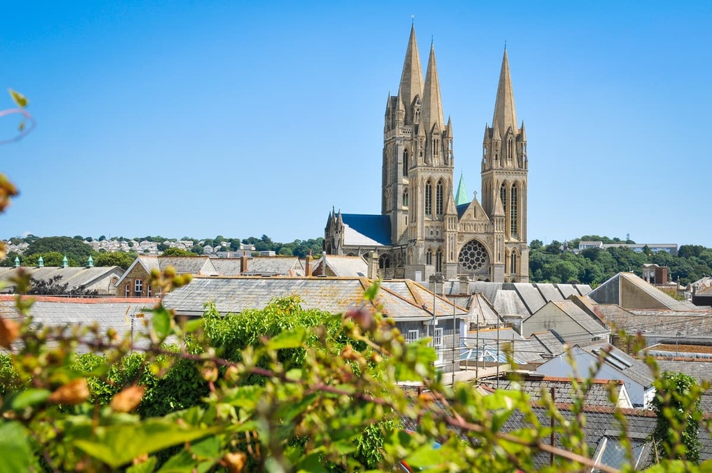
Truro has been around since at least the twelfth century and is home to some excellent historical attractions, like Truro Cathedral, Trelissick Garden, and the Royal Cornwall Museum. Hotels in Truro include the Alverton Hotel, the County Arms, and Mannings Hotel.
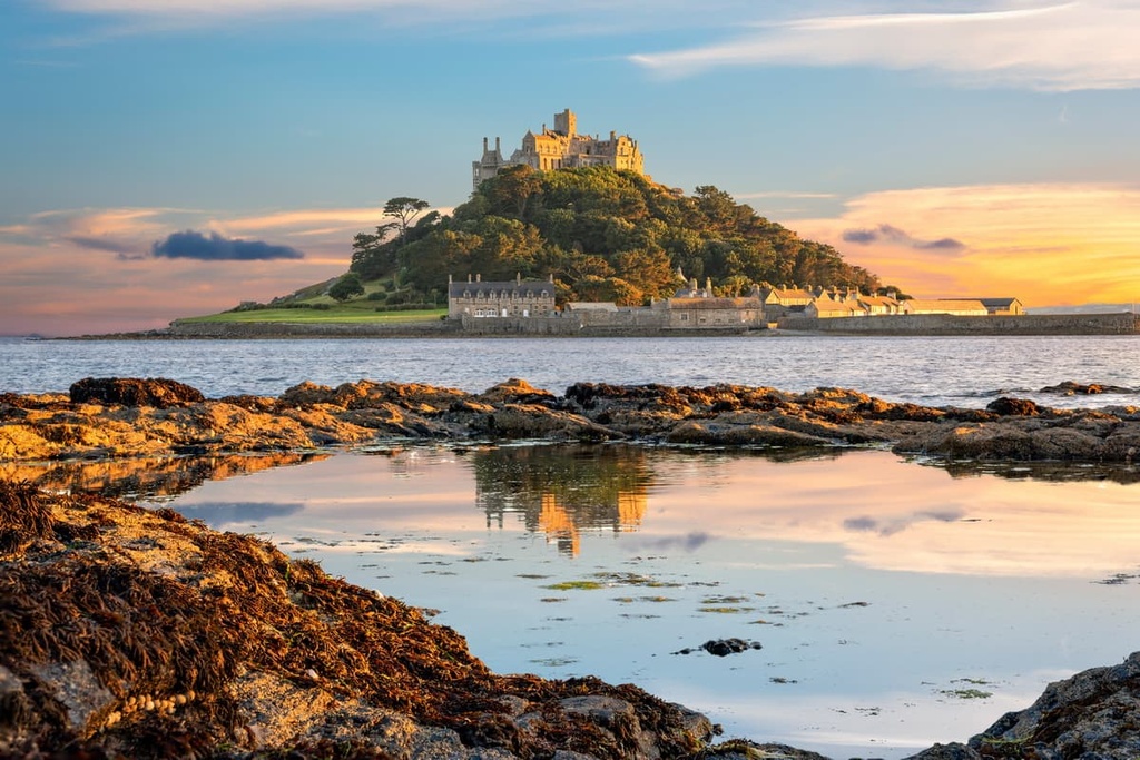
The seaside town of Penzance is one of the top places to stay in Penwith. This port town sits overlooking Mount Bay, with St Micheal's Mount being one of the region's top tourist attractions. Other popular local attractions include Penlee House Gallery & Museum, Newlyn Art Gallery, and Trengwainton Garden.
Penzance is less than 10 mi (16 km) from Land's End and Cape Cornwall. From the town, you'll have easy access to the Lizard Peninsula. If you're planning to stay in Penzance, book a room at the Hotel Penzance, the Longboat Inn, or the Artist Residence.
Another popular seaside town in Cornwall is Newquay. Perched on Cornwall's north coast, Newquay is famous for being one of the best surf spots in Europe and for having some of the best beaches in the UK.
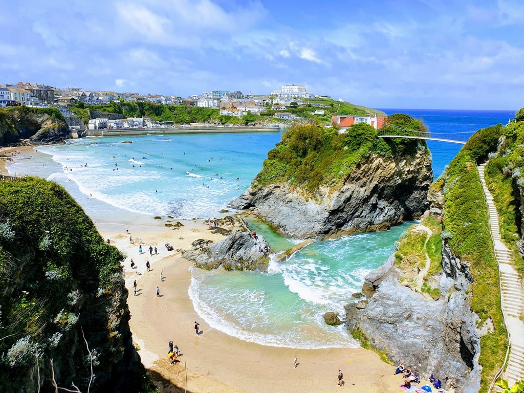
Away from the beaches, Newquay boasts some superb family-friendly attractions, like the Blue Reef Aquarium and Newquay Zoo. Hotels in Newquay include the Fistral Beach Hotel, the Newquay Beach Hotel, and the Beresford Hotel.


The highest peak in Cornwall AONB is Brown Willy, at 420 m.
Notable peaks in Cornwall AONB include Brown Willy, Rough Tor, Kilmar Tor, Little Rough Tor and High Rock.


