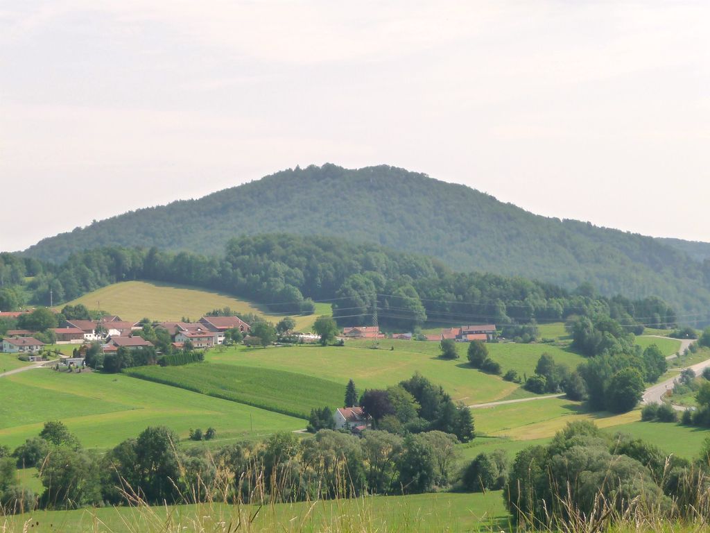
Frauenberg is a mountain of 728m in the Bavarian Forest, close to Grafenau in Bavaria, Germany.
Despite its inferior height, it is a recognizable part of the environment, as its conical form distinguishes it from the surrounding mountains of the Bavarian Forest. The Kleine Ohe (also Grafenauer Ohe) at this point crosses the Pfahl in the Elsenthaler Leite. Its more plain northern and eastern flank is foremost vegetated by spruces, whereas the more cliffy western and southern flanks going towards the Kleine Ohe are more grown over with deciduous forest, dominated by common beech, largeleaf linden and sycamore maple. There on 460m to 560m since 1978 a natural reserve of 19,5ha was established. Additionally there is one known viewing point on the southern side.
To the pilgrimage chapel of Brudersbrunn, being located in the forest north of the peak, stations of the cross lead upwards from Grafenau.The chapel was constructed in 1842, on the spot where 1803 the former one was destroyed. The baroque Icon (1704) was stolen in 1969, together with some votive offerings and angel-formed candelabra.
We use GPS information embedded into the photo when it is available.
3D mountains overlay
Adjust mountain panorama to perfectly match your photos because recorded by camera photo position might be imprecise.
Move tool
Rotate tool
Zoom
More customization
Choose which peak labels should make into the final photo and what photo title should be.
Next
Photo Location
Satellitte
Flat map
Relief map
Latitude
Longitude
Altitude
OR
Latitude
°'''
Longitude
°'''
Apply
Register Peak
Peak Name
Latitude
Longitude
Altitude
Register
Teleport
PeakVisor
This 3D model of Sagarmatha National Park in Nepal was made using the PeakVisor app topographic data. The mobile app features higher precision models worldwide, more topographic details, and works offline. Download PeakVisor maps today.
Download OBJ model
PeakVisor
The download should start shortly. If you find it useful please consider supporting the PeakVisor app.
PeakVisor for iOS and Android
Be a superhero of outdoor navigation with state-of-the-art 3D maps and mountain identification in the palm of your hand!