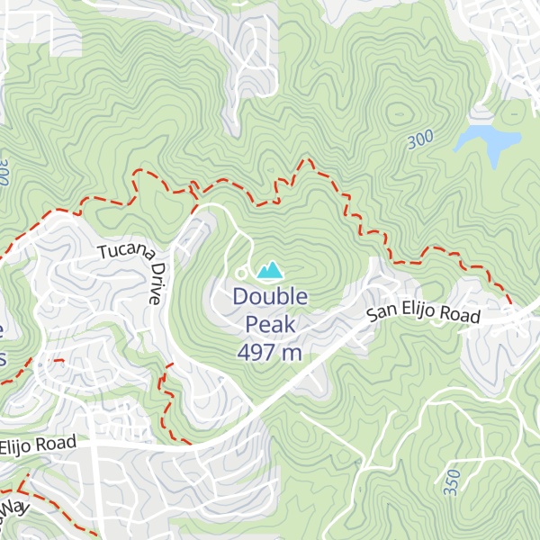
Double Peak is located south of San Marcos, California. The elevation at the summit is 1,646 ft (502 m), and approximately 1,000 feet (305 m) above the north foot of the mountain. Most trails leading to the summit of Double Peak are classified as "moderately strenuous."
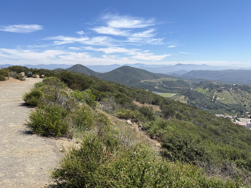
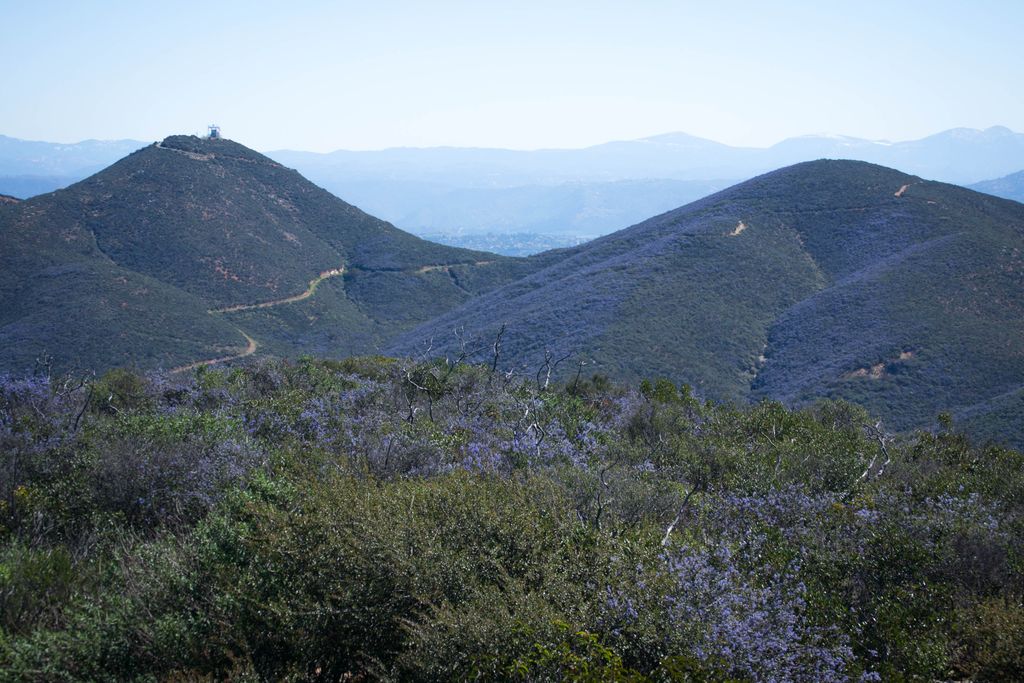
Double Peak is a popular hiking and biking area due to its many trails and convenient access points. On the north side, the mountain can be accessed by hikers and bikers through Discovery Lake Park, but this trailhead is closed to motorized vehicles. On the south side, the mountain can be accessed by vehicles through Double Peak Drive, extending from the neighborhood of San Elijo Hills. Both the North and the South access trails offer wide, partially paved surfaces. There is also a less-accessible rock and dirt trail which allows summiting the mountain from the East side. The Eastern trail has a steep incline, with rugged, staircase-like rock extrusions and at some points, loosely packed shale. The Eastern trail can only be accessed by following other trails along either the north or south face of the mountain, around to the eastern face of the mountain.
Accessing the mountain from the north side, at Discovery Lake Park, a City of San Marcos information sign states that the length of the trail is 2.5 mi (4 km) from the park to the summit.
On a clear day, the peak offers views of distant places such as Mexico, downtown San Diego, San Clemente Island, Catalina Island, the Palos Verdes Peninsula, the Santa Ana Mountains, and the San Bernardino Mountains. A telescope is located at the peak for use by visitors.
We use GPS information embedded into the photo when it is available.
3D mountains overlay
Adjust mountain panorama to perfectly match your photos because recorded by camera photo position might be imprecise.
Move tool
Rotate tool
Zoom
More customization
Choose which peak labels should make into the final photo and what photo title should be.
Next
Photo Location
Satellitte
Flat map
Relief map
Latitude
Longitude
Altitude
OR
Latitude
°'''
Longitude
°'''
Apply
Register Peak
Peak Name
Latitude
Longitude
Altitude
Register
Teleport
PeakVisor
This 3D model of Sagarmatha National Park in Nepal was made using the PeakVisor app topographic data. The mobile app features higher precision models worldwide, more topographic details, and works offline. Download PeakVisor maps today.
Download OBJ model
PeakVisor
The download should start shortly. If you find it useful please consider supporting the PeakVisor app.
PeakVisor for iOS and Android
Be a superhero of outdoor navigation with state-of-the-art 3D maps and mountain identification in the palm of your hand!