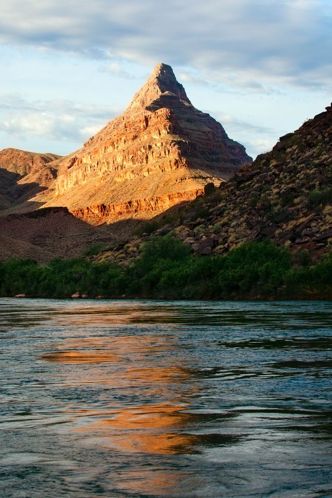
Diamond Peak is a 3,512-foot-elevation (1,070 meter) summit located in the western end of the Grand Canyon, on the Hualapai Indian Reservation in Mohave County of northwestern Arizona, United States. This double summit landmark is situated at the mouth of Peach Springs Canyon, where Diamond Creek meets the Colorado River. This peak is an erosional remnant composed of Cambrian Muav Limestone and Mississippian Redwall Limestone. Topographic relief is significant as Diamond Peak towers 2,200 feet above the Colorado River in one-half mile. According to the Köppen climate classification system, Diamond Peak is located in a desert climate zone.
We use GPS information embedded into the photo when it is available.
3D mountains overlay
Adjust mountain panorama to perfectly match your photos because recorded by camera photo position might be imprecise.
Move tool
Rotate tool
Zoom
More customization
Choose which peak labels should make into the final photo and what photo title should be.
Next
Photo Location
Satellitte
Flat map
Relief map
Latitude
Longitude
Altitude
OR
Latitude
°'''
Longitude
°'''
Apply
Register Peak
Peak Name
Latitude
Longitude
Altitude
Register
Teleport
PeakVisor
This 3D model of Sagarmatha National Park in Nepal was made using the PeakVisor app topographic data. The mobile app features higher precision models worldwide, more topographic details, and works offline. Download PeakVisor maps today.
Download OBJ model
PeakVisor
The download should start shortly. If you find it useful please consider supporting the PeakVisor app.
PeakVisor for iOS and Android
Be a superhero of outdoor navigation with state-of-the-art 3D maps and mountain identification in the palm of your hand!