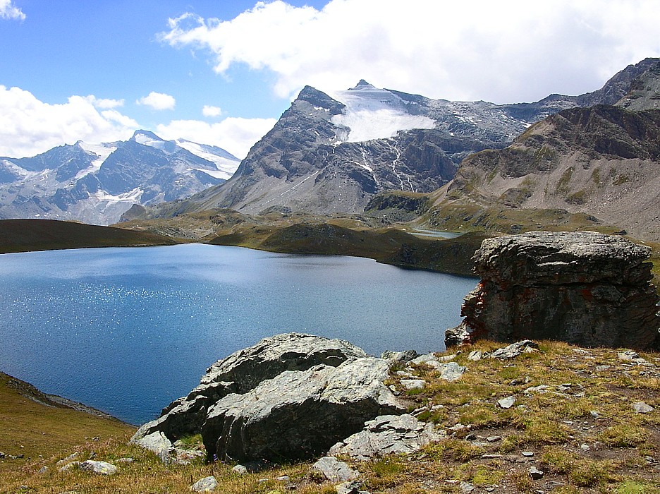
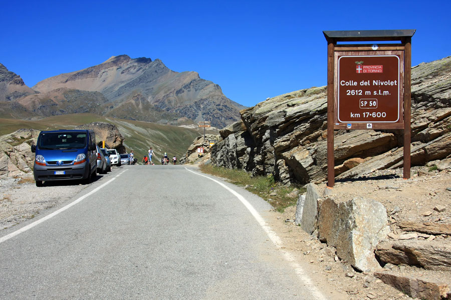
The Nivolet Pass ([nivɔlɛ]; Italian: Colle del Nivolet or French: Col du Nivolet) is a mountain pass in the Eastern group of the Graian Alps in northern Italy. It is located at the top of the Orco Valley on the road from Turin to Ceresole Reale, in the Gran Paradiso National Park. Beyond the pass, the road terminates in the upper reaches of the eponymous Valsavarenche valley in the Gran Paradiso mountain group, before the valley descends to Valsavarenche and Villeneuve. The colle forms part of the boundary between the Aosta Valley and the Piedmont region. The highest point of the paved road is 2,641 metres (8,665 feet). Two artificial lakes, Serrù Lake and Agnel Lake, are located immediately below the pass.
The approach road from Agnel Lake was the location of several scenes in the film The Italian Job, including the iconic final bus crash.
There's a hiking trail (T2) leading to the summit. Colle Del Nivolet is one of the 1 peaks along the (SI E34Z) Rifugio Jervis - Rifugio Savoia (Valle d'Aosta).
The nearest mountain hut is Rifugio Città di Chivasso located 342m/1 121ft ENE of the summit.
We use GPS information embedded into the photo when it is available.
3D mountains overlay
Adjust mountain panorama to perfectly match your photos because recorded by camera photo position might be imprecise.
Move tool
Rotate tool
Zoom
More customization
Choose which peak labels should make into the final photo and what photo title should be.
Next
Photo Location
Satellitte
Flat map
Relief map
Latitude
Longitude
Altitude
OR
Latitude
°'''
Longitude
°'''
Apply
Register Peak
Peak Name
Latitude
Longitude
Altitude
Register
Teleport
PeakVisor
This 3D model of Sagarmatha National Park in Nepal was made using the PeakVisor app topographic data. The mobile app features higher precision models worldwide, more topographic details, and works offline. Download PeakVisor maps today.
Download OBJ model
PeakVisor
The download should start shortly. If you find it useful please consider supporting the PeakVisor app.
PeakVisor for iOS and Android
Be a superhero of outdoor navigation with state-of-the-art 3D maps and mountain identification in the palm of your hand!