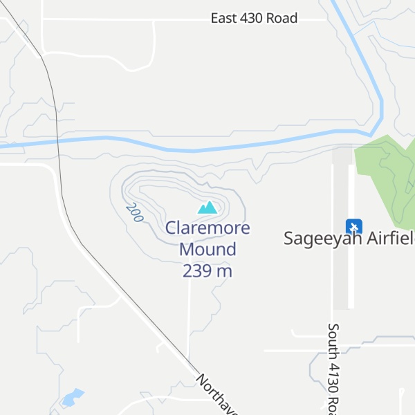
Claremore Mound, a natural feature in present-day Rogers County, Oklahoma. The mound is located north of Sageeyah near the south bank of the Verdigris River.
The rocky mound has an elevation of 784 feet (239 m) above sea level. The area on top of the mound, where the Osage built a village called Pasona about 1802, is about 25 acres (100,000 m2).
Claremore Mound was the site of the Battle of Strawberry Moon (a.k.a. Battle of Claremore Mound). In June 1817, a band of Cherokee Indians and their allies, under Chief Spring Frog (Too-an-tuh), attacked Pasuga, an Osage Indian village at the foot of Claremore Mound, killing thirty-eight Osage, including their Chief Glahmo, and taking one hundred and four captives. In revenge, the Osage attacked the Cherokee for the next twenty years, led by Wah-tianka, Glahmo's son.
European-American settlers designated both the mound and the nearby town as Clermont ("clear mountain" in English) in honor of Chief Glahmo, who French traders had nicknamed Chief Clermont. When the town petitioned for a post office in 1874, a clerical error listed Clermont as Claremore; the error was never rectified and today both the mound and the town are named Claremore.
Parts of the Cherokee reservation, established in the late 1830s in Indian Territory, lay about 2 miles (3.2 km) to the west. The modern city of Claremore, developed by European Americans, is about 7 miles (11 km) away.
We use GPS information embedded into the photo when it is available.
3D mountains overlay
Adjust mountain panorama to perfectly match your photos because recorded by camera photo position might be imprecise.
Move tool
Rotate tool
Zoom
More customization
Choose which peak labels should make into the final photo and what photo title should be.
Next
Photo Location
Satellitte
Flat map
Relief map
Latitude
Longitude
Altitude
OR
Latitude
°'''
Longitude
°'''
Apply
Register Peak
Peak Name
Latitude
Longitude
Altitude
Register
Teleport
PeakVisor
This 3D model of Sagarmatha National Park in Nepal was made using the PeakVisor app topographic data. The mobile app features higher precision models worldwide, more topographic details, and works offline. Download PeakVisor maps today.
Download OBJ model
PeakVisor
The download should start shortly. If you find it useful please consider supporting the PeakVisor app.
PeakVisor for iOS and Android
Be a superhero of outdoor navigation with state-of-the-art 3D maps and mountain identification in the palm of your hand!


.jpg)