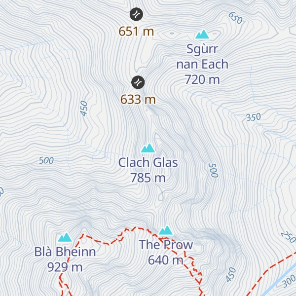
Clach Glas is a mountain on the Black Cuillin of the Isle of Skye, Scotland. Its elevation is 786 m (2,579 ft) and the name translates as The Grey Stone. It is often traversed as a sustained scrambling route to Blà Bheinn, mostly at a standard between Easy and Moderate, depending on the line followed (see Parker, routes 101 & 102). It is the penultimate mountain in the Greater Traverse of the Black Cuillin.
Ashley Abraham called it "the Matterhorn of Skye" (a description which is often still used).
According to some sources the first ascent of the top was probably not until 1888 by Charles Pilkington and party.
We use GPS information embedded into the photo when it is available.
3D mountains overlay
Adjust mountain panorama to perfectly match your photos because recorded by camera photo position might be imprecise.
Move tool
Rotate tool
Zoom
More customization
Choose which peak labels should make into the final photo and what photo title should be.
Next
Photo Location
Satellitte
Flat map
Relief map
Latitude
Longitude
Altitude
OR
Latitude
°'''
Longitude
°'''
Apply
Register Peak
Peak Name
Latitude
Longitude
Altitude
Register
Teleport
PeakVisor
This 3D model of Sagarmatha National Park in Nepal was made using the PeakVisor app topographic data. The mobile app features higher precision models worldwide, more topographic details, and works offline. Download PeakVisor maps today.
Download OBJ model
PeakVisor
The download should start shortly. If you find it useful please consider supporting the PeakVisor app.
PeakVisor for iOS and Android
Be a superhero of outdoor navigation with state-of-the-art 3D maps and mountain identification in the palm of your hand!