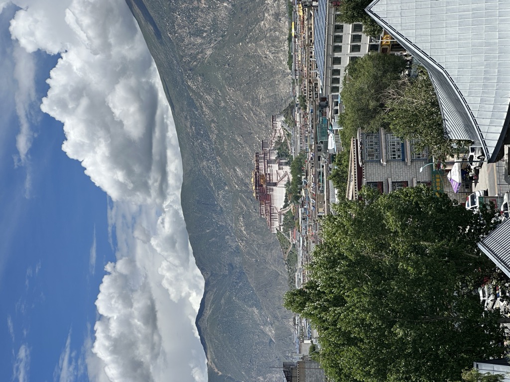
Chagpori, Chakpori, Chokpori, Chagpo Ri (Wylie: lcags po ri, literally "Iron Mountain") is a spirit-mountain of Vajrapani in Lhasa, Tibet. It is south of Potala and just to the left when one is facing the Potala. It is considered to be one of the four holy mountains of central Tibet.
Chagpori was the site of the monastic medical college of the same name founded there by Sangye Gyatso in 1696. This medical college, which incorporated a recently restored temple made by Thang Tong Gyalpo, was supplied with revenue generating lands and with a constant stream of students by a "monk tax". It remained an important medical institution in Tibet and Central Asia up until the mid-Twentieth century. Peter Aufschnaiter was photographed by Heinrich Harrer on top of the College of Medicine (Men-Tsee-Khang) using a theodolite for surveying the city of Lhasa. Aufschnaiter wrote, "Since 23 December 1947 I have been staying in Lhasa for some months to make a town plan, and have now been appointed to the government service by a decree of the Regent."
During the March 1959 Lhasa uprising, the medical school established by the 13th Dalai Lama named Men-Tsee-Khang and a temple housing statutes of coral (Tsepame), mother-of-pearl (of Tujechempo) and turquoise (of Drolma) were demolished by the People's Liberation Army artillery as the Tibetans had placed a few cannons up there. Jianglin Li's book Tibet in Agony: Lhasa 1959 says,"On March 20 (...) That was the morning of the shelling of Chakpori Hill. While the Tibetan Medical Institute crumbled..."The monk Jampa Phuntsok of the Namgyal Monastery recalled, "when the bombardment of Chakpori Hill began (...) the Tibetans at the Potala could only watch as their beloved landmark went up in smoke." It is now crowned by radio antennas. A road has been constructed through the spur that used to connect Chagpori with the Marpori ('Red Hill') on which the Potala is built. At this spur connecting these two hills was the famous chorten Pargo Kaling, a spired reliquary with an arch that served as the town's western gate and was demolished in 1967 and rebuilt in 1995.
Some rebuilding has since taken place a number of old rock carvings have survived through damage. Some of them are thought to have been carved during the reign of king Songtsen Gampo (605 or 617? - 649 CE) and painted by Nepalese artists. Some buildings have been rebuilt near the base of the hill and there is now again a small temple with prayer wheels.
Tradition has it that the three main hills of Lhasa represent the "Three Protectors of Tibet." Chagpori is the soul-mountain (bla-ri) of Vajrapani, Pongwari that of Manjushri, and Marpori, the hill on which the Potala stands, represents Chenresig or Avalokiteshvara.
We use GPS information embedded into the photo when it is available.
3D mountains overlay
Adjust mountain panorama to perfectly match your photos because recorded by camera photo position might be imprecise.
Move tool
Rotate tool
Zoom
More customization
Choose which peak labels should make into the final photo and what photo title should be.
Next
Photo Location
Satellitte
Flat map
Relief map
Latitude
Longitude
Altitude
OR
Latitude
°'''
Longitude
°'''
Apply
Register Peak
Peak Name
Latitude
Longitude
Altitude
Register
Teleport
PeakVisor
This 3D model of Sagarmatha National Park in Nepal was made using the PeakVisor app topographic data. The mobile app features higher precision models worldwide, more topographic details, and works offline. Download PeakVisor maps today.
Download OBJ model
PeakVisor
The download should start shortly. If you find it useful please consider supporting the PeakVisor app.
PeakVisor for iOS and Android
Be a superhero of outdoor navigation with state-of-the-art 3D maps and mountain identification in the palm of your hand!