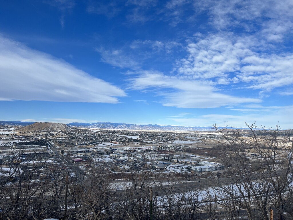
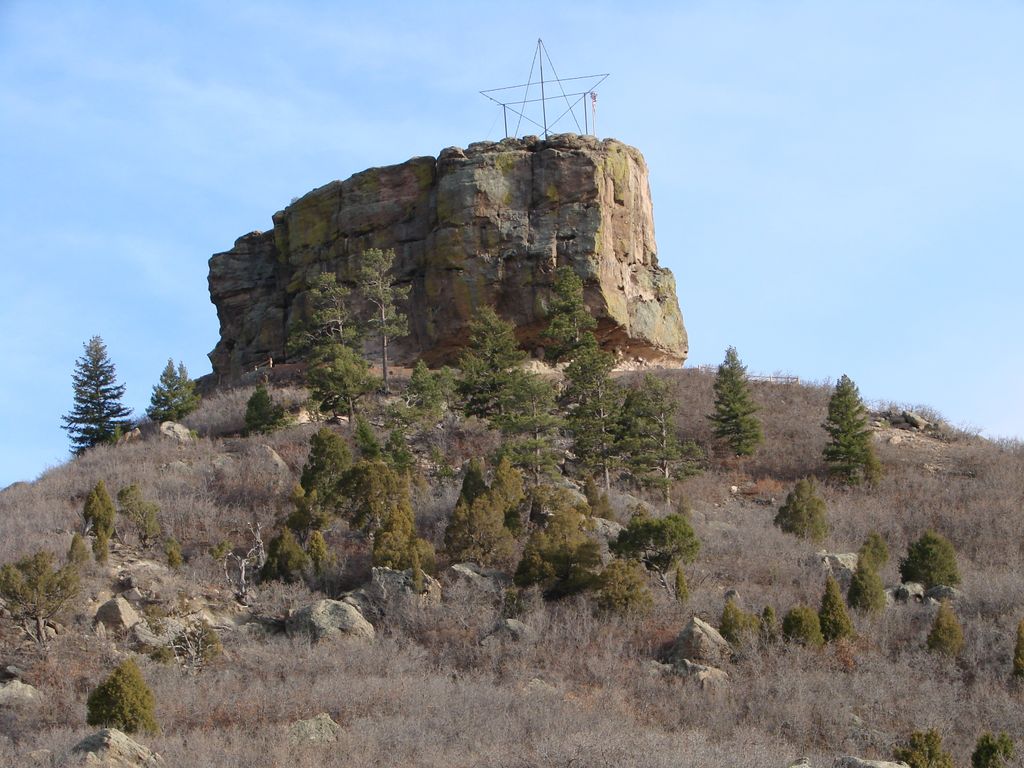
Castle Rock is a butte in the Colorado Piedmont region of the Great Plains. An area landmark, it is the namesake of the town of Castle Rock, Colorado.
The mesa’s caprock consists of rhyolite, rock which is strongly resistant to erosion. About 58 million years ago, a volcanic eruption took place that covered the area around Castle Rock with 20 feet (6.1 m) of rhyolite. After a few million years, mass flooding and erosion of the volcanic rock gave way to the butte-shaped mesa that almost resembles plateau.
Public hiking trails on the mesa are in Rock Park, at the intersection of Front Street and Canyon Drive in the town of Castle Rock. The trailhead and parking are about two blocks south of the intersection on Front Street, for a 1.4-mile round-trip hike to the base of the town's namesake (climbing the rest of the way to the summit is discouraged by a sign warning that the loose rocks are a fall hazard). Other trailheads can be found along Canyon Drive and Sunset Drive.
We use GPS information embedded into the photo when it is available.
3D mountains overlay
Adjust mountain panorama to perfectly match your photos because recorded by camera photo position might be imprecise.
Move tool
Rotate tool
Zoom
More customization
Choose which peak labels should make into the final photo and what photo title should be.
Next
Photo Location
Satellitte
Flat map
Relief map
Latitude
Longitude
Altitude
OR
Latitude
°'''
Longitude
°'''
Apply
Register Peak
Peak Name
Latitude
Longitude
Altitude
Register
Teleport
PeakVisor
This 3D model of Sagarmatha National Park in Nepal was made using the PeakVisor app topographic data. The mobile app features higher precision models worldwide, more topographic details, and works offline. Download PeakVisor maps today.
Download OBJ model
PeakVisor
The download should start shortly. If you find it useful please consider supporting the PeakVisor app.
PeakVisor for iOS and Android
Be a superhero of outdoor navigation with state-of-the-art 3D maps and mountain identification in the palm of your hand!