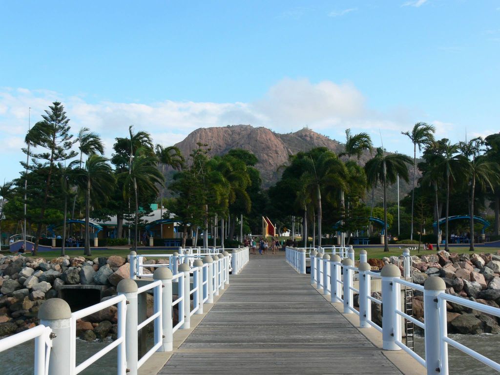
Castle Hill is a heritage-listed isolated pink granite monolith in the suburb of Castle Hill, City of Townsville, Queensland, Australia. Its Indigenous name is Cootharinga, sometimes written as Cooderinga.
It rises to a height of some 286 metres (938 ft) above sea level and dominates the city skyline. It is one of the most distinctive natural features on the Queensland coast. There are a number of vantage points from which to view the city below and also across Cleveland Bay to nearby Magnetic Island. Castle Hill (as a hill) was listed on the Queensland Heritage Register in 1993.
There's a trail called Radar Hill Walk leading to the summit.
We use GPS information embedded into the photo when it is available.
3D mountains overlay
Adjust mountain panorama to perfectly match your photos because recorded by camera photo position might be imprecise.
Move tool
Rotate tool
Zoom
More customization
Choose which peak labels should make into the final photo and what photo title should be.
Next
Photo Location
Satellitte
Flat map
Relief map
Latitude
Longitude
Altitude
OR
Latitude
°'''
Longitude
°'''
Apply
Register Peak
Peak Name
Latitude
Longitude
Altitude
Register
Teleport
PeakVisor
This 3D model of Sagarmatha National Park in Nepal was made using the PeakVisor app topographic data. The mobile app features higher precision models worldwide, more topographic details, and works offline. Download PeakVisor maps today.
Download OBJ model
PeakVisor
The download should start shortly. If you find it useful please consider supporting the PeakVisor app.
PeakVisor for iOS and Android
Be a superhero of outdoor navigation with state-of-the-art 3D maps and mountain identification in the palm of your hand!