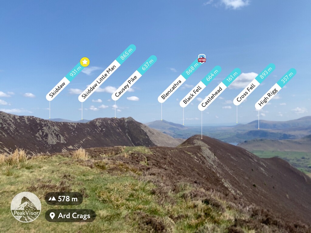
Ard Crags is a fell in the Lake District in Cumbria, England, it is situated in the Newlands Valley just off the minor road between Keswick and Buttermere. The Ordnance Survey officially records the fell's altitude at 581 metres (1,906 ft), considerably more than the approximate 1,860 feet (570 m) that Alfred Wainwright attributed to it in his Pictorial Guide to the North Western Fells, published in 1964 well before the advent of satellite mapping. Ard Crags is situated close to other higher fells such as Causey Pike and Eel Crag and can be easily overlooked. However, viewed from certain points in the Rigg Beck or Newlands valley area it presents a clearly defined and pyramidal shape which catches the eye.
There's a hiking trail (T1) leading to the summit.
By prominence Ard Crags is
# 79 out of 864 in Lake District National Park # 78 out of 838 in The English Lake District WHS
We use GPS information embedded into the photo when it is available.
3D mountains overlay
Adjust mountain panorama to perfectly match your photos because recorded by camera photo position might be imprecise.
Move tool
Rotate tool
Zoom
More customization
Choose which peak labels should make into the final photo and what photo title should be.
Next
Photo Location
Satellitte
Flat map
Relief map
Latitude
Longitude
Altitude
OR
Latitude
°'''
Longitude
°'''
Apply
Register Peak
Peak Name
Latitude
Longitude
Altitude
Register
Teleport
PeakVisor
This 3D model of Sagarmatha National Park in Nepal was made using the PeakVisor app topographic data. The mobile app features higher precision models worldwide, more topographic details, and works offline. Download PeakVisor maps today.
Download OBJ model
PeakVisor
The download should start shortly. If you find it useful please consider supporting the PeakVisor app.
PeakVisor for iOS and Android
Be a superhero of outdoor navigation with state-of-the-art 3D maps and mountain identification in the palm of your hand!