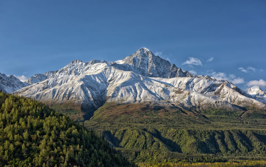
Amulet Peak is a prominent 8,290-foot (2,527 m) elevation mountain summit located 39 mi (63 km) east-northeast of Palmer, in the northern Chugach Mountains of the U.S. state of Alaska. This landmark of the Matanuska Valley is set midway between Anchorage and Glennallen, at mile 94 of the Glenn Highway. It is situated 12 mi (19 km) west of Matanuska Glacier, and 3.7 mi (6 km) northeast of Awesome Peak, its nearest higher neighbor. Established climbing routes on this peak include the east and south ridges, as well as the north face which is the most difficult and dangerous. The first ascent of this peak was made in 1968 by John Vincent Hoeman, his wife Grace Hoeman, and William Babcock, via the south ridge.
We use GPS information embedded into the photo when it is available.
3D mountains overlay
Adjust mountain panorama to perfectly match your photos because recorded by camera photo position might be imprecise.
Move tool
Rotate tool
Zoom
More customization
Choose which peak labels should make into the final photo and what photo title should be.
Next
Photo Location
Satellitte
Flat map
Relief map
Latitude
Longitude
Altitude
OR
Latitude
°'''
Longitude
°'''
Apply
Register Peak
Peak Name
Latitude
Longitude
Altitude
Register
Teleport
PeakVisor
This 3D model of Sagarmatha National Park in Nepal was made using the PeakVisor app topographic data. The mobile app features higher precision models worldwide, more topographic details, and works offline. Download PeakVisor maps today.
Download OBJ model
PeakVisor
The download should start shortly. If you find it useful please consider supporting the PeakVisor app.
PeakVisor for iOS and Android
Be a superhero of outdoor navigation with state-of-the-art 3D maps and mountain identification in the palm of your hand!