
Scan the QR code and open PeakVisor on your phone
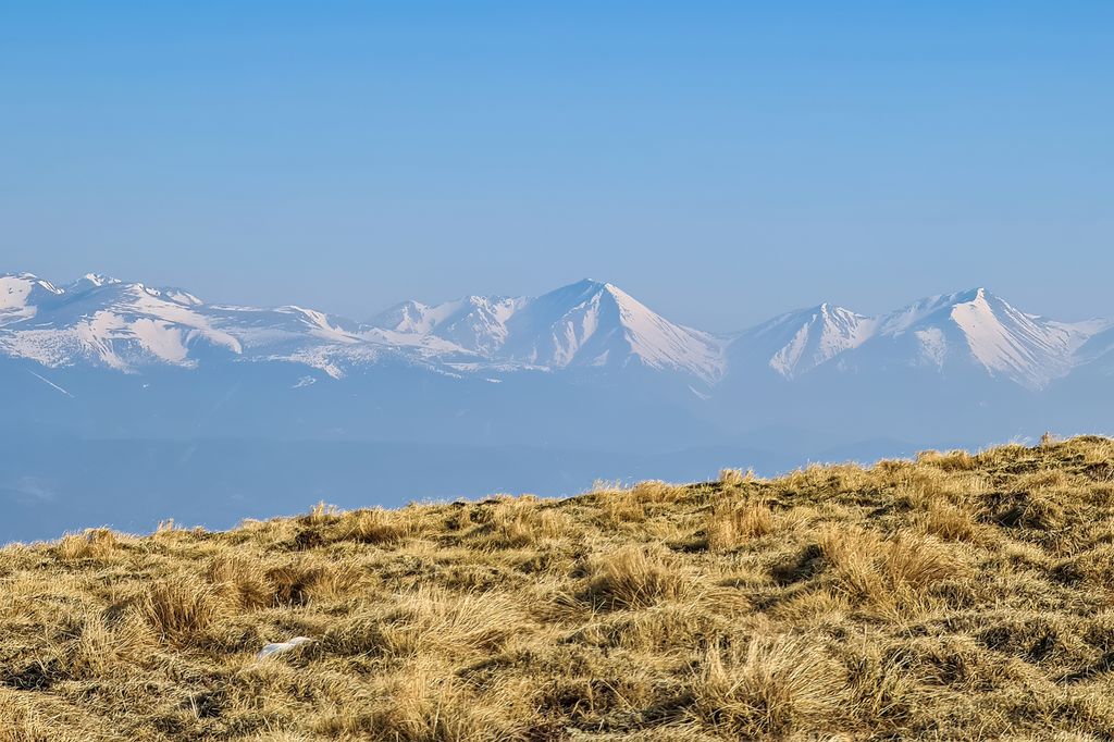
Western and Eastern Slopes of the Zirbitzkogel has 11 named peaks. The highest is Zirbitzkogel at 2,396 m. Other notable peaks include Scharfes Eck, Seetaler Alpen and Schlaferkogel.
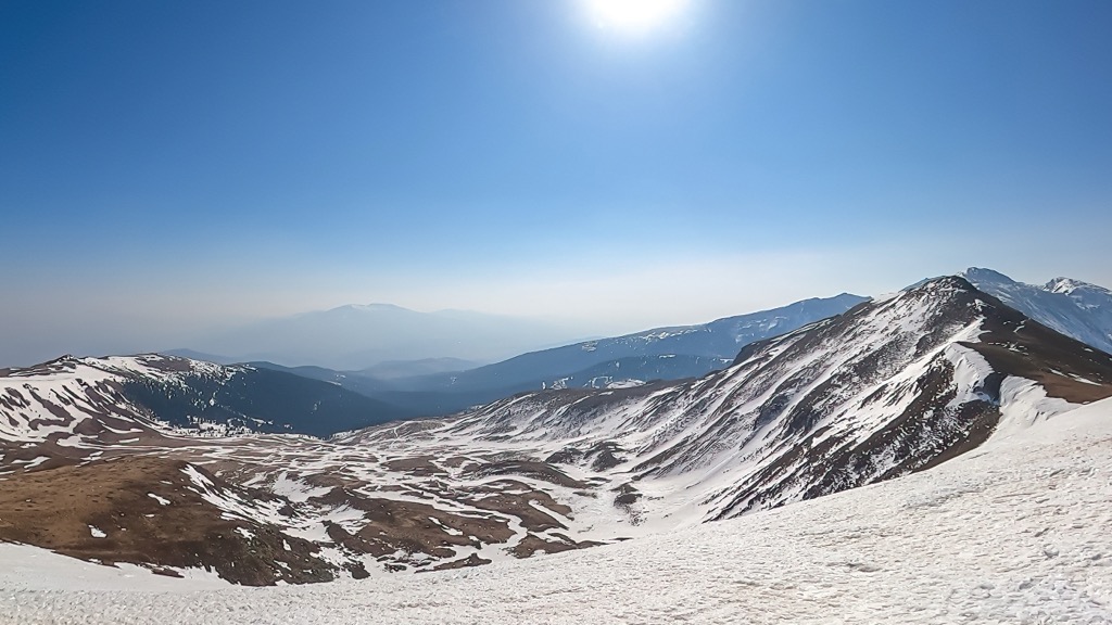
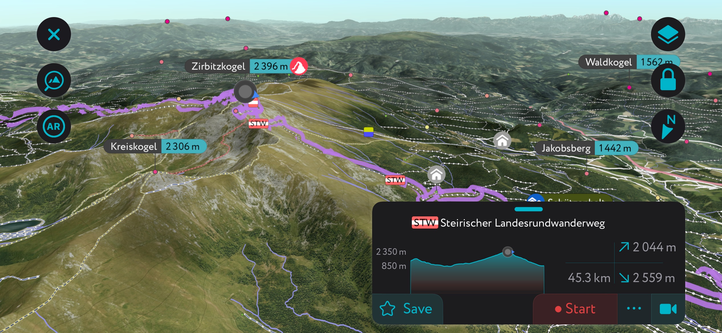
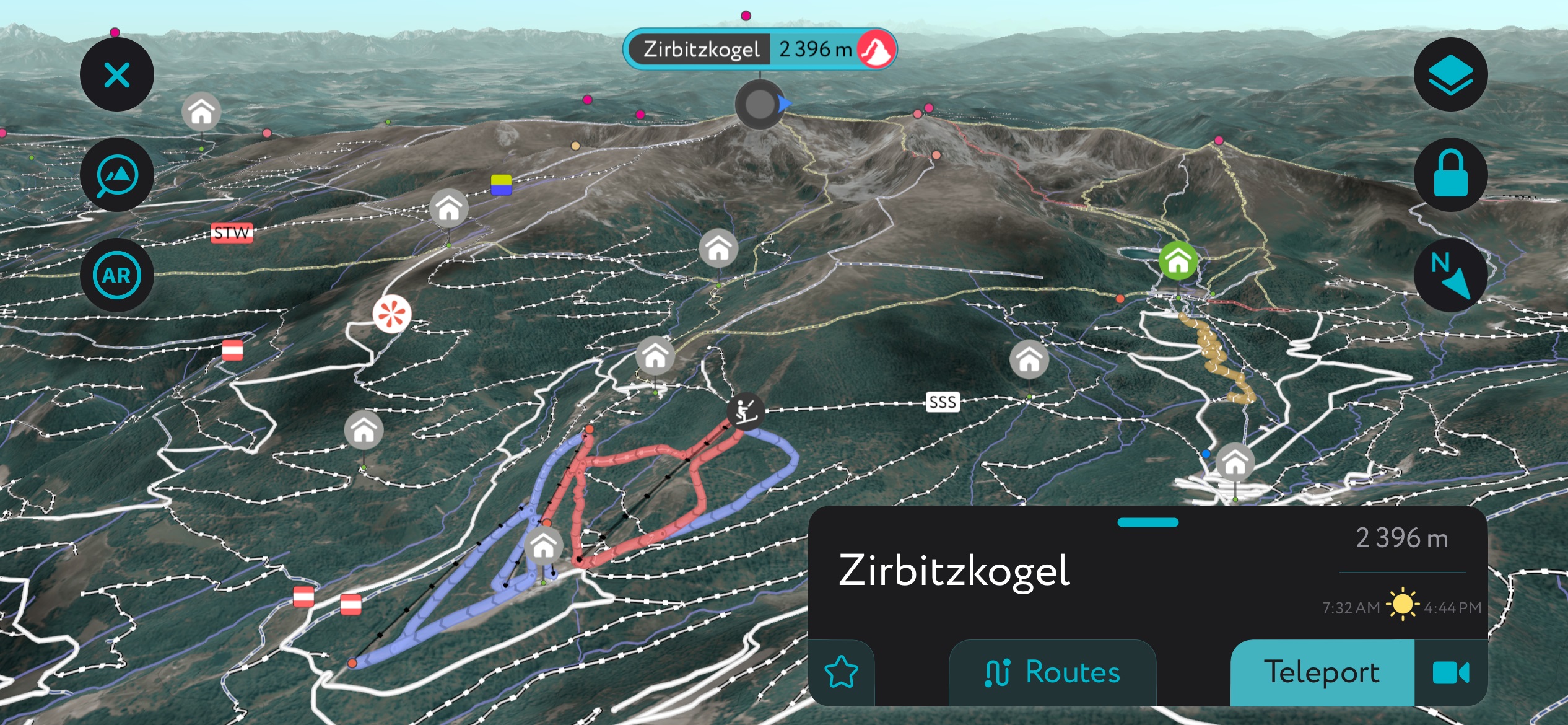
The Western and Eastern Slopes of the Zribitzkogel (West- u. Ostabhänge des Zirbitzkogels) is a protected area in Styria in southern Austria. The park encompasses 11 peaks; Zirbitzkogel (2,396 m / 7,861 ft) is the tallest peak not only in the protected area, but also in the Seetal Alps and greater Lavanttal Alps. It’s also the most prominent peak, rising 1,504 m (4,934 ft) from its surroundings. It's a popular year-round destination with an extensive system of hiking trails, several mountain huts, and ski touring routes in winter.
The Zirbitzkogel massif runs northwest to southeast in the state of Styria in Austria, very near to the border with Carinthia. Most choose to hike the peak from the west or east rather than from the lengthy approach from the north or south. The mountains are positioned south of the Mur River, between the Obdacher saddle to the east and the Neumarkter saddle to the west.
At 2,396 m (7,861 ft), the peak of Zirbitkogel is the highest point of the Seetal Alps and Lavantall Alps. The Lavant River, a tributary of the Drava, begins in the southern slopes of Zirbitzkogel. Similar to other parts of the Seetal Alps, ponds, streams, moorlands, and broad plateaus show the impact of the last ice age on the mountains.
With high ecological and recreational value, the mountains are protected as part of the Nature Park Zirbitzkogel-Grebenzen and as a European Natura 2000 area. The Nature Park’s ten-stage, 130-km (80 mi) Via Natura trail guides visitors through a series of informational displays highlighting the relationship between humans and the landscape.
Winter has its own appeal with ski touring, downhill skiing, snowboarding, snowshoeing, and lift-assisted sledding from the Tonnerhütte ski area.
The Zirbitzkogel is part of the greater European Alps; specifically, it lies within the Lavanttal Alps and the smaller sub-group of the Seetal Alps. The mountains were shaped primarily by the Alpine Orogeny and, more recently, by consecutive Ice Ages. The Zirbitzkogel primarily comprises crystalline rocks such as slate, gneiss, and granite.
The Alps began forming millions of years ago as the African tectonic plate collided with the European plate, closing the ancient Tethys Sea and uplifting the sediment-filled ocean floor. Today, the Alps continue to uplift slightly (and rebound due to shrinking glaciers) while simultaneously losing elevation due to erosion. These competing forces mean the Alps are not considered a growing range.
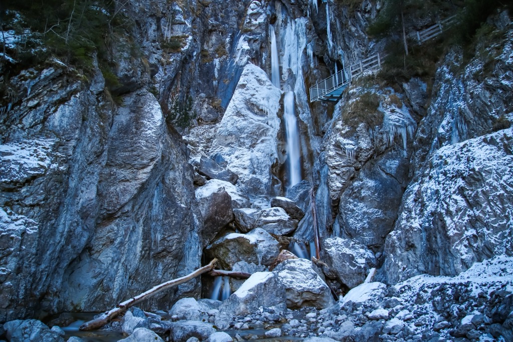
During the Pleistocene, glaciers advanced and retreated across the landscape, grinding down rock and carving out U-shaped valleys. During periods of glacial retreat, rivers wore down V-shaped gorges.
The Seetal Alps have long been mined for iron ore. Some mines in the region date back thousands of years, although the protected area does not support mining.
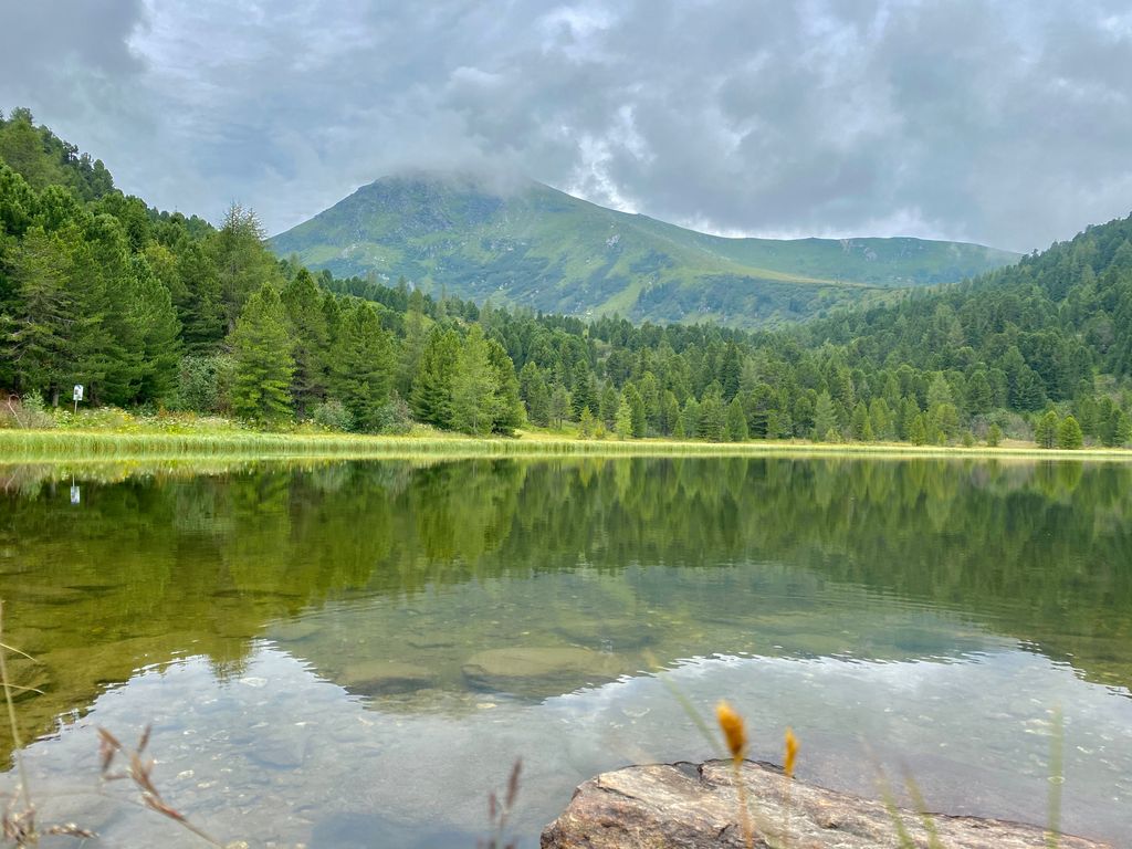
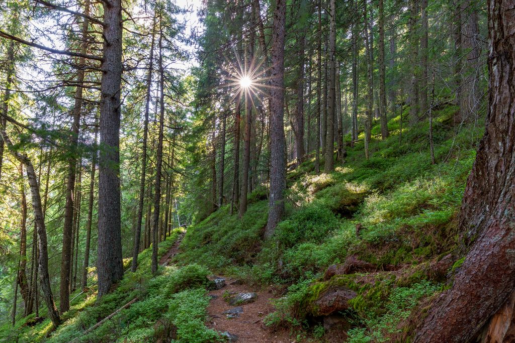
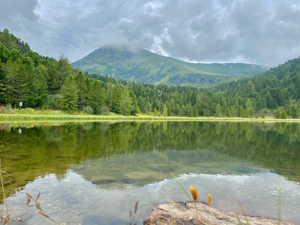
Along the lower slopes around Zirbitzkogel, meadows, moorland, and forest stands define the landscape. The upper slopes are treeless and boast sweeping, subalpine grasslands and several high-altitude lakes.
Where forested, Swiss pine (Pinus cembra) is widespread. These pines live hundreds of years, grow over 20 m (65 ft) tall, and produce high-quality wood. Spruce and pine-larch forests extend into the subalpine zone and are eventually replaced by sedge grasslands along the slopes and numerous plateaus. You may also spot alpine roses of the Rhododendron family, as well as alpine azalea.
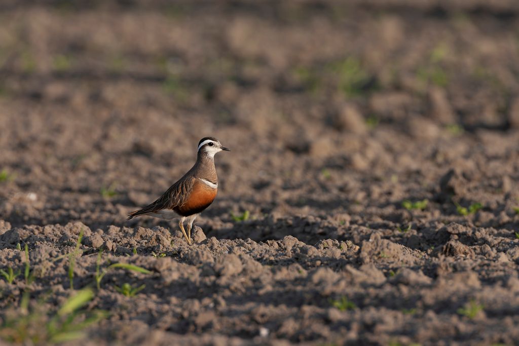
The summit was previously a critical breeding area for the Eurasian dotterel. No breeding pairs have been observed in the past few decades, but individual birds from this species pass through. The mountains also support capercaillie, also known as wood grouse, and mammals such as hare and deer in the forested areas. Several rare butterfly species live on the mountain, including the endemic Elophos zirbitzensis.
Humans have occupied the state of Styria in Austria since the Stone Age and mined the mountains as far back as the Bronze Age. The area was part of a Celtic kingdom before coming under the rule of the Roman Empire around 15 BC. The following centuries saw the arrival of Germanic tribes, Avars, and Slavs. Sections of the region shifted ownership among various empires and duchies until ultimately falling under the Habsburgs in 1282; at this point, it joined the shared history of the Austrian state.
Mining for iron ore is common, and there are mining projects for graphite, talc, gypsum, and salt throughout the region, although none are within the protected area. Hydroelectric plants on the Mur and other rivers generate the region’s power.
Nature Park Zirbitzkogel-Grebenzen is one of seven nature parks in Styria. These nature parks focus on preserving ecological integrity and the cultural ties of humans to the landscape. The Zirbitzkogel shelter just below the summit was the first hut of the Austrian Tourist Club and opened in 1870.
The Austrian Armed Forces utilize part of the northern slope as a military training area; signage clarifies what parts are off-limits.
The Zirbitzkogel is one of Styria's most popular hiking and ski-touring mountains. It is the tallest peak in the Seetal and Lavanttal Alps but is accessible to hikers of all levels. The landscape ranges from forest to high-elevation grassland, boasts streams and lakes along the way, and offers spectacular panoramic views.
With an extensive trail and hut system, it’s easy to navigate and plan your time in the mountains. Common starting points are St. Anna and St. Wolfgang on the northern/eastern side and Neumarkt on the southern/western side. Hikers can mix and match trails and huts to create multi-day mountain trips. Tonnerhütte, Alpengasthof Sabathy, Stoanahütte, and Waldheimhütte are just a few of the huts in the area.
Eisenwurzenweg 08, a 580-km (360 mi) Austrian hiking trail, runs from the Czech-Austrian border to the Karawanken in southern Austria and crosses Zirbitzkogel along the way. The area has some rock climbing spots and via ferratas.
The Via Natura trail runs through Zirbitzkogel-Grebenzen Nature Park for 130 km (80 mi). Constructed as both a hiking trail and educational space, various informational panels help visitors understand the relationship between humans and the landscape.
The route begins in Neumarkt and can be completed in four to seven days. It passes several small villages, including St. Lambrecht, Mariahof, and Mühlen, before looping back to Neumarkt.
The trail from Tonnerhütte is one of the most common starting points to reach the summit. While the route is steep, it’s popular, and hikers are rewarded with sweeping panoramic views from the top. The trail is 9 km (5.6 mi) out and back, with 794 m (2,605 ft) of elevation gain.
This is a challenging and beautiful hike with a 10.8 km (6.7 mi) trail with 779 m (2,556 ft) of elevation gain. Starting at Winterleitenhütte, the trail runs through forest and meadows as it climbs towards the rocky ridgeline. It passes two lakes before summiting Kresikogel (2,306 m/7,566 ft).
Accompanied by sweeping views, the trail continues, passing Scharfes Eck (2,364 m/7,756 ft) on the way to Zirbitzkogel. The trail returns along the Schreibersteig to the starting point.
The Tonnerhütte-Mühlen ski resort includes 4 km (2.5 mi) of skiing and snowboarding slopes and two lifts, mainly targeting beginner and intermediate levels. If you’re looking for something more adventurous, the upper slopes around Zirbitzkogel offer panoramic ski touring routes for all levels, such as a half-day, 10.5 km (6.5 mi) trail from Waldheimhütte.
Small towns and cities surround Zirbitzkogel, and the mountains are only a few hours' drive from Vienna and Salzburg. Small towns, such as Neumarkt, St. Wolfgang bei Obdach, and Mühlen, are perfect spots to base yourself to reach Zirbitzkogel.
For a few points of reference, from the east side, Judenburgerhütte can be reached from Judenburg and Obdach, Waldheimhütte from St. Anna, and Sabathyhütte and Zirbenwaldhütte from St. Wolfgang. You can depart from Neumarkt and drive to Jacobsberg, Tonnerhütte, or See from the west.
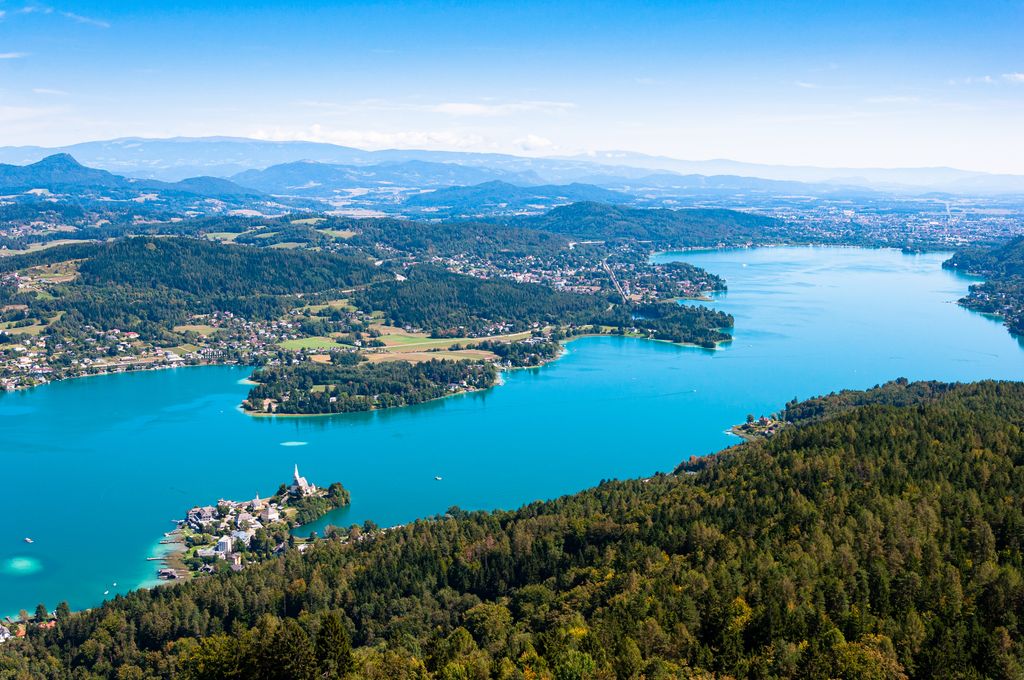
Klagenfurt is the capital of Carinthia and has an international airport. Sitting on the eastern shore of Lake Wörthersee, it’s a great option to the south of Zirbitzkogel for balancing proximity to the mountains (a little over one hour by car) and culture.
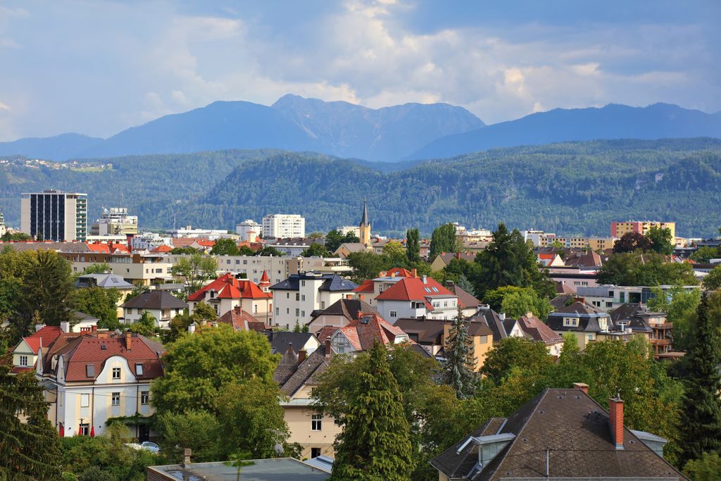
Klagenfurt is packed with centuries of history, restored palaces and courtyards, and a handful of art and history museums. The city combines regional fresh produce, cheeses, wines, and herbs at the Benedictine farmers’ market.
If you’re looking for hikes beyond Zirbitzkogel during your time in Klagenfurt, there are trails in the city center’s Kreuzbergl recreation area, the Karawanken to the south, and trails around Lake Wörthersee.
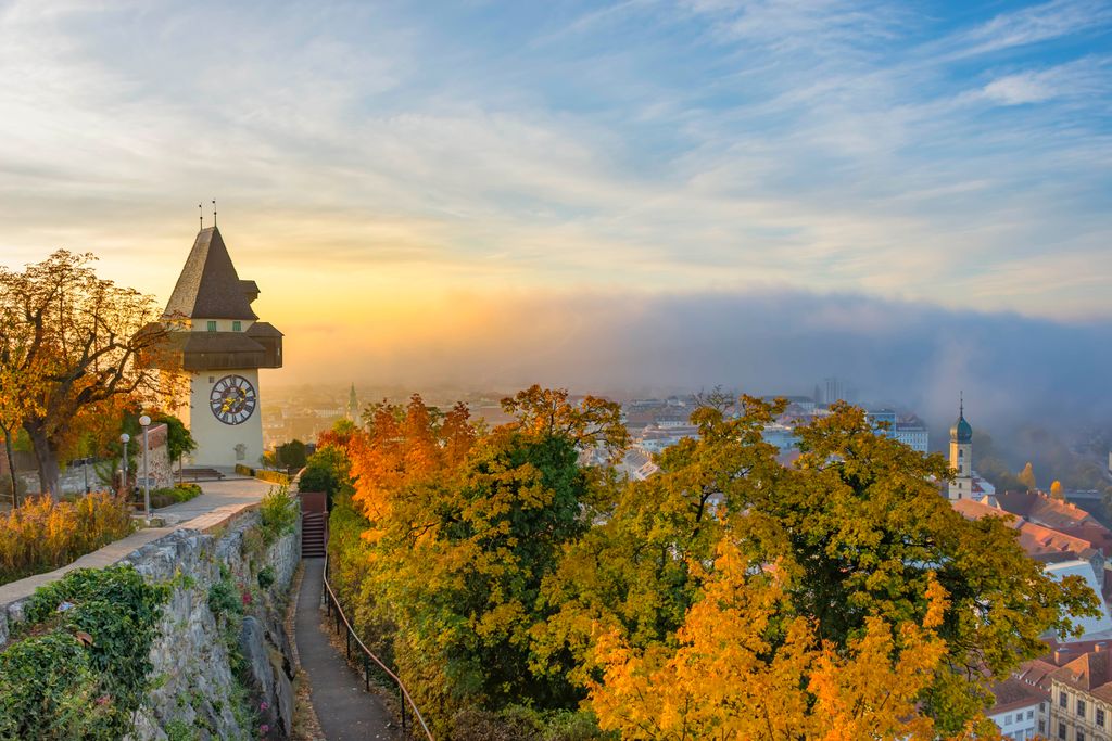
Only an hour west of Judenburg and Obdech and with an international airport, Graz is the capital of Styria. Graz takes care of the cultural component if you’re looking for more than access to the outdoors.
With around 295,000 inhabitants, it’s Austria’s second-largest city. The historic center and the Eggenberg Castle are UNESCO World Heritage Sites, rich in architecture and history, accessible by solo or guided tours. The city’s got a great food scene, incorporating fresh and local ingredients in classic Austrian dishes.
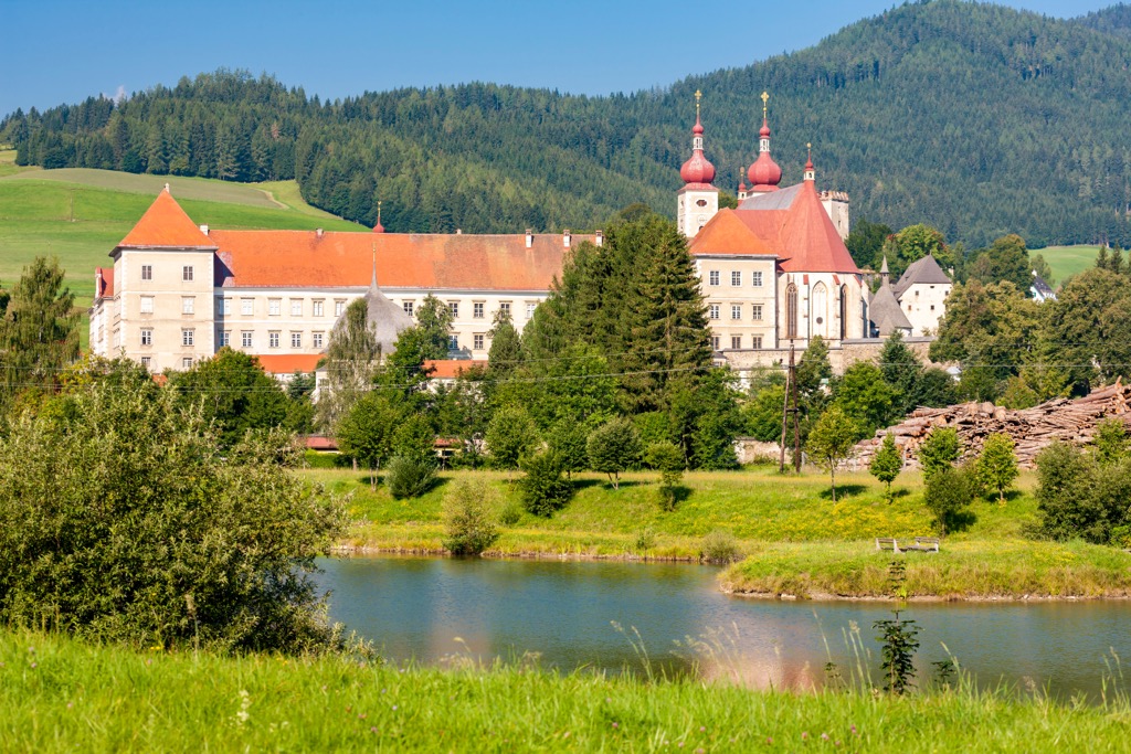
Sankt Lambrecht, population 2,000, lies in the district of Murau in Styria, Austria, and is known for St. Lambrecht's Abbey. The abbey is one of the most important Benedictine monasteries in Austria. The monastery and grounds are part of the Zirbitzkogel-Grebenzen Nature Park.
Grebenzen ski area is situated on the north side of the Zirbitzkogel - Grebenzen Nature Park. In addition to the ski slopes and chairlifts, several ski touring routes traverse the higher elevations.


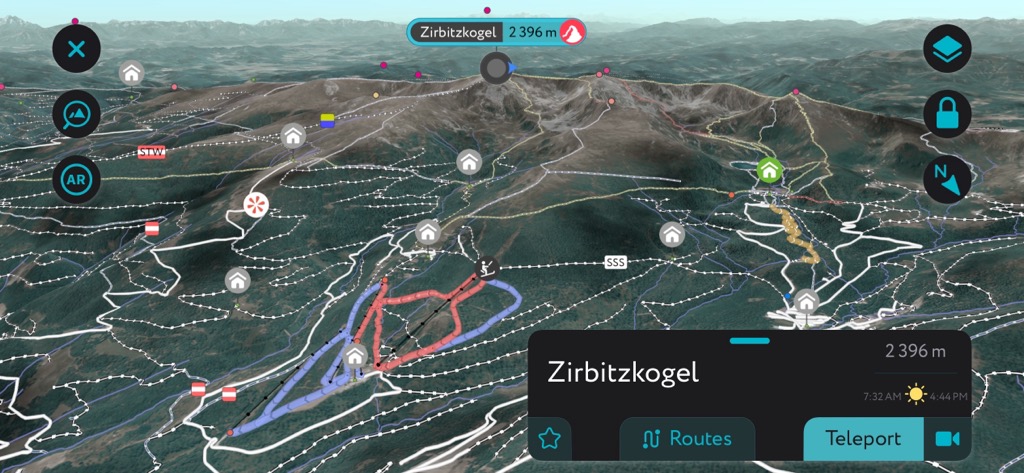


The highest peak in Western and Eastern Slopes of the Zirbitzkogel is Zirbitzkogel, at 2,396 m.
Notable peaks in Western and Eastern Slopes of the Zirbitzkogel include Zirbitzkogel, Scharfes Eck, Seetaler Alpen, Schlaferkogel and Fuchskogel.


